BGS Data Catalogue
Marine Multibeam Backscatter Data from around the UK (2005 Onwards)
The British Geological Survey (BGS) holds an archive of multibeam backscatter data from BGS, Maritime & Coastguard Agency (MCA) and other organisations. The data are stored within the National Geoscience Data Centre (NGDC) and the Marine Environmental Data and Information Network (MEDIN) Data Archive Centre (DAC) for Geology and Geophysics. BGS works with the partner DAC for bathymetry at the United Kingdom Hydrographic Office (UKHO) to archive backscatter data. The majority of the data were collected and processed for the Maritime and Coastguard Agency (MCA) under the Civil Hydrography Programme (CHP). Backscatter data is useful for seabed characterisation for geological and habitat mapping. View the backscatter image layer and download backscatter data (geotiff) via the BGS Offshore GeoIndex www.bgs.ac.uk/GeoIndex/offshore.htm. The data underlying the images are available on request enquiries@bgs.ac.uk. If further backscatter processing is required, BGS can provide a quote. View and download the related bathymetry data via the UKHO INSPIRE portal enquiries@bgs.ac The British Geological Survey (BGS) holds an archive of multibeam backscatter data from BGS, Maritime & Coastguard Agency (MCA) and other organisations. The data are stored within the National Geoscience Data Centre (NGDC) and the Marine Environmental Data and Information Network (MEDIN) Data Archive Centre (DAC) for Geology and Geophysics. BGS works with the partner DAC for bathymetry at the United Kingdom Hydrographic Office (UKHO) to archive backscatter data. The majority of the data were collected and processed for the Maritime and Coastguard Agency (MCA) under the Civil Hydrography Programme (CHP). Backscatter data is useful for seabed characterisation for geological and habitat mapping. View the backscatter image layer and download backscatter data (geotiff) via the BGS Offshore GeoIndex www.bgs.ac.uk/GeoIndex/offshore.htm. The data underlying the images are available on request enquiries@bgs.ac.uk. If further backscatter processing is required, BGS can provide a quote. View and download the related bathymetry data via the UKHO INSPIRE portal https://www.gov.uk/guidance/inspire-portal-and-medin-bathymetry-data-archive-centre.
INSPIRE
Identification
- File identifier
- c35db9dd-2a07-6c2d-e044-0003ba9b0d98 XML
- Resource type
- dataset
Online resource
Resource identifier
- Metadata Language
- English (en)
- Spatial representation type
- grid
Encoding
- Format
-
Geotiff
Classification of data and services
- Topic category
-
- Geoscientific information
Classification of data and services
Coupled resource
Coupled resource
Classification of data and services
Coupled resource
Coupled resource
Keywords
- GEMET - INSPIRE themes, version 1.0
- BGS Thesaurus of Geosciences
-
-
Bathymetry
-
Sea floor
-
UK Location (INSPIRE)
-
Marine geology
-
MEDIN
-
Geological mapping
-
Geology
-
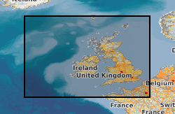
Geographic coverage
))
Temporal reference
Temporal extent
Temporal extent
- Dataset Reference Date ()
- 2005
Quality and validity
- Lineage
-
For BGS multibeam surveys processed backscatter data is created using CARIS software. BGS works with the partner Data Archive Centre (DAC) for bathymetry at the United Kingdom Hydrographic Office (UKHO) to obtain multibeam bathymetry data mainly from the Maritime & Coastguard Agency (MCA) Civil Hydrography Programme (CHP). The data often includes processed backscatter data which BGS will make available. In some cases if there is no backscatter data already BGS may create processed backscatter from the raw data.
Conformity
Conformity
Conformity
Conformity
Conformity
Conformity
- Explanation
-
See the referenced specification
Restrictions on access and use
- Access constraints
- licenceOGL
- Access constraints
- Available under the Open Government Licence subject to the following acknowledgement accompanying the reproduced NERC materials "Contains NERC materials ©NERC [year]"
- Access constraints
-
The copyright of materials derived from the British Geological Survey's work is vested in the Natural Environment Research Council [NERC]. No part of this work may be reproduced or transmitted in any form or by any means, or stored in a retrieval system of any nature, without the prior permission of the copyright holder, via the BGS Intellectual Property Rights Manager. Use by customers of information provided by the BGS, is at the customer's own risk. In view of the disparate sources of information at BGS's disposal, including such material donated to BGS, that BGS accepts in good faith as being accurate, the Natural Environment Research Council (NERC) gives no warranty, expressed or implied, as to the quality or accuracy of the information supplied, or to the information's suitability for any use. NERC/BGS accepts no liability whatever in respect of loss, damage, injury or other occurence however caused.
- Access constraints
-
Available under the Open Government Licence subject to the following acknowledgement accompanying the reproduced NERC materials "Contains NERC materials ©NERC [year]"
Responsible organization (s)
Contact for the resource
- Organisation name
-
Maritime and Coastguard Agency
-
not available
- Organisation name
-
British Geological Survey
-
enquiries@bgs.ac enquiries@bgs.ac.uk
- Organisation name
-
British Geological Survey
-
enquiries@bgs.ac enquiries@bgs.ac.uk
- Organisation name
-
British Geological Survey
-
not available
- Organisation name
-
British Geological Survey
-
not available
- Organisation name
-
British Geological Survey
-
not available
- Organisation name
-
British Geological Survey
-
not available
Metadata information
Contact for the metadata
- Organisation name
-
British Geological Survey
-
enquiries@bgs.ac enquiries@bgs.ac.uk
- Metadata Date
- 2024-04-22
- Metadata Language
- English (en)