 BGS Metadata Catalogue
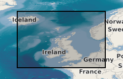
Marine survey data from around the UK (1966 onwards)
This dataset is the complete collection of the British Geological Survey (BGS) held Marine Survey data. The data held includes digital data and analogue records, plus associated physical sample material. Data are stored within the National Geoscience Data Centre (NGDC) and the Marine Environmental Data and Information Network (MEDIN) Data Archive Centre (DAC) for Geology and Geophysics. BGS have collected marine survey data since 1966, and have also been provided with a range of third-party data. The data includes geophysical data (seismic reflection, side-scan sonar, multibeam echosounder bathymetry and backscatter, gravity and magnetics) and sample data from boreholes, cores and seabed grabs (logs, geological description, geochemical, particle size analysis and geotechnical data). The majority of surveys are within the United Kingdom Continental Shelf (UKCS) area. Individual survey data coverage varies, depending on survey type (sampling, geophysics, multibeam or multi-disciplinary) and objectives (regional or local, shallow or deep). These data are applicable to a wide range of uses including environmental, geotechnical, geophysical and geological studies. A summary layer of areas covered by individual marine surveys, including links to downloadable data where available, is available on the BGS GeoIndex. Additional data are available on request to enquiries@bgs.ac.uk.
Simple
- Alternate title
-
Marine survey data
- Date (Creation)
- 1966
- Citation identifier
- http://data.bgs.ac.uk/id/dataHolding/13605638
- Point of contact
-
Organisation name Individual name Electronic mail address Role British Geological Survey
Enquiries
Distributor British Geological Survey
Enquiries
Point of contact British Geological Survey
Enquiries
not available
Distributor British Geological Survey
Enquiries
not available
Point of contact
- Maintenance and update frequency
- Irregular
-
GEMET - INSPIRE themes, version 1.0
-
BGS Thesaurus of Geosciences
-
-
Geology
-
Magnetic data
-
Marine seismic surveys
-
Seismic surveys
-
Geological data
-
Magnetic surveys
-
Marine geology
-
Seismic data
-
Site investigations
-
Boreholes
-
Bathymetry
-
Gravity surveys
-
Drilling
-
Geological surveys
-
Marine gravity surveys
-
Marine magnetic surveys
-
Geophysical data
-
Geophysical surveys
-
Geophysics
-
Gravity data
-
Geochemical data
-
Marine geochemistry
-
Marine geophysics
-
Marine surveys
-
Offshore drilling
-
Sampling
-
Sea floor
-
Seismic reflection surveys
-
Core drilling
-
Geochemistry
-
- dataCentre
- Keywords
-
-
NERC_DDC
-
- Access constraints
- Other restrictions
- Use constraints
- Other restrictions
- Other constraints
-
The copyright of materials derived from the British Geological Survey's work is vested in the Natural Environment Research Council [NERC]. No part of this work may be reproduced or transmitted in any form or by any means, or stored in a retrieval system of any nature, without the prior permission of the copyright holder, via the BGS Intellectual Property Rights Manager. Use by customers of information provided by the BGS, is at the customer's own risk. In view of the disparate sources of information at BGS's disposal, including such material donated to BGS, that BGS accepts in good faith as being accurate, the Natural Environment Research Council (NERC) gives no warranty, expressed or implied, as to the quality or accuracy of the information supplied, or to the information's suitability for any use. NERC/BGS accepts no liability whatever in respect of loss, damage, injury or other occurence however caused.
- Other constraints
-
Available under the Open Government Licence subject to the following acknowledgement accompanying the reproduced NERC materials "Contains NERC materials ©NERC [year]"
- Spatial representation type
- Vector
- Language
- English
- Topic category
-
- Geoscientific information
- Geographic identifier
-
BRISTOL CHANNEL [id=2001350]
British Geological Survey Gazetteer: Gazetteer of sea areas 2010 revision
- Geographic identifier
-
CELTIC SEA [id=2001353]
British Geological Survey Gazetteer: Gazetteer of sea areas 2010 revision
- Geographic identifier
-
ENGLISH CHANNEL [id=2001401]
British Geological Survey Gazetteer: Gazetteer of sea areas 2010 revision
- Geographic identifier
-
INNER SEAS OFF THE WEST COAST OF SCOTLAND [id=2001428]
British Geological Survey Gazetteer: Gazetteer of sea areas 2010 revision
- Geographic identifier
-
IRISH SEA [id=2001430]
British Geological Survey Gazetteer: Gazetteer of sea areas 2010 revision
- Geographic identifier
-
NORTH ATLANTIC OCEAN [id=2002262]
British Geological Survey Gazetteer: Gazetteer of sea areas 2010 revision
- Geographic identifier
-
NORTH SEA [id=2001452]
British Geological Survey Gazetteer: Gazetteer of sea areas 2010 revision
- Geographic identifier
-
NORTHEAST ATLANTIC OCEAN (40W) [id=2001453]
British Geological Survey Gazetteer: Gazetteer of sea areas 2010 revision
- Geographic identifier
-
NORTHWEST EUROPEAN CONTINENTAL SHELF [id=121700]
British Geological Survey Gazetteer: Geographical hierarchy from Geosaurus 1979 creation
- Geographic identifier
-
UK CONTINENTAL SHELF [id=121701]
British Geological Survey Gazetteer: Geographical hierarchy from Geosaurus 1979 creation
))
- Begin date
- 1966
Reference System Information
- Distribution format
-
Name Version Digital data
Digital images
Physical specimens
Paper hard-copy records
SEG-Y
ESRI Shapefile
1994
Image (BMP)
Image (JPEG)
Image (PNG)
Image (GIF)
Image (SVG)
Image (TIFF)
- Distributor contact
-
Organisation name Individual name Electronic mail address Role British Geological Survey
Enquiries
Distributor
- Distributor contact
-
Organisation name Individual name Electronic mail address Role British Geological Survey
Enquiries
not available
Distributor
- OnLine resource
-
Protocol Linkage Name OGC:WMS
https://map.bgs.ac.uk/arcgis/services/GeoIndex_Offshore/offshore_data/MapServer/WmsServer? GeoIndex_Offshore_offshore_data
- OnLine resource
-
Protocol Linkage Name WWW:LINK-1.0-http--link
https://www.bgs.ac.uk/map-viewers/geoindex-offshore/ GeoIndex (offshore)
- Hierarchy level
- Dataset
- Other
-
dataset
Conformance result
- Title
-
INSPIRE Implementing rules laying down technical arrangements for the interoperability and harmonisation of Geology
- Date (Publication)
- 2011
- Explanation
-
See the referenced specification
- Pass
- No
Conformance result
- Title
-
Commission Regulation (EU) No 1089/2010 of 23 November 2010 implementing Directive 2007/2/EC of the European Parliament and of the Council as regards interoperability of spatial data sets and services
- Date (Publication)
- 2010-12-08
- Explanation
-
See http://eur-lex.europa.eu/LexUriServ/LexUriServ.do?uri=OJ:L:2010:323:0011:0102:EN:PDF
- Pass
- No
- Statement
-
Data were collected using various survey techniques. This dataset has been managed by BGS over a considerable period of time. Legacy paper records have undergone selective scanning and/or transcription to digital formats, with QC of the information captured and migration into the BGS database. More recent data are captured digitally and loaded to the database. The related sample material is curated and managed as part of the physical materials collections. Information is delivered via the BGS web site.
Metadata
- File identifier
- c35c748d-3f7d-682d-e044-0003ba9b0d98 XML
- Metadata language
- English
- Hierarchy level
- Dataset
- Date stamp
- 2026-07-26
- Metadata standard name
- UK GEMINI
- Metadata standard version
-
2.3
- Metadata author
-
Organisation name Individual name Electronic mail address Role British Geological Survey
Point of contact
- Dataset URI
)))
