 BGS Metadata Catalogue
Soil gas sampling and analysis method test results
The dataset contains details of field collection of test soil gas samples with use of Supel Inert Foil gas sampling bags and the results of methane and ethane measurements performed in order to validate a methodology of soil gas sampling and analysis. The dataset is not intended to be used for any site characterisation, sampling sites were chosen based on high probability of occurrence of measureable methane content in soil gas. Furthermore, the data will be used for formal procedure to obtain the methodology accreditation from the Polish Centre for Accreditation (PCA). The dataset might be used as a set of results of the analytical methodology in future field experimental works. However measurement data are related to particular soil types and beside validation/inter-comparison purpose are not reusable. The dataset was created within SECURe project (Subsurface Evaluation of CCS and Unconventional Risks) - https://www.securegeoenergy.eu/. This project has received funding from the European Union’s Horizon 2020 research and innovation programme under grant agreement No 764531
Simple
- Date (Creation)
- 2021-04-23
- Citation identifier
- http://data.bgs.ac.uk/id/dataHolding/13607746
- Point of contact
-
Organisation name Individual name Electronic mail address Role Polish Geological Institute - National Research Institute
Monika Konieczyńska
not available
Originator British Geological Survey
Enquiries
not available
Distributor British Geological Survey
Enquiries
not available
Point of contact
- Maintenance and update frequency
- notApplicable
-
GEMET - INSPIRE themes, version 1.0
-
BGS Thesaurus of Geosciences
-
-
Statistical analysis
-
Soil gas sampling
-
- dataCentre
- Keywords
-
-
NERC_DDC
-
- Access constraints
- Other restrictions
- Other constraints
- licenceOGL
- Use constraints
- Other restrictions
- Other constraints
-
The copyright of materials derived from the British Geological Survey's work is vested in the Natural Environment Research Council [NERC]. No part of this work may be reproduced or transmitted in any form or by any means, or stored in a retrieval system of any nature, without the prior permission of the copyright holder, via the BGS Intellectual Property Rights Manager. Use by customers of information provided by the BGS, is at the customer's own risk. In view of the disparate sources of information at BGS's disposal, including such material donated to BGS, that BGS accepts in good faith as being accurate, the Natural Environment Research Council (NERC) gives no warranty, expressed or implied, as to the quality or accuracy of the information supplied, or to the information's suitability for any use. NERC/BGS accepts no liability whatever in respect of loss, damage, injury or other occurence however caused.
- Other constraints
-
Available under the Open Government Licence subject to the following acknowledgement accompanying the reproduced NERC materials "Contains NERC materials ©NERC [year]"
- Spatial representation type
- Text, table
- Language
- English
- Topic category
-
- Geoscientific information
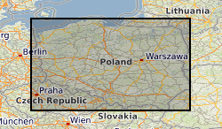
- Geographic identifier
-
PL
ISO 3166_1 alpha-2 2009 revision
- Geographic identifier
-
POL
ISO 3166_1 alpha-3 2009 revision
- Geographic identifier
-
POLAND [id=330000]
British Geological Survey Gazetteer: Geographical hierarchy from Geosaurus 1979 creation
))
- Begin date
- 2020-06-14
- End date
- 2021-03-03
- Unique resource identifier
- WGS 84 (EPSG::4326)
- Distribution format
-
Name Version Microsoft Excel
witheld
- Distributor contact
-
Organisation name Individual name Electronic mail address Role British Geological Survey
Enquiries
not available
Distributor
- OnLine resource
-
Protocol Linkage Name WWW:DOWNLOAD-1.0-http--download
https://webapps.bgs.ac.uk/services/ngdc/accessions/index.html#item166227 Data
- OnLine resource
-
Protocol Linkage Name WWW:LINK-1.0-http--related
https://doi.org/10.5285/3d33fb5f-cdb3-4b8e-b048-13da53c96196 Citation Information - Digital Object Identifier (DOI)
- Hierarchy level
- Dataset
- Other
-
dataset
Conformance result
- Title
-
INSPIRE Implementing rules laying down technical arrangements for the interoperability and harmonisation of Geology
- Date (Publication)
- 2011
- Explanation
-
See the referenced specification
- Pass
- No
Conformance result
- Title
-
Commission Regulation (EU) No 1089/2010 of 23 November 2010 implementing Directive 2007/2/EC of the European Parliament and of the Council as regards interoperability of spatial data sets and services
- Date (Publication)
- 2010-12-08
- Explanation
-
See http://eur-lex.europa.eu/LexUriServ/LexUriServ.do?uri=OJ:L:2010:323:0011:0102:EN:PDF
- Pass
- No
- Statement
-
The data represent sampling site and time details and the computed results of gas content (methane, ethane) from GC-FID (Gas chromatography with flame ionization detector). The data are provided in .xlsx (MS Excel file) format. First spreadsheet contains meta data and a detailed description of data presented in next spreadsheets. All spreadsheets have clear rows and columns descriptions.
Metadata
- File identifier
- c12cd970-d5ec-569c-e054-002128a47908 XML
- Metadata language
- English
- Hierarchy level
- Dataset
- Date stamp
- 2026-07-28
- Metadata standard name
- UK GEMINI
- Metadata standard version
-
2.3
- Metadata author
-
Organisation name Individual name Electronic mail address Role British Geological Survey
Point of contact
- Dataset URI
)))
