 BGS Metadata Catalogue
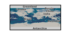
VOLCORE, a global database of visible tephra layers sampled by ocean drilling (NERC Grant NE/P020895/1)
The VOLCORE (Volcanic Core Records) database is a collection of 34,696 visible tephra (volcanic ash and lithological or grain size variations) occurrences reported in the initial reports volumes of all of the Deep Sea Drilling Project (DSDP; 1966–1983), the Ocean Drilling Program (ODP; 1983–2003), the Integrated Ocean Drilling Program (IODP; 2003–2013) and the International Ocean Discovery Program (IODP; 2013-present) up to and including IODP Expedition 381. The combined international ocean drilling programmes (OD) have locations with global coverage. Cored tephra layers and tephra-bearing sediments span timescales from recent to ~150 million years in age. This database is a collection of information about reported visible tephra layers entirely or predominantly composed of volcanic ash. Data include the depth below sea floor, tephra thickness, location, and any reported comments. An approximate age was estimated for most (29,493) of the tephra layers using published age-depth models. The database can be used as a starting point for studies of tephrochronology, volcanology, geochemistry, studies of sediment transport and palaeoclimatology.
Simple
- Date (Creation)
- 2021-03-02
- Citation identifier
- http://data.bgs.ac.uk/id/dataHolding/13607726
- Point of contact
-
Organisation name Individual name Electronic mail address Role University of Bristol
Professor Stephen Sparks
not available
Principal investigator University of Bristol
Dr Sue Mahony
not available
Originator British Geological Survey
Enquiries
not available
Distributor British Geological Survey
Enquiries
not available
Point of contact
- Maintenance and update frequency
- notApplicable
-
GEMET - INSPIRE themes, version 1.0
- dataCentre
- Keywords
-
-
NERC_DDC
-
- Access constraints
- Other restrictions
- Other constraints
- licenceOGL
- Use constraints
- Other restrictions
- Other constraints
-
The copyright of materials derived from the British Geological Survey's work is vested in the Natural Environment Research Council [NERC]. No part of this work may be reproduced or transmitted in any form or by any means, or stored in a retrieval system of any nature, without the prior permission of the copyright holder, via the BGS Intellectual Property Rights Manager. Use by customers of information provided by the BGS, is at the customer's own risk. In view of the disparate sources of information at BGS's disposal, including such material donated to BGS, that BGS accepts in good faith as being accurate, the Natural Environment Research Council (NERC) gives no warranty, expressed or implied, as to the quality or accuracy of the information supplied, or to the information's suitability for any use. NERC/BGS accepts no liability whatever in respect of loss, damage, injury or other occurence however caused.
- Other constraints
-
Available under the Open Government Licence subject to the following acknowledgement accompanying the reproduced NERC materials "Contains NERC materials ©NERC [year]"
- Language
- English
- Topic category
-
- Geoscientific information
- Geographic identifier
-
WORLD [id=100000]
British Geological Survey Gazetteer: Geographical hierarchy from Geosaurus 1979 creation
))
- Begin date
- 2010-10-01
- End date
- 2019-11-01
- Unique resource identifier
- WGS 84 (EPSG::4326)
- Distribution format
-
Name Version Microsoft Excel
witheld
- Distributor contact
-
Organisation name Individual name Electronic mail address Role British Geological Survey
Enquiries
not available
Distributor
- OnLine resource
-
Protocol Linkage Name https://www.nature.com/articles/s41597-020-00673-1 Published Paper
- OnLine resource
-
Protocol Linkage Name https://researchdata.springernature.com/posts/150-million-years-of-large-magnitude-explosive-volcanism Blog post about VOLCORE
- OnLine resource
-
Protocol Linkage Name WWW:DOWNLOAD-1.0-http--download
https://webapps.bgs.ac.uk/services/ngdc/accessions/index.html#item163765 Data
- Hierarchy level
- Dataset
- Other
-
dataset
Conformance result
- Title
-
INSPIRE Implementing rules laying down technical arrangements for the interoperability and harmonisation of Geology
- Date (Publication)
- 2011
- Explanation
-
See the referenced specification
- Pass
- No
Conformance result
- Title
-
Commission Regulation (EU) No 1089/2010 of 23 November 2010 implementing Directive 2007/2/EC of the European Parliament and of the Council as regards interoperability of spatial data sets and services
- Date (Publication)
- 2010-12-08
- Explanation
-
See http://eur-lex.europa.eu/LexUriServ/LexUriServ.do?uri=OJ:L:2010:323:0011:0102:EN:PDF
- Pass
- No
- Statement
-
Tephra layers are recorded in the Visual Core Description (VCD) during systematic logging of sediment cores on board during an expedition. Every expedition produces reports which include the visual core description forms (VCDs), these were the primary source used for VOLCORE data collection. Visual core description forms for all OD expeditions were individually inspected for recording of tephra, ash, glass or other volcanic products. To be consistent across all of the expeditions only the shipboard VCDs were used as the data source, published post-cruise literature were not used. If the user is interested in a particular expedition, they should check the literature for post-expedition updates regarding tephra identification. VOLCORE provides a global overview of volcanism via a standardised data capture method, it does not include post-expedition studies. The data were collected from 3,886 drill holes (expeditions 1–381), distributed across all major seas and oceans. For each tephra layer that passed the criteria (>25% tephra content) we extracted data on core location, on depth down the core and tephra layer thickness. Definitions of a ‘tephra layer’ vary between expeditions, so care should be taken when using VOLCORE, it is highly advisable to carefully read the accompanying data descriptor paper ( https://www.nature.com/articles/s41597-020-00673-1). The data are spread over five worksheets, one with details per tephra layer (or patch), one with details for each drill hole, one with the age-depth models used in this study, one with the coring information for each drill hole. A fifth sheet titled ‘Key’ describes the basic meaning of every column in the data worksheets. The individual data sheets can be linked via the common Hole and Site ID fields (HID, SID). We estimated the age of the layer using age-depth models for each drill hole. In each age-depth model the rate of deposition between tie points in the age-depth model is assumed to be linear. The listing of a tephra layer in VOLCORE is based on descriptive criteria and does not imply any firm knowledge of source processes, i.e. primary fall, flow or reworking.
Metadata
- File identifier
- bec2eef1-8ab5-2fa1-e054-002128a47908 XML
- Metadata language
- English
- Hierarchy level
- Dataset
- Date stamp
- 2026-06-27
- Metadata standard name
- UK GEMINI
- Metadata standard version
-
2.3
- Metadata author
-
Organisation name Individual name Electronic mail address Role British Geological Survey
Point of contact
- Dataset URI
)))
