 BGS Metadata Catalogue
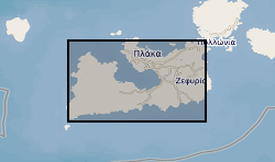
Whole-rock XRD (X-ray diffraction) data of hydrothermal alteration from the island of Milos, Greece
Summary of semi-quantitative whole-rock XRD analysis of hydrothermal alteration across the island of Milos, Greece. The samples were acquired during numerous field visits between 2010 and 2018 by the British Geological Survey and GW4+ Doctorial Training Partnership (NE/L002434/1). The data were acquired using a PANAlytical X’Pert Pro diffractometer at the British Geological Survey, Keyworth, UK. These data were primarily used to identify mineral phases to improve our understanding of regional and local paleo-hydrothermal activity. This may be useful within the metallic and industrial mineral mining sector and associated researchers. The data includes grid references (± 5 m), field observations and instrument running conditions. Samples from 2010 are supported by a grant award from the Natural Environment Research Council (GA/09F/139). Samples from 2016 - 2018 are supported by the GW4+ Doctoral Training Partnership (NE/L002434/1) grant award GA/09F/139 – RMS E3557, and the British Geological Survey’s University Funding Initiative (BUFI S345).
Simple
- Date (Creation)
- 2021-01-31
- Citation identifier
- http://data.bgs.ac.uk/id/dataHolding/13607707
- Point of contact
-
Organisation name Individual name Electronic mail address Role University of Bristol
Valdes, Professor Paul
not available
Principal investigator British Geological Survey
Enquiries
Distributor British Geological Survey
Enquiries
Originator British Geological Survey
Enquiries
not available
Distributor British Geological Survey
Enquiries
not available
Point of contact
- Maintenance and update frequency
- notApplicable
-
GEMET - INSPIRE themes, version 1.0
-
BGS Thesaurus of Geosciences
-
-
Hydrothermal alteration
-
Clays
-
Mineralogy
-
Volcanic rocks
-
- dataCentre
- Keywords
-
-
NERC_DDC
-
- Access constraints
- Other restrictions
- Other constraints
- licenceOGL
- Use constraints
- Other restrictions
- Other constraints
-
The copyright of materials derived from the British Geological Survey's work is vested in the Natural Environment Research Council [NERC]. No part of this work may be reproduced or transmitted in any form or by any means, or stored in a retrieval system of any nature, without the prior permission of the copyright holder, via the BGS Intellectual Property Rights Manager. Use by customers of information provided by the BGS, is at the customer's own risk. In view of the disparate sources of information at BGS's disposal, including such material donated to BGS, that BGS accepts in good faith as being accurate, the Natural Environment Research Council (NERC) gives no warranty, expressed or implied, as to the quality or accuracy of the information supplied, or to the information's suitability for any use. NERC/BGS accepts no liability whatever in respect of loss, damage, injury or other occurence however caused.
- Other constraints
-
Available under the Open Government Licence subject to the following acknowledgement accompanying the reproduced NERC materials "Contains NERC materials ©NERC [year]"
- Spatial representation type
- Text, table
- Language
- English
- Topic category
-
- Geoscientific information
- Geographic identifier
-
MILOS [id=361650]
British Geological Survey Gazetteer: Geographical hierarchy from Geosaurus 1979 creation
))
- Begin date
- 2010-05-17
- End date
- 2018-04-16
- Unique resource identifier
- WGS 84 (EPSG::4326)
- Distribution format
-
Name Version Microsoft Excel (XLSX)
witheld
- Distributor contact
-
Organisation name Individual name Electronic mail address Role British Geological Survey
Enquiries
Distributor
- Distributor contact
-
Organisation name Individual name Electronic mail address Role British Geological Survey
Enquiries
not available
Distributor
- OnLine resource
-
Protocol Linkage Name WWW:DOWNLOAD-1.0-http--download
https://webapps.bgs.ac.uk/services/ngdc/accessions/index.html#item162146 Data
- OnLine resource
-
Protocol Linkage Name WWW:LINK-1.0-http--related
https://doi.org/10.5285/f2f48acc-c522-46b5-8fc6-3b579560d195 Citation Information - Digital Object Identifier (DOI)
- Hierarchy level
- Dataset
- Other
-
dataset
Conformance result
- Title
-
INSPIRE Implementing rules laying down technical arrangements for the interoperability and harmonisation of Geology
- Date (Publication)
- 2011
- Explanation
-
See the referenced specification
- Pass
- No
Conformance result
- Title
-
Commission Regulation (EU) No 1089/2010 of 23 November 2010 implementing Directive 2007/2/EC of the European Parliament and of the Council as regards interoperability of spatial data sets and services
- Date (Publication)
- 2010-12-08
- Explanation
-
See http://eur-lex.europa.eu/LexUriServ/LexUriServ.do?uri=OJ:L:2010:323:0011:0102:EN:PDF
- Pass
- No
- Statement
-
Spray-dried, micronised powder samples were scanned from 4.5 – 85°2q at 2.06°2q/minute on a Malvern PANalytical X’Pert Pro diffractometer with Co radiation, operating at 45kV 40 mA, automatic divergence slit and X’Celerator detector. X-ray Diffraction data were analysed using PANalytical X’Pert HighScore Plus. Major, minor and trace semi-quantification are based upon known fully quantifiable template samples and are defined on the following estimations: trace <5 %, minor 5 – 25 % and major >25 %. Individual data files can be made available upon request.
Metadata
- File identifier
- ba70a87d-0e73-26e3-e054-002128a47908 XML
- Metadata language
- English
- Hierarchy level
- Dataset
- Date stamp
- 2026-07-11
- Metadata standard name
- UK GEMINI
- Metadata standard version
-
2.3
- Metadata author
-
Organisation name Individual name Electronic mail address Role British Geological Survey
Point of contact
- Dataset URI
)))
