 BGS Metadata Catalogue
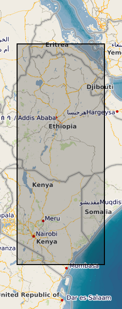
Processed InSAR images over the volcanoes of the East African Rift (NERC Grant NE/L013649/1)
This data set contains a set of 20,740 unwrapped, geocoded interferograms derived from Sentinel-1 InSAR scenes processed over 63 volcanoes within the East African Rift system. A full description of the dataset is provided in the accompanying READMe file. This data set was first published in Albino, F. & Biggs, J. (2020). Magmatic processes in the east African rift system: Insights from a 2015-2020 Sentinel-1 InSAR survey, Geochemistry, Geophysics, Geosystems.
Simple
- Date (Creation)
- 2020-12-10
- Citation identifier
- http://data.bgs.ac.uk/id/dataHolding/13607697
- Point of contact
-
Organisation name Individual name Electronic mail address Role University of Edinburgh
Whaler, Kathy
Principal investigator University of Bristol
Ophelia George
not available
Originator University of Bristol
Professor Juliet Biggs
not available
Principal investigator British Geological Survey
Enquiries
not available
Distributor British Geological Survey
Enquiries
not available
Point of contact
- Maintenance and update frequency
- notApplicable
-
GEMET - INSPIRE themes, version 1.0
-
BGS Thesaurus of Geosciences
-
-
Geodesy
-
Monitoring
-
Rift faults
-
Rift valleys
-
Volcanoes
-
Volcanology
-
Deformation (structural geology)
-
- dataCentre
- Keywords
-
-
NERC_DDC
-
- Access constraints
- Other restrictions
- Other constraints
- licenceOGL
- Use constraints
- Other restrictions
- Other constraints
-
The copyright of materials derived from the British Geological Survey's work is vested in the Natural Environment Research Council [NERC]. No part of this work may be reproduced or transmitted in any form or by any means, or stored in a retrieval system of any nature, without the prior permission of the copyright holder, via the BGS Intellectual Property Rights Manager. Use by customers of information provided by the BGS, is at the customer's own risk. In view of the disparate sources of information at BGS's disposal, including such material donated to BGS, that BGS accepts in good faith as being accurate, the Natural Environment Research Council (NERC) gives no warranty, expressed or implied, as to the quality or accuracy of the information supplied, or to the information's suitability for any use. NERC/BGS accepts no liability whatever in respect of loss, damage, injury or other occurence however caused.
- Other constraints
-
Available under the Open Government Licence subject to the following acknowledgement accompanying the reproduced NERC materials "Contains NERC materials ©NERC [year]"
- Spatial representation type
- Grid
- Language
- English
- Topic category
-
- Geoscientific information
- Geographic identifier
-
EASTERN RIFT SYSTEM [id=680300]
British Geological Survey Gazetteer: Geographical hierarchy from Geosaurus 1979 creation
))
- Begin date
- 2014-10-14
- End date
- 2020-02-17
- Unique resource identifier
- WGS 84 (EPSG::4326)
- Distribution format
-
Name Version Text file (TXT)
witheld
netCDF
- Distributor contact
-
Organisation name Individual name Electronic mail address Role British Geological Survey
Enquiries
not available
Distributor
- OnLine resource
-
Protocol Linkage Name WWW:DOWNLOAD-1.0-http--download
https://webapps.bgs.ac.uk/services/ngdc/accessions/index.html#item140345 Data
- OnLine resource
-
Protocol Linkage Name WWW:LINK-1.0-http--related
https://doi.org/10.5285/e7c3177b-4c73-4c20-961f-03afd09ccf69 Citation Information - Digital Object Identifier (DOI)
- Hierarchy level
- Dataset
- Other
-
dataset
Conformance result
- Title
-
INSPIRE Implementing rules laying down technical arrangements for the interoperability and harmonisation of Geology
- Date (Publication)
- 2011
- Explanation
-
See the referenced specification
- Pass
- No
Conformance result
- Title
-
Commission Regulation (EU) No 1089/2010 of 23 November 2010 implementing Directive 2007/2/EC of the European Parliament and of the Council as regards interoperability of spatial data sets and services
- Date (Publication)
- 2010-12-08
- Explanation
-
See http://eur-lex.europa.eu/LexUriServ/LexUriServ.do?uri=OJ:L:2010:323:0011:0102:EN:PDF
- Pass
- No
- Statement
-
The unwrapped interferograms presented here were automatically processed as part of the Centre for the Observation and Modelling of Earthquakes, Volcanoes and Tectonics (COMET) using the LiCSAR processor which builds on the Gamma SAR and Interferometry software. Time series analysis was carried out on all or a subset of the processed interferograms at each volcano. Further details are provided in the accompanying READMe file and in Albino, F. & Biggs, J. (2020)
Metadata
- File identifier
- b83d6162-4d6a-68f5-e054-002128a47908 XML
- Metadata language
- English
- Hierarchy level
- Dataset
- Date stamp
- 2026-07-26
- Metadata standard name
- UK GEMINI
- Metadata standard version
-
2.3
- Metadata author
-
Organisation name Individual name Electronic mail address Role British Geological Survey
Point of contact
- Dataset URI
)))
