 BGS Metadata Catalogue
BGS Mineral Resources Wales version 2
This dataset provides digital spatial information on the location of mineral resources in Wales at a scale of 1:50 000. The term ‘mineral resources’ has a definition under international standards that includes both an economic and geological dimension. These data are based primarily on mapped geology with limited assessment of economics. Therefore, the term ‘mineral resources’ is used here in a broad sense. The dataset allows users to visualise the extent and distribution of mineral resources and to relate them to other forms of land-use (such as urban areas or designated environmentally sensitive areas) or to other factors (such as transport infrastructure and conservation information). The British Geological Survey (BGS) was awarded a grant from the Welsh Assembly Government Aggregates Levy Fund in 2009 to provide a comprehensive, relevant and accessible information base to enhance the sustainability of mineral resources for Wales. BGS co-funded this project through its Sustainable Mineral Solutions project. This work was completed in 2010. This dataset comprises the digital GIS files which were produced through this project. The major elements of minerals information presented on the maps are; the geological distribution of all onshore mineral resources in Wales, the location of mineral extraction sites, the recorded occurrences of metallic minerals, the recorded location of former slate quarries and significant areas of slate waste and the recorded location of historic building stone quarries. In 2020 minor revisions to geometry and attributes were made in in response to minor corrections that were required. The paper maps were not re-released with these data updates. Point data for mineral occurrence and mine site data has not been included in this revision as these data are superseded by other BGS datasets, such as the BGS BritPits database of mines and quarries. The BGS Mineral Resource data does not determine mineral reserves and therefore does not denote potential areas of extraction. Only onshore, mainland mineral resources are included in the dataset. This dataset has been produced by the collation and interpretation of mineral resource data principally held by the British Geological Survey. The mineral resource data presented are based on the best available information, but are not comprehensive and their quality is variable. The dataset should only be used to show a broad distribution of those mineral resources which may be of current or potential economic interest.
Simple
- Date (Creation)
- 2020
- Citation identifier
- http://data.bgs.ac.uk/id/dataHolding/13607683
- Point of contact
-
Organisation name Individual name Electronic mail address Role British Geological Survey
Enquiries
Distributor British Geological Survey
Enquiries
Point of contact
- Maintenance and update frequency
- As needed
-
GEMET - INSPIRE themes, version 1.0
-
BGS Thesaurus of Geosciences
-
-
Mineral resource maps
-
Mineral resources
-
Minerals
-
Planning
-
- dataCentre
- Keywords
-
-
NERC_DDC
-
- Access constraints
- Other restrictions
- Other constraints
- license
- Use constraints
- Other restrictions
- Other constraints
-
The copyright of materials derived from the British Geological Survey's work is vested in the Natural Environment Research Council [NERC]. No part of this work may be reproduced or transmitted in any form or by any means, or stored in a retrieval system of any nature, without the prior permission of the copyright holder, via the BGS Intellectual Property Rights Manager. Use by customers of information provided by the BGS, is at the customer's own risk. In view of the disparate sources of information at BGS's disposal, including such material donated to BGS, that BGS accepts in good faith as being accurate, the Natural Environment Research Council (NERC) gives no warranty, expressed or implied, as to the quality or accuracy of the information supplied, or to the information's suitability for any use. NERC/BGS accepts no liability whatever in respect of loss, damage, injury or other occurence however caused.
- Other constraints
-
The dataset is made available to external clients under BGS Digital Data Licence terms and conditions. Revert to the IPR Section ( iprdigital@bgs.ac.uk) if further advice is required with regard to permitted usage.
- Spatial representation type
- Vector
- Denominator
- 50000
- Language
- English
- Topic category
-
- Geoscientific information
- Geographic identifier
-
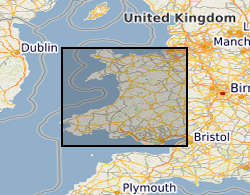
WALES [id=170000]
British Geological Survey Gazetteer: Geographical hierarchy from Geosaurus 1979 creation
- Geographic identifier
-
WLS
ISO 3166_1 alpha-3 2009 revision
))
- End date
- 2020-11 Before
- Unique resource identifier
- OSGB 1936 / British National Grid (EPSG::27700)
- Distribution format
-
Name Version ESRI Shapefile
1994
MapInfo (TAB)
- Distributor contact
-
Organisation name Individual name Electronic mail address Role British Geological Survey
Enquiries
Distributor
- OnLine resource
-
Protocol Linkage Name WWW:LINK-1.0-http--related
https://doi.org/10.5285/83c4e31f-237d-4fa7-a345-7648315f4d22 Citation Information - Digital Object Identifier (DOI)
- OnLine resource
-
Protocol Linkage Name WWW:LINK-1.0-http--link
https://www.bgs.ac.uk/datasets/bgs-mineral-resources/ BGS Datasets - Mineral resources
- Hierarchy level
- Dataset
- Other
-
dataset
Conformance result
- Title
-
INSPIRE Implementing rules laying down technical arrangements for the interoperability and harmonisation of Geology
- Date (Publication)
- 2011
- Explanation
-
See the referenced specification
- Pass
- No
Conformance result
- Title
-
Commission Regulation (EU) No 1089/2010 of 23 November 2010 implementing Directive 2007/2/EC of the European Parliament and of the Council as regards interoperability of spatial data sets and services
- Date (Publication)
- 2010-12-08
- Explanation
-
See http://eur-lex.europa.eu/LexUriServ/LexUriServ.do?uri=OJ:L:2010:323:0011:0102:EN:PDF
- Pass
- No
- Statement
-
[1] BGS DiGMapGB-50 version 5 geology polygons were clipped to the county boundary. [2] A list and map of the geological lithologies for each county were supplied to the Economic Geologist for interpretation of which bedrock and superficial geological formations might now, or in the foreseeable future, be of economic value. [3] Interpretations are then extracted from the derived from DiGMapGB-50 version 5 and given a mineral resource attribute and colour. [4] Maps were re-supplied to the Economic Geologist for correction. Small areas of resources were deleted when considered to be uneconomic/unworkable. [5] Drafts of the finished maps taken to stakeholders for comment. [6] Maps approved and digital data, collated for each map, sent to GIS specialist for dataset preparation and cleaning. [7] Data produced for each map was merged together to produce regional files based on resource commodity. [8] Mineral commodity and name attributes are correctly assigned using the legend supplied by Economic Geologist. [9] Polygons dissolved based on name attribute, removing all county boundaries. [10] Remove sliver polygons (created as a result of geological sheet boundaries) where possible and re-dissolve. [11] Multipart to single part operation conducted on each dataset. [12] Redundant attributes removed. [13] Repair geometry operation to clean the dataset. [14] Economic Geologist approves final resource dataset. The British Geological Survey (BGS) was awarded a grant from the Welsh Assembly Government Aggregates Levy Fund in 2009 to provide a comprehensive, relevant and accessible information base to enhance the sustainability of mineral resources for Wales. BGS co-funded this project through its Sustainable Mineral Solutions project. This work was completed in 2010. In 2020 minor revisions to geometry and attributes were made in in response to minor corrections that were required. The paper maps were not re-released with these data updates. Point data for mineral occurrence and mine site data has not been included in this revision as these data are superseded by other BGS datasets, such as the BGS BritPits database of mines and quarries.
Metadata
- File identifier
- b3c3cf14-9b38-60b7-e054-002128a47908 XML
- Metadata language
- English
- Hierarchy level
- Dataset
- Date stamp
- 2026-07-10
- Metadata standard name
- UK GEMINI
- Metadata standard version
-
2.3
- Metadata author
-
Organisation name Individual name Electronic mail address Role British Geological Survey
Point of contact
- Dataset URI
)))
