 BGS Metadata Catalogue
Laser scans of Ediacaran Fossil Surfaces (NERC Grant NE/P002412/1)
Laser scans of Ediacaran Fossil Surfaces. Data collected 2016-2018 in Newfoundland Canada using a laser-line probe. Data is in the form of .wrp files so can only be opened in Geomagic. The scan files are in files of the bedding plane. All scan numbers with the same base were scanned with the tripod in the same position, so no alignment is needed. Manuel alignment is needed between bases.
Simple
- Date (Creation)
- 2020-06-06
- Citation identifier
- http://data.bgs.ac.uk/id/dataHolding/13607677
- Point of contact
-
Organisation name Individual name Electronic mail address Role British Geological Survey
Enquiries
not available
Distributor British Geological Survey
Enquiries
not available
Point of contact
- Maintenance and update frequency
- notApplicable
-
GEMET - INSPIRE themes, version 1.0
-
BGS Thesaurus of Geosciences
-
-
Fossils
-
Macrofossils
-
- dataCentre
- Keywords
-
-
NERC_DDC
-
- Access constraints
- Other restrictions
- Other constraints
- licenceOGL
- Use constraints
- Other restrictions
- Other constraints
-
The copyright of materials derived from the British Geological Survey's work is vested in the Natural Environment Research Council [NERC]. No part of this work may be reproduced or transmitted in any form or by any means, or stored in a retrieval system of any nature, without the prior permission of the copyright holder, via the BGS Intellectual Property Rights Manager. Use by customers of information provided by the BGS, is at the customer's own risk. In view of the disparate sources of information at BGS's disposal, including such material donated to BGS, that BGS accepts in good faith as being accurate, the Natural Environment Research Council (NERC) gives no warranty, expressed or implied, as to the quality or accuracy of the information supplied, or to the information's suitability for any use. NERC/BGS accepts no liability whatever in respect of loss, damage, injury or other occurence however caused.
- Other constraints
-
Available under the Open Government Licence subject to the following acknowledgement accompanying the reproduced NERC materials "Contains NERC materials ©NERC [year]"
- Language
- English
- Topic category
-
- Geoscientific information
- Geographic identifier
-
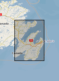
NEWFOUNDLAND PROVINCE [id=745950]
British Geological Survey Gazetteer: Geographical hierarchy from Geosaurus 1979 creation
))
- Begin date
- 2018-09-01
- End date
- 2018-09-30
Reference System Information
- Distribution format
-
Name Version
- Distributor contact
-
Organisation name Individual name Electronic mail address Role British Geological Survey
Enquiries
not available
Distributor
- OnLine resource
-
Protocol Linkage Name WWW:DOWNLOAD-1.0-http--download
https://data.ceda.ac.uk/ngdc/NE_P002412_1 Data
- Hierarchy level
- Dataset
- Other
-
dataset
Conformance result
- Title
-
INSPIRE Implementing rules laying down technical arrangements for the interoperability and harmonisation of Geology
- Date (Publication)
- 2011
- Explanation
-
See the referenced specification
- Pass
- No
Conformance result
- Title
-
Commission Regulation (EU) No 1089/2010 of 23 November 2010 implementing Directive 2007/2/EC of the European Parliament and of the Council as regards interoperability of spatial data sets and services
- Date (Publication)
- 2010-12-08
- Explanation
-
See http://eur-lex.europa.eu/LexUriServ/LexUriServ.do?uri=OJ:L:2010:323:0011:0102:EN:PDF
- Pass
- No
- Statement
-
Laser line probe laser scans of fossil surfaces. Scanned using Geomagic Wrap. Data is in the form of .wrp files so can only be opened in Geomagic.
Metadata
- File identifier
- b25302a0-889e-6f65-e054-002128a47908 XML
- Metadata language
- English
- Hierarchy level
- Dataset
- Date stamp
- 2026-06-27
- Metadata standard name
- UK GEMINI
- Metadata standard version
-
2.3
- Metadata author
-
Organisation name Individual name Electronic mail address Role British Geological Survey
Point of contact
- Dataset URI
)))
