 BGS Metadata Catalogue
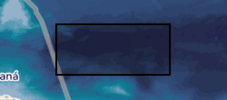
Five Deeps Expedition to map the western Puerto Rico Trench (Atlantic Ocean)
The Brownson Deep area of the Puerto Rico Trench was surveyed with a Kongsberg EM 124 gondola-mounted to the hull of the 225-foot DSSV Pressure Drop. The survey was conducted over the course of two days – December 18-19, 2018. The data meet the requirements for IHO Special Order standards.
Simple
- Date (Creation)
- 2020-09-21
- Citation identifier
- http://data.bgs.ac.uk/id/dataHolding/13607671
- Point of contact
-
Organisation name Individual name Electronic mail address Role Caladan Oceanic LLC
not available
Originator British Geological Survey
Enquiries
not available
Distributor British Geological Survey
Enquiries
not available
Point of contact
- Maintenance and update frequency
- notApplicable
-
GEMET - INSPIRE themes, version 1.0
-
BGS Thesaurus of Geosciences
-
-
Bathymetry
-
Multibeam
-
- dataCentre
- Keywords
-
-
NERC_DDC
-
- Access constraints
- Other restrictions
- Other constraints
- licenceOGL
- Use constraints
- Other restrictions
- Other constraints
-
The copyright of materials derived from the British Geological Survey's work is vested in the Natural Environment Research Council [NERC]. No part of this work may be reproduced or transmitted in any form or by any means, or stored in a retrieval system of any nature, without the prior permission of the copyright holder, via the BGS Intellectual Property Rights Manager. Use by customers of information provided by the BGS, is at the customer's own risk. In view of the disparate sources of information at BGS's disposal, including such material donated to BGS, that BGS accepts in good faith as being accurate, the Natural Environment Research Council (NERC) gives no warranty, expressed or implied, as to the quality or accuracy of the information supplied, or to the information's suitability for any use. NERC/BGS accepts no liability whatever in respect of loss, damage, injury or other occurence however caused.
- Other constraints
-
Available under the Open Government Licence subject to the following acknowledgement accompanying the reproduced NERC materials "Contains NERC materials ©NERC [year]"
- Spatial representation type
- Grid
- Language
- English
- Topic category
-
- Geoscientific information
- Geographic identifier
-
PUERTO RICO TRENCH [id=906900]
British Geological Survey Gazetteer: Geographical hierarchy from Geosaurus 1979 creation
))
- Begin date
- 2018-12-18
- End date
- 2018-12-19
- Unique resource identifier
- WGS 84 (EPSG::4326)
- Distribution format
-
Name Version XYZ
witheld
PDF
witheld
Image (TIFF)
XML
witheld
BAG
- Distributor contact
-
Organisation name Individual name Electronic mail address Role British Geological Survey
Enquiries
not available
Distributor
- OnLine resource
-
Protocol Linkage Name WWW:DOWNLOAD-1.0-http--download
https://webapps.bgs.ac.uk/services/ngdc/accessions/index.html#item137749 Data
- OnLine resource
-
Protocol Linkage Name WWW:LINK-1.0-http--related
https://doi.org/10.5285/7df163a1-30c6-40b6-844d-20fa0acffd18 Citation Information - Digital Object Identifier (DOI)
- Hierarchy level
- Dataset
- Other
-
dataset
Conformance result
- Title
-
INSPIRE Implementing rules laying down technical arrangements for the interoperability and harmonisation of Geology
- Date (Publication)
- 2011
- Explanation
-
See the referenced specification
- Pass
- No
Conformance result
- Title
-
Commission Regulation (EU) No 1089/2010 of 23 November 2010 implementing Directive 2007/2/EC of the European Parliament and of the Council as regards interoperability of spatial data sets and services
- Date (Publication)
- 2010-12-08
- Explanation
-
See http://eur-lex.europa.eu/LexUriServ/LexUriServ.do?uri=OJ:L:2010:323:0011:0102:EN:PDF
- Pass
- No
- Statement
-
All hydrographic surveys were executed aboard the DSSV Pressure Drop built in 1985 (68.28 m long by 13.11 m wide), fitted with a 1° x 2° Kongsberg EM 124 multibeam echosounder (MBES). All MBES data acquisition was undertaken at a typical vessel speed of 8 knots, with a swath width typically 2-3 times water depth or ~ 15-20 km. Survey lines were spaced between 6-7 km to ensure 100% overlap over areas of interest. All raw bathymetry data were processed in QPS Qimera and gridded to 75 m using CUBE algorithms. CUBE algorithms use the surrounding depth information and advanced statistical practices to determine the best estimate of depth while simultaneously calculating the uncertainty of those estimates. The total propagated uncertainty (TPU) was calculated for each dataset.
Metadata
- File identifier
- b0260092-164e-2590-e054-002128a47908 XML
- Metadata language
- English
- Hierarchy level
- Dataset
- Date stamp
- 2026-07-11
- Metadata standard name
- UK GEMINI
- Metadata standard version
-
2.3
- Metadata author
-
Organisation name Individual name Electronic mail address Role British Geological Survey
Point of contact
- Dataset URI
)))
