BGS Data Catalogue
Corrosivity Map for the UK
The dataset is a Soil Corrosivity Map for the U.K. based on the BGS DIGMapGB-PLUS Map. The creation of this dataset involves scoring the Soil Parent Material types for five different attributes that contribute towards the corrosion of underground assets. These are (i) high or low soil pH, (ii) general soil moisture, (iii) the likelihood that soil saturated and undergo periods of anaerobic conditions, (iv) the presence of sulphides and sulphates and (v) the resistivity of the soil parent material. The scoring of each of these parameters was undertaken based on the Cast Iron Pipe Association (CIPA) (now the Ductile Iron Pipe Research Association, DIPRA) rating system. By combining the scores of each parameter a GIS layer has been created that identifies those areas that may provide a corrosive environment to underground cast iron assets. The final map has been classified into three categories signifying: 'GROUND CONDITIONS BENEATH TOPSOIL ARE UNLIKELY TO CAUSE CORROSION OF IRON', 'GROUND CONDITIONS BENEATH TOPSOIL MAY CAUSE CORROSION TO IRON', 'GROUND CONDITIONS BENEATH TOPSOIL ARE LIKELY TO CAUSE CORROSION TO IRON'. The dataset is designed to aid engineers and planners in the management of and maintenance of underground ferrous assets.
INSPIRE
Identification
- File identifier
- aef31136-4603-2b47-e044-0003ba9b0d98 XML
- Resource type
- dataset
Online resource
- Protocol
-
HTTP
Resource identifier
- Metadata Language
- English (en)
- Spatial representation type
- vector
Encoding
- Format
-
ArcGIS Shapefile
- Version
-
any
Projection
Classification of data and services
- Topic category
-
- Geoscientific information
Classification of data and services
Coupled resource
Coupled resource
Classification of data and services
Coupled resource
Coupled resource
Keywords
- GEMET - INSPIRE themes, version 1.0
- BGS Thesaurus of Geosciences
-
-
Chlorides
-
Iron
-
Resistivity
-
Sulphides
-
Sulphates
-
UK Location (INSPIRE)
-
Corrosion
-
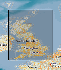
Geographic coverage
))
Temporal reference
Temporal extent
Temporal extent
- Dataset Reference Date ()
- 2011-10-10
Quality and validity
- Lineage
-
The Corrosivity (Ferrosu) dataset comprises a series of layers (water content, pH, redox, resistivity and sulphates/sulphides) where the ‘potential for corrosion’ of each of the properties is scored. The separate GIS property layers contain the scores for each property according to the Cast Iron Pipe Research Association rating (Table 1). These are then combined to give an overall corrosion rating. By having separate layers as well as a combined score layer, the user can see which of the corrosion causing factors is/are detrimental so appropriate engineering remedies can be undertaken if required. It also allows for easier and better data checking.
- Denominator
- 50000
Conformity
Conformity
Conformity
Conformity
Conformity
Conformity
- Explanation
-
See the referenced specification
Restrictions on access and use
- Access constraints
- license
- Access constraints
-
The copyright of materials derived from the British Geological Survey's work is vested in the Natural Environment Research Council [NERC]. No part of this work may be reproduced or transmitted in any form or by any means, or stored in a retrieval system of any nature, without the prior permission of the copyright holder, via the BGS Intellectual Property Rights Manager. Use by customers of information provided by the BGS, is at the customer's own risk. In view of the disparate sources of information at BGS's disposal, including such material donated to BGS, that BGS accepts in good faith as being accurate, the Natural Environment Research Council (NERC) gives no warranty, expressed or implied, as to the quality or accuracy of the information supplied, or to the information's suitability for any use. NERC/BGS accepts no liability whatever in respect of loss, damage, injury or other occurence however caused.
- Access constraints
-
The dataset is made available to external clients under BGS Digital Data Licence terms and conditions. Revert to the IPR Section (iprdigital@bgs.ac.uk) if further advice is required with regard to permitted usage. iprdigital@bgs.ac The dataset is made available to external clients under BGS Digital Data Licence terms and conditions. Revert to the IPR Section (iprdigital@bgs.ac.uk) if further advice is required with regard to permitted usage.
Responsible organization (s)
Contact for the resource
- Organisation name
-
British Geological Survey
-
enquiries@bgs.ac enquiries@bgs.ac.uk
- Organisation name
-
British Geological Survey
-
enquiries@bgs.ac enquiries@bgs.ac.uk
- Organisation name
-
British Geological Survey
-
enquiries@bgs.ac enquiries@bgs.ac.uk
- Organisation name
-
British Geological Survey
-
enquiries@bgs.ac enquiries@bgs.ac.uk
Metadata information
Contact for the metadata
- Organisation name
-
British Geological Survey
-
enquiries@bgs.ac enquiries@bgs.ac.uk
- Metadata Date
- 2024-04-17
- Metadata Language
- English (en)