 BGS Metadata Catalogue
Field photographs of rock formations or modern precipitates from the sedimentary environment (NERC Grant NE/M010953/1)
Field photographs of rock formations or modern precipitates from the sedimentary environment. Samples were collected throughout the UK. This data was collected between February 2019 and November 2019. This data was collected to better understand the low temperature cycling of Telurium (Te) and Sellenium (Se) in the geological environment. For example, a range of ochre samples were included in this data. Ochres are a modern precipitate commonly found in rivers and streams which flow through geographical areas with a history of mining resources which are rich in sulphides. Iron from the sulphides are leached out and deposited downstream, coating river and stream beds, giving a red, yellow or orange colouration. Ochres can be a sink for trace metals such as Te and Se, therefore studying these environments could be informative from a resource perspective but also from an environmental hazard perspective. This data would be useful for researchers who require reference photographs for similar studies or as an aid for resampling.
Simple
- Date (Creation)
- 2020-04-26
- Citation identifier
- http://data.bgs.ac.uk/id/dataHolding/13607622
- Point of contact
-
Organisation name Individual name Electronic mail address Role University of Aberdeen
Dr John Parnell
Principal investigator University of Aberdeen
Connor Brolly
not available
Originator British Geological Survey
Enquiries
not available
Distributor British Geological Survey
Enquiries
not available
Point of contact
- Maintenance and update frequency
- notApplicable
-
GEMET - INSPIRE themes, version 1.0
-
BGS Thesaurus of Geosciences
-
-
Sandstone
-
Slate
-
Ironstone
-
Chalk
-
- dataCentre
- Keywords
-
-
NERC_DDC
-
- Access constraints
- Other restrictions
- Other constraints
- licenceOGL
- Use constraints
- Other restrictions
- Other constraints
-
The copyright of materials derived from the British Geological Survey's work is vested in the Natural Environment Research Council [NERC]. No part of this work may be reproduced or transmitted in any form or by any means, or stored in a retrieval system of any nature, without the prior permission of the copyright holder, via the BGS Intellectual Property Rights Manager. Use by customers of information provided by the BGS, is at the customer's own risk. In view of the disparate sources of information at BGS's disposal, including such material donated to BGS, that BGS accepts in good faith as being accurate, the Natural Environment Research Council (NERC) gives no warranty, expressed or implied, as to the quality or accuracy of the information supplied, or to the information's suitability for any use. NERC/BGS accepts no liability whatever in respect of loss, damage, injury or other occurence however caused.
- Other constraints
-
Available under the Open Government Licence subject to the following acknowledgement accompanying the reproduced NERC materials "Contains NERC materials ©NERC [year]"
- Language
- English
- Topic category
-
- Geoscientific information
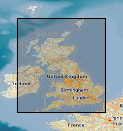
- Geographic identifier
-
GB
ISO 3166_1 alpha-3 2009 revision
- Geographic identifier
-
UK [id=139300]
British Geological Survey Gazetteer: Geographical hierarchy from Geosaurus 1979 creation
- Geographic identifier
-
UKM
ISO 3166_2 2009 revision
))
- Begin date
- 2019-02-04
- End date
- 2019-11-30
- Unique resource identifier
- OSGB 1936 / British National Grid (EPSG::27700)
- Distribution format
-
Name Version Image (JPEG)
- Distributor contact
-
Organisation name Individual name Electronic mail address Role British Geological Survey
Enquiries
not available
Distributor
- OnLine resource
-
Protocol Linkage Name WWW:DOWNLOAD-1.0-http--download
https://webapps.bgs.ac.uk/services/ngdc/accessions/index.html?#item135105 Data
- Hierarchy level
- Dataset
- Other
-
dataset
Conformance result
- Title
-
INSPIRE Implementing rules laying down technical arrangements for the interoperability and harmonisation of Geology
- Date (Publication)
- 2011
- Explanation
-
See the referenced specification
- Pass
- No
Conformance result
- Title
-
Commission Regulation (EU) No 1089/2010 of 23 November 2010 implementing Directive 2007/2/EC of the European Parliament and of the Council as regards interoperability of spatial data sets and services
- Date (Publication)
- 2010-12-08
- Explanation
-
See http://eur-lex.europa.eu/LexUriServ/LexUriServ.do?uri=OJ:L:2010:323:0011:0102:EN:PDF
- Pass
- No
- Statement
-
Field photographs were taken at each locality as part of the sample collection process, to document the in situ geological, geographical or environmental context of the sample. The data is structured as a compressed folder containing subfolders titled with the geographical area, geological age and sample type. Within each folder is a further subfolder titled with the UK OS grid reference for each sample locality.
Metadata
- File identifier
- a5894fd1-b8ee-39cb-e054-002128a47908 XML
- Metadata language
- English
- Hierarchy level
- Dataset
- Date stamp
- 2026-07-11
- Metadata standard name
- UK GEMINI
- Metadata standard version
-
2.3
- Metadata author
-
Organisation name Individual name Electronic mail address Role British Geological Survey
Point of contact
- Dataset URI
)))
