 BGS Data Catalogue
Hidden Crisis Project, Survey 1 dataset: detailed functionality assessments of hand pump boreholes in Ethiopia, Uganda and Malawi (NERC Grant NE/M008606/1)
This dataset provides the field data collected in 2016 to assess the functionality and performance of 600 handpumped borehole supplies (HPBs) across the three countries, Ethiopia, Malawi and Uganda, and the capacity of the community water management arrangements. The individual HPBs surveyed in the dataset were selected by a two or three stage randomised sampling approach. The UPGro Hidden Crisis project (2015-20) was an international research project aimed at developing a robust evidence base and understanding of the complex and multi-faceted causes which underlie the current high failure rates of many new groundwater supplies in Africa. The project was jointly funded by: DFID, NERC and ESRC as part of the UPGro programme. The project carried out the research work in three countries - Ethiopia, Malawi and Uganda – to examine functionality and performance of groundwater supplies in a range of hydrogeological, climatic and social, institutional and governance environments in East Africa. The work focused specifically on examining the functionality of HPBs – these being the main form of improved community water supply across rural Africa. The Survey 1 dataset, is major dataset developed by the project.
INSPIRE
Identification
- File identifier
- a0916dd9-0946-0915-e054-002128a47908 XML
- Resource type
- dataset
Online resource
Resource identifier
- Metadata Language
- English (en)
Encoding
- Format
-
Access Database
- Format
-
PDF
Projection
- code
- WGS 84 (EPSG::4326)
Classification of data and services
- Topic category
-
- Geoscientific information
Classification of data and services
Coupled resource
Coupled resource
Classification of data and services
Coupled resource
Coupled resource
Keywords
- GEMET - INSPIRE themes, version 1.0
- BGS Thesaurus of Geosciences
-
-
Boreholes
-
NGDC Deposited Data
-
Water supply
-
Groundwater
-
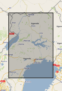
Geographic coverage
))
))
))
Temporal reference
Temporal extent
Temporal extent
- Dataset Reference Date ()
- 2020-03-09
Quality and validity
- Lineage
-
Several methodologies and delivery methods were used to developed the Hidden Crisis Survey 1 dataset. A full description of the different methodologies used to develop the dataset are provided in the Metadata document documents, available with the dataset.
Conformity
Conformity
Conformity
Conformity
Conformity
Conformity
- Explanation
-
See the referenced specification
Restrictions on access and use
- Access constraints
- licenceOGL
- Access constraints
- Available under the Open Government Licence subject to the following acknowledgement accompanying the reproduced NERC materials "Contains NERC materials ©NERC [year]"
- Access constraints
-
The copyright of materials derived from the British Geological Survey's work is vested in the Natural Environment Research Council [NERC]. No part of this work may be reproduced or transmitted in any form or by any means, or stored in a retrieval system of any nature, without the prior permission of the copyright holder, via the BGS Intellectual Property Rights Manager. Use by customers of information provided by the BGS, is at the customer's own risk. In view of the disparate sources of information at BGS's disposal, including such material donated to BGS, that BGS accepts in good faith as being accurate, the Natural Environment Research Council (NERC) gives no warranty, expressed or implied, as to the quality or accuracy of the information supplied, or to the information's suitability for any use. NERC/BGS accepts no liability whatever in respect of loss, damage, injury or other occurence however caused.
- Access constraints
-
There are no restrictions on the use that may be made of the dataset, although an appropriate copyright acknowledgement must be made when any part of the dataset is reproduced. Either no third party data / information is contained in the dataset or BGS has secured written permission from the owner of any third party data / information contained in the dataset to make the dataset freely available without any use constraints - inclusion of any third party data / information will affect the copyright acknowledgement that needs to be made.
Responsible organization (s)
Contact for the resource
- Organisation name
-
British Geological Survey
-
enquiries@bgs.ac enquiries@bgs.ac.uk
- Organisation name
-
British Geological Survey
-
enquiries@bgs.ac enquiries@bgs.ac.uk
- Organisation name
-
British Geological Survey
-
enquiries@bgs.ac enquiries@bgs.ac.uk
- Organisation name
-
British Geological Survey
-
enquiries@bgs.ac enquiries@bgs.ac.uk
Metadata information
Contact for the metadata
- Organisation name
-
British Geological Survey
-
enquiries@bgs.ac enquiries@bgs.ac.uk
- Metadata Date
- 2024-04-18
- Metadata Language
- English (en)
SDS
Conformance class 1: invocable
Access Point URL
Endpoint URL
Technical specification
Conformance class 2: interoperable
Access constraints
Limitation
Use constraints
Limitation
Responsible custodian
Contact for the resource
Overviews
Publishing Body
