 BGS Metadata Catalogue
GSNI 50K Superficial
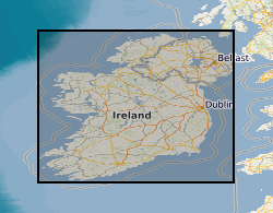
1:50,000 maps showing the main geological superficial divisions in Northern Ireland. This series shows the superficial (drift) geology of Northern Ireland at 1:50,000 scale. For each rock unit there is a brief generalised description under the following headings. LEX_D: Description of the selected polygon. LEX_RCS: Map code as it appears on the published 1:250,000 map. RCS_D: Decription of the deposit. VERSION: Version of the data. RELEASED: Date of release/update of the data. Persons interested in the detailed geology of particular sites should consult the latest large-scale maps or the Geological Survey of Northern Ireland at:- Geological Survey of Northern Ireland Colby House Stranmillis Court Belfast BT9 5BF
Simple
- Date (Creation)
- 2001
- Citation identifier
- http://data.bgs.ac.uk/id/dataHolding/13605556
- Point of contact
-
Organisation name Individual name Electronic mail address Role British Geological Survey
Enquiries
Distributor British Geological Survey
Enquiries
Point of contact British Geological Survey
Enquiries
User
- Maintenance and update frequency
- Continual
-
GEMET - INSPIRE themes, version 1.0
-
BGS Thesaurus of Geosciences
-
-
Geology
-
General geology
-
Field geology
-
- dataCentre
- Keywords
-
-
NERC_DDC
-
- Access constraints
- Other restrictions
- Other constraints
- license
- Other constraints
- Copyright acknowledgement required: Reproduced from the Geological Survey of Northern Ireland, with the permission of the Director.© Crown Copyright.
- Use constraints
- Other restrictions
- Other constraints
-
The copyright of materials derived from the British Geological Survey's work is vested in the Natural Environment Research Council [NERC]. No part of this work may be reproduced or transmitted in any form or by any means, or stored in a retrieval system of any nature, without the prior permission of the copyright holder, via the BGS Intellectual Property Rights Manager. Use by customers of information provided by the BGS, is at the customer's own risk. In view of the disparate sources of information at BGS's disposal, including such material donated to BGS, that BGS accepts in good faith as being accurate, the Natural Environment Research Council (NERC) gives no warranty, expressed or implied, as to the quality or accuracy of the information supplied, or to the information's suitability for any use. NERC/BGS accepts no liability whatever in respect of loss, damage, injury or other occurence however caused.
- Other constraints
-
formal permission to do something. Copyright acknowledgement required: Reproduced from the Geological Survey of Northern Ireland, with the permission of the Director.© Crown Copyright.
- Other constraints
-
limitation not listed. Copyright acknowledgement required: Reproduced from the Geological Survey of Northern Ireland, with the permission of the Director.© Crown Copyright.
- Spatial representation type
- Grid
- Denominator
- 50000
- Language
- English
- Topic category
-
- Geoscientific information
- Geographic identifier
-
NIR
ISO 3166_1 alpha-3 2009 revision
- Geographic identifier
-
NORTHERN IRELAND [id=181000]
British Geological Survey Gazetteer: Geographical hierarchy from Geosaurus 1979 creation
))
- Begin date
- 2010 Before
- Unique resource identifier
- TM65 / Irish National Grid (EPSG::29900)
- Distribution format
-
Name Version
- Distributor contact
-
Organisation name Individual name Electronic mail address Role British Geological Survey
Enquiries
Distributor
- OnLine resource
-
Protocol Linkage Name WWW:LINK-1.0-http--link
https://mapapps2.bgs.ac.uk/GSNI_Geoindex/home.html GSNI GeoIndex
- Hierarchy level
- Dataset
Conformance result
- Title
-
INSPIRE Implementing rules laying down technical arrangements for the interoperability and harmonisation of Geology
- Date (Publication)
- 2011
- Explanation
-
See the referenced specification
- Pass
- No
Conformance result
- Title
-
Commission Regulation (EU) No 1089/2010 of 23 November 2010 implementing Directive 2007/2/EC of the European Parliament and of the Council as regards interoperability of spatial data sets and services
- Date (Publication)
- 2010-12-08
- Explanation
-
See http://eur-lex.europa.eu/LexUriServ/LexUriServ.do?uri=OJ:L:2010:323:0011:0102:EN:PDF
- Pass
- No
- Statement
-
This layer shows the superficial (drift) geology of Northern Ireland at 1:50,000 scale.
Metadata
- File identifier
- 9fc79e94-a9ca-3e5c-e044-0003ba9b0d98 XML
- Metadata language
- English
- Hierarchy level
- Dataset
- Date stamp
- 2026-07-10
- Metadata standard name
- UK GEMINI
- Metadata standard version
-
2.3
- Metadata author
-
Organisation name Individual name Electronic mail address Role British Geological Survey
Point of contact
- Dataset URI
)))
