BGS Data Catalogue
Structure and evolution of the Sorbas basin - dataset (NERC Grant NE/F019475/1)
The dataset comprises: Petrophysical data for rocks from the region, XRD mineralogical data, Results of the gravity survey of the basin, tabulation and location of all bedding orientation data for the basin, and sediment transport lineation data. The dataset accompanies publication : On the Structure and Evolution of the Sorbas Basin, S.E. Spain, Tectonophysics 773 (2019) 228230, DOI: https://doi.org/10.1016/j.tecto.2019.228230
INSPIRE
Identification
- File identifier
- 9df98f33-d292-3c82-e054-002128a47908 XML
- Resource type
- dataset
Online resource
Resource identifier
- Metadata Language
- English (en)
Encoding
- Format
-
MS Excel
Projection
Classification of data and services
- Topic category
-
- Geoscientific information
Classification of data and services
Coupled resource
Coupled resource
Classification of data and services
Coupled resource
Coupled resource
Keywords
- GEMET - INSPIRE themes, version 1.0
- BGS Thesaurus of Geosciences
-
-
Gravity
-
Petrophysics
-
NGDC Deposited Data
-
Mineralogy
-
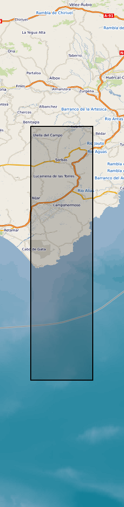
Geographic coverage
))
Temporal reference
Temporal extent
Temporal extent
- Dataset Reference Date ()
- 2020-02-03
Quality and validity
- Lineage
-
Orientation data: standard geological mapping. Gravity data and depth to basin floor: standard regional gravity survey. Petrophysical data: density, porosity, and acoustic velocity anisotropy data by time-of-flight lab velocity measurements. Standard XRD analysis for mineralogical modal fractions.
Conformity
Conformity
Conformity
Conformity
Conformity
Conformity
- Explanation
-
See the referenced specification
Restrictions on access and use
- Access constraints
- no limitations
- Access constraints
- The dataset is made freely available for access, e.g. via the Internet. Either no third party data / information is contained in the dataset or BGS has secured written permission from the owner(s) of any third party data / information contained in the dataset to make the dataset freely accessible.
- Access constraints
-
The copyright of materials derived from the British Geological Survey's work is vested in the Natural Environment Research Council [NERC]. No part of this work may be reproduced or transmitted in any form or by any means, or stored in a retrieval system of any nature, without the prior permission of the copyright holder, via the BGS Intellectual Property Rights Manager. Use by customers of information provided by the BGS, is at the customer's own risk. In view of the disparate sources of information at BGS's disposal, including such material donated to BGS, that BGS accepts in good faith as being accurate, the Natural Environment Research Council (NERC) gives no warranty, expressed or implied, as to the quality or accuracy of the information supplied, or to the information's suitability for any use. NERC/BGS accepts no liability whatever in respect of loss, damage, injury or other occurence however caused.
- Access constraints
-
Available under the Open Government Licence subject to the following acknowledgement accompanying the reproduced NERC materials "Contains NERC materials ©NERC [year]"
Responsible organization (s)
Contact for the resource
- Organisation name
-
University of Manchester
-
not available
- Organisation name
-
University of Manchester
-
not available
Responsible organization (s)
Contact for the resource
- Organisation name
-
University of Manchester
-
not available
- Organisation name
-
University of Manchester
-
not available
Metadata information
Contact for the metadata
- Organisation name
-
British Geological Survey
-
enquiries@bgs.ac enquiries@bgs.ac.uk
- Metadata Date
- 2024-04-24
- Metadata Language
- English (en)