 BGS Metadata Catalogue
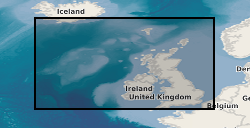
Map based index (GeoIndex) offshore seabed samples
The data shows the location of seabed and sub-seabed samples collected from the UK continental shelf, held by BGS. A BGS Sample Station is a general location at which sampling with one or more equipment types, such as borehole, grab, dredge, has been used. Historically, all deployment of equipment was recorded with the same coordinates so the data shown here will often show several sets of data at the same location. Newer data will begin to show distinct locations based on an equipment type. This layer shows all the BGS Sample Station Locations, including those where the Sampling was unsuccessful. The layers below are divided into distinct equipment types, plus a separate layer for unsuccessful sampling. BGS Sample Station Locations can have a wide range of potential information available. This can vary from a basic description derived from a simple piece of paper up to a complex set of information with a number of datasets. These datasets can include particle size analysis, geotechnical parameters, detailed marine geology, geochemical analysis and others. Prices are available on further enquiry.
Simple
- Date (Creation)
- 2000
- Citation identifier
- http://data.bgs.ac.uk/id/dataHolding/13605481
- Point of contact
-
Organisation name Individual name Electronic mail address Role British Geological Survey
Enquiries
Distributor British Geological Survey
Enquiries
Point of contact
- Maintenance and update frequency
- As needed
-
GEMET - INSPIRE themes, version 1.0
-
BGS Thesaurus of Geosciences
-
-
Sea floor
-
Dredges
-
Core samples
-
Grab samples
-
Sea floor sediments
-
Bottom sampling
-
Drilling
-
Marine geology
-
- dataCentre
- Keywords
-
-
NERC_DDC
-
- Access constraints
- Other restrictions
- Other constraints
- Free access. The usual BGS licensing terms and conditions apply to external use of the data.
- Use constraints
- Other restrictions
- Other constraints
-
The copyright of materials derived from the British Geological Survey's work is vested in the Natural Environment Research Council [NERC]. No part of this work may be reproduced or transmitted in any form or by any means, or stored in a retrieval system of any nature, without the prior permission of the copyright holder, via the BGS Intellectual Property Rights Manager. Use by customers of information provided by the BGS, is at the customer's own risk. In view of the disparate sources of information at BGS's disposal, including such material donated to BGS, that BGS accepts in good faith as being accurate, the Natural Environment Research Council (NERC) gives no warranty, expressed or implied, as to the quality or accuracy of the information supplied, or to the information's suitability for any use. NERC/BGS accepts no liability whatever in respect of loss, damage, injury or other occurence however caused.
- Other constraints
-
Either: (i) the dataset is made freely available, e.g. via the Internet, for a restricted category of use (e.g. educational use only); or (ii) the dataset has not been formally approved by BGS for access and use by external clients under licence, but its use may be permitted under alternative formal arrangements; or (iii) the dataset contains 3rd party data or information obtained by BGS under terms and conditions that must be consulted in order to determine the permitted usage of the dataset. Refer to the BGS staff member responsible for the creation of the dataset if further advice is required. He / she should be familiar with the composition of the dataset, particularly with regard to 3rd party IPR contained in it, and any resultant use restrictions. This staff member should revert to the IPR Section ( ipr@bgs.ac.uk) for advice, should the position not be clear.
- Spatial representation type
- Vector
- Denominator
- 2500000
- Language
- English
- Topic category
-
- Geoscientific information
- Geographic identifier
-
UK CONTINENTAL SHELF [id=121701]
British Geological Survey Gazetteer: Geographical hierarchy from Geosaurus 1979 creation
))
- End date
- 2014-01
- Supplemental Information
-
Data visible at map scales below 1:2,500,000.
- Unique resource identifier
- WGS 84 (EPSG::4326)
- Distribution format
-
Name Version
- Distributor contact
-
Organisation name Individual name Electronic mail address Role British Geological Survey
Enquiries
Distributor
- OnLine resource
-
Protocol Linkage Name WWW:LINK-1.0-http--link
https://www.bgs.ac.uk/map-viewers/geoindex-offshore/ GeoIndex (offshore)
- OnLine resource
-
Protocol Linkage Name WWW:LINK-1.0-http--link
https://mapapps2.bgs.ac.uk/geoindex_offshore/home.html GeoIndex Offshore
- Hierarchy level
- Dataset
- Other
-
dataset
Conformance result
- Title
-
INSPIRE Implementing rules laying down technical arrangements for the interoperability and harmonisation of Geology
- Date (Publication)
- 2011
- Explanation
-
See the referenced specification
- Pass
- No
Conformance result
- Title
-
Commission Regulation (EU) No 1089/2010 of 23 November 2010 implementing Directive 2007/2/EC of the European Parliament and of the Council as regards interoperability of spatial data sets and services
- Date (Publication)
- 2010-12-08
- Explanation
-
See http://eur-lex.europa.eu/LexUriServ/LexUriServ.do?uri=OJ:L:2010:323:0011:0102:EN:PDF
- Pass
- No
- Statement
-
GeoIndex is a publically-accessible map-based index to the datasets that BGS have collected or have obtained from other sources. All datasets presented are derived from the BGS corporate data holdings.
Metadata
- File identifier
- 9df8df53-2aa3-37a8-e044-0003ba9b0d98 XML
- Metadata language
- English
- Hierarchy level
- Dataset
- Date stamp
- 2026-07-26
- Metadata standard name
- UK GEMINI
- Metadata standard version
-
2.3
- Metadata author
-
Organisation name Individual name Electronic mail address Role British Geological Survey
Point of contact
- Dataset URI
)))
