 BGS Metadata Catalogue
BGS Mineral Assessment Reports
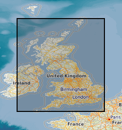
This dataset shows the geographic extents of Mineral Assessment Reports covering sand and gravel resources and selected other industrial minerals across the United Kingdom. The index polygons represent the areas surveyed, typically between 100 and 200 square kilometres, for which individual reports and accompanying 1:25 000 scale maps were produced. The sand and gravel resources of the UK were surveyed on a regional basis by the Industrial Minerals Assessment Unit (IMAU) between 1968 and 1990. Each survey area was investigated through drilling and sampling of sand and gravel deposits, borehole logging, and particle-size analysis to determine the proportion of gravel, sand and fines. The accompanying maps categorise resources as exposed, present beneath overburden, or potentially not workable. In addition to sand and gravel, other industrial mineral resources were assessed during the same period, including celestite, limestone and dolomite, conglomerate, and hard rock resources. Selecting individual polygons provides details of the corresponding report, including title, report number, author(s), subtitle and publication date. The Mineral Assessment Report series was commissioned by the Department of the Environment and undertaken by the British Geological Survey.
Simple
- Date (Creation)
- 2000
- Citation identifier
- http://data.bgs.ac.uk/id/dataHolding/13605476
- Point of contact
-
Organisation name Individual name Electronic mail address Role British Geological Survey
Enquiries
Distributor British Geological Survey
Enquiries
Point of contact
- Maintenance and update frequency
- As needed
-
GEMET - INSPIRE themes, version 1.0
-
BGS Thesaurus of Geosciences
-
-
Economic geology
-
Mineral deposits
-
Resource assessment
-
Mineral resources
-
Mineral sands
-
Gravel
-
Digital data
-
Natural resources
-
Boreholes
-
- dataCentre
- Keywords
-
-
NERC_DDC
-
- Access constraints
- Other restrictions
- Other constraints
- licenceOGL
- Use constraints
- Other restrictions
- Other constraints
-
The copyright of materials derived from the British Geological Survey's work is vested in the Natural Environment Research Council [NERC]. No part of this work may be reproduced or transmitted in any form or by any means, or stored in a retrieval system of any nature, without the prior permission of the copyright holder, via the BGS Intellectual Property Rights Manager. Use by customers of information provided by the BGS, is at the customer's own risk. In view of the disparate sources of information at BGS's disposal, including such material donated to BGS, that BGS accepts in good faith as being accurate, the Natural Environment Research Council (NERC) gives no warranty, expressed or implied, as to the quality or accuracy of the information supplied, or to the information's suitability for any use. NERC/BGS accepts no liability whatever in respect of loss, damage, injury or other occurence however caused.
- Other constraints
-
Available under the Open Government Licence subject to the following acknowledgement accompanying the reproduced NERC materials "Contains NERC materials ©NERC [year]"
- Spatial representation type
- Vector
- Denominator
- 10560
- Language
- English
- Topic category
-
- Geoscientific information
- Geographic identifier
-
GBN
ISO 3166_2 2009 revision
- Geographic identifier
-
GREAT BRITAIN [id=139600]
British Geological Survey Gazetteer: Geographical hierarchy from Geosaurus 1979 creation
))
- End date
- 2014-01 Before
- Supplemental Information
-
Data is visible at all map scales.
- Unique resource identifier
- OSGB 1936 / British National Grid (EPSG::27700)
- Distribution format
-
Name Version ESRI Shapefile (.shp)
PDF file (.pdf)
- Distributor contact
-
Organisation name Individual name Electronic mail address Role British Geological Survey
Enquiries
Distributor
- OnLine resource
-
Protocol Linkage Name WWW:LINK-1.0-http--link
https://www.bgs.ac.uk/map-viewers/geoindex-onshore/ GeoIndex (onshore)
- OnLine resource
-
Protocol Linkage Name WWW:LINK-1.0-http--link
https://www.bgs.ac.uk/mineralsuk/minerals/mine-and-quarry/industrial-mineral-assessment-unit-imau-reports-and-maps/ Industrial Mineral Assessment Unit (IMAU) reports and maps
- Hierarchy level
- Dataset
- Other
-
dataset
Conformance result
- Title
-
INSPIRE Implementing rules laying down technical arrangements for the interoperability and harmonisation of Geology
- Date (Publication)
- 2011
- Explanation
-
See the referenced specification
- Pass
- No
Conformance result
- Title
-
Commission Regulation (EU) No 1089/2010 of 23 November 2010 implementing Directive 2007/2/EC of the European Parliament and of the Council as regards interoperability of spatial data sets and services
- Date (Publication)
- 2010-12-08
- Explanation
-
See http://eur-lex.europa.eu/LexUriServ/LexUriServ.do?uri=OJ:L:2010:323:0011:0102:EN:PDF
- Pass
- No
- Statement
-
The information for this dataset was taken from the BGS UK Sand and Gravel Database. Each report studied the sand and gravel resources of an area of between one hundred and two hundred square kilometres. Specially commissioned boreholes were used in conjunction with existing geological knowledge to make a resource level assessment of the volume and quality of sand and gravel resource available. A total of 12,563 boreholes were drilled, 53,721 Lithological units described and 54,128 samples collected and graded. This information is presented in the appendixes of the individual reports and as a single database.
Metadata
- File identifier
- 9df8df53-2a9e-37a8-e044-0003ba9b0d98 XML
- Metadata language
- English
- Hierarchy level
- Dataset
- Date stamp
- 2026-07-10
- Metadata standard name
- UK GEMINI
- Metadata standard version
-
2.3
- Metadata author
-
Organisation name Individual name Electronic mail address Role British Geological Survey
Point of contact
- Dataset URI
)))
