 BGS Metadata Catalogue
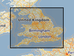
Map based index (GeoIndex) Aquifer Vulnerability Maps
This layer of the map based index (GeoIndex) shows where aquifer vulnerability maps are available for England and Wales. These maps identify areas in which the groundwater resources require protection from potentially polluting activities. The maps are designed to be used by planners, developers, consultants and regulatory bodies to ensure that developments conform to the Policy and Practice of the Environment Agency for the protection of Groundwater. The Soil Survey, Land Research Centre and the British Geological Survey were commissioned by the Environment Agency to prepare 53 groundwater vulnerability maps at 1:100,000 scale. Currently we are unable to provide scanned copies of these maps due to Copyright restrictions. Please note that these maps are based on data from the late 1980's and early 1990's. More up-to-date digital data may now be available from the Environment Agency.
Simple
- Date (Creation)
- 2000
- Citation identifier
- http://data.bgs.ac.uk/id/dataHolding/13605469
- Point of contact
-
Organisation name Individual name Electronic mail address Role British Geological Survey
Enquiries
Distributor British Geological Survey
Enquiries
Point of contact
- Maintenance and update frequency
- As needed
-
GEMET - INSPIRE themes, version 1.0
-
BGS Thesaurus of Geosciences
-
-
Ground water pollution
-
Aquifers
-
Groundwater
-
Maps
-
- dataCentre
- Keywords
-
-
NERC_DDC
-
- Access constraints
- Other restrictions
- Other constraints
- Free access. The usual BGS licensing terms and conditions apply to external use of the data.
- Use constraints
- Other restrictions
- Other constraints
-
The copyright of materials derived from the British Geological Survey's work is vested in the Natural Environment Research Council [NERC]. No part of this work may be reproduced or transmitted in any form or by any means, or stored in a retrieval system of any nature, without the prior permission of the copyright holder, via the BGS Intellectual Property Rights Manager. Use by customers of information provided by the BGS, is at the customer's own risk. In view of the disparate sources of information at BGS's disposal, including such material donated to BGS, that BGS accepts in good faith as being accurate, the Natural Environment Research Council (NERC) gives no warranty, expressed or implied, as to the quality or accuracy of the information supplied, or to the information's suitability for any use. NERC/BGS accepts no liability whatever in respect of loss, damage, injury or other occurence however caused.
- Other constraints
-
Either: (i) the dataset is made freely available, e.g. via the Internet, for a restricted category of use (e.g. educational use only); or (ii) the dataset has not been formally approved by BGS for access and use by external clients under licence, but its use may be permitted under alternative formal arrangements; or (iii) the dataset contains 3rd party data or information obtained by BGS under terms and conditions that must be consulted in order to determine the permitted usage of the dataset. Refer to the BGS staff member responsible for the creation of the dataset if further advice is required. He / she should be familiar with the composition of the dataset, particularly with regard to 3rd party IPR contained in it, and any resultant use restrictions. This staff member should revert to the IPR Section ( ipr@bgs.ac.uk) for advice, should the position not be clear.
- Spatial representation type
- Vector
- Denominator
- 1000000
- Language
- English
- Topic category
-
- Geoscientific information
- Geographic identifier
-
EAW
ISO 3166_2 2009 revision
- Geographic identifier
-
ENGLAND & WALES [id=149000]
British Geological Survey Gazetteer: Geographical hierarchy from Geosaurus 1979 creation
))
- End date
- 2014-01 Before
- Supplemental Information
-
Data is visible at all map scales.
- Unique resource identifier
- OSGB 1936 / British National Grid (EPSG::27700)
- Distribution format
-
Name Version
- Distributor contact
-
Organisation name Individual name Electronic mail address Role British Geological Survey
Enquiries
Distributor
- OnLine resource
-
Protocol Linkage Name WWW:LINK-1.0-http--link
https://mapapps2.bgs.ac.uk/geoindex/home.html?layer=BGSAquVul GeoIndex Onshore: Aquifer vulnerability maps
- OnLine resource
-
Protocol Linkage Name OGC:WMS
https://map.bgs.ac.uk/arcgis/services/GeoIndex_Onshore/products/MapServer/WMSServer? British Geological Survey (BGS) GeoIndex - Map products data theme
- OnLine resource
-
Protocol Linkage Name OGC:WMS-1.3.0-http-get-capabilities
https://map.bgs.ac.uk/arcgis/services/GeoIndex_Onshore/products/MapServer/WMSServer?service=WMS&request=GetCapabilities British Geological Survey (BGS) GeoIndex - Map products data theme
- Hierarchy level
- Dataset
- Other
-
dataset
Conformance result
- Title
-
INSPIRE Implementing rules laying down technical arrangements for the interoperability and harmonisation of Geology
- Date (Publication)
- 2011
- Explanation
-
See the referenced specification
- Pass
- No
Conformance result
- Title
-
Commission Regulation (EU) No 1089/2010 of 23 November 2010 implementing Directive 2007/2/EC of the European Parliament and of the Council as regards interoperability of spatial data sets and services
- Date (Publication)
- 2010-12-08
- Explanation
-
See http://eur-lex.europa.eu/LexUriServ/LexUriServ.do?uri=OJ:L:2010:323:0011:0102:EN:PDF
- Pass
- No
- Statement
-
This layer of the GeoIndex provides an index to aquifer vulnerability maps produced by the British Geological Survey, the Soil Survey and the Land Research Centre, commissioned by the Environment Agency.
Metadata
- File identifier
- 9df8df53-2a97-37a8-e044-0003ba9b0d98 XML
- Metadata language
- English
- Hierarchy level
- Dataset
- Date stamp
- 2026-07-10
- Metadata standard name
- UK GEMINI
- Metadata standard version
-
2.3
- Metadata author
-
Organisation name Individual name Electronic mail address Role British Geological Survey
Point of contact
- Dataset URI
)))
