BGS Data Catalogue
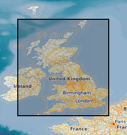
Map based index (GeoIndex) Coal Authority seismic data
The map shows the location and line-identifiers of reflection seismic profiles acquired by the former National Coal Board and British Coal during their exploration for coal in the UK. Ownership of UK coal exploration data was transferred to the Coal Authority following privatisation of the UK coal industry. The Coal Authority have appointed the British Geological Survey as custodian of this important national geological data archive. These data are, in general, publicly available; however, access to data within active mining licences is restricted in that it requires the consent of the mining licensee. The Coal Authority data archive includes hardcopy and digital data for the reflection seismic profiles, such as film and paper prints, original field tapes, demultiplexed data, processed stacked data, navigation (location) data and observers' and surveyors' acquisition reports. But please note that not all data types are available for all profiles. The BGS will be pleased to provide information on data availability for named profiles or within specified geographic areas, together with cost estimates and options for supplying copies.
- Identification
- Distribution
- Quality
- Spatial rep.
- Ref. system
- Content
- Portrayal
- Metadata
- Md. constraints
- Md. maintenance
- Schema info
Identification
Data identification
Citation
- Dataset Reference Date ()
- 2000
British Geological Survey
-Enquiries
Environmental Science Centre, Nicker Hill, Keyworth
,NOTTINGHAM
,NOTTINGHAMSHIRE
,NG12 5GG
,United Kingdom
0115 936 3276
British Geological Survey
-Enquiries
Environmental Science Centre, Nicker Hill, Keyworth
,NOTTINGHAM
,NOTTINGHAMSHIRE
,NG12 5GG
,United Kingdom
0115 936 3276
- Maintenance and update frequency
- monthly
- GEMET - INSPIRE themes, version 1.0
- BGS Thesaurus of Geosciences
-
-
Coal
-
Coal exploration
-
UK Location (INSPIRE)
-
Seismic data
-
Scottish SDI
-
- Keywords ()
- Keywords
-
-
NERC_DDC
-
Legal constraints
- Limitations on Public Access
- otherRestrictions
Legal constraints
- Use constraints
- otherRestrictions
- Other constraints
-
The copyright of materials derived from the British Geological Survey's work is vested in the Natural Environment Research Council [NERC]. No part of this work may be reproduced or transmitted in any form or by any means, or stored in a retrieval system of any nature, without the prior permission of the copyright holder, via the BGS Intellectual Property Rights Manager. Use by customers of information provided by the BGS, is at the customer's own risk. In view of the disparate sources of information at BGS's disposal, including such material donated to BGS, that BGS accepts in good faith as being accurate, the Natural Environment Research Council (NERC) gives no warranty, expressed or implied, as to the quality or accuracy of the information supplied, or to the information's suitability for any use. NERC/BGS accepts no liability whatever in respect of loss, damage, injury or other occurence however caused.
- Other constraints
-
Either: (i) the dataset is made freely available, e.g. via the Internet, for a restricted category of use (e.g. educational use only); or (ii) the dataset has not been formally approved by BGS for access and use by external clients under licence, but its use may be permitted under alternative formal arrangements; or (iii) the dataset contains 3rd party data or information obtained by BGS under terms and conditions that must be consulted in order to determine the permitted usage of the dataset. Refer to the BGS staff member responsible for the creation of the dataset if further advice is required. He / she should be familiar with the composition of the dataset, particularly with regard to 3rd party IPR contained in it, and any resultant use restrictions. This staff member should revert to the IPR Section (ipr@bgs.ac.uk) for advice, should the position not be clear. ipr@bgs.ac Either: (i) the dataset is made freely available, e.g. via the Internet, for a restricted category of use (e.g. educational use only); or (ii) the dataset has not been formally approved by BGS for access and use by external clients under licence, but its use may be permitted under alternative formal arrangements; or (iii) the dataset contains 3rd party data or information obtained by BGS under terms and conditions that must be consulted in order to determine the permitted usage of the dataset. Refer to the BGS staff member responsible for the creation of the dataset if further advice is required. He / she should be familiar with the composition of the dataset, particularly with regard to 3rd party IPR contained in it, and any resultant use restrictions. This staff member should revert to the IPR Section (ipr@bgs.ac.uk) for advice, should the position not be clear.
- Spatial representation type
- vector
- Denominator
- 2000000
- Metadata Language
- English (en)
- Topic category
-
- Geoscientific information
Extent
- Extent
-
GBN
Citation
- Dataset Reference Date ()
- 2009
- Extent
-
GREAT BRITAIN [id=139600]
Citation
- Dataset Reference Date ()
- 1979
))
- End date
- 2014-01
- Additional information
-
Data is visible at map scales below 1:2000000.
Distribution
Distribution
- Data format
-
-
Geographic Information System
()
-
British Geological Survey
-Enquiries
Environmental Science Centre, Nicker Hill, Keyworth
,NOTTINGHAM
,NOTTINGHAMSHIRE
,NG12 5GG
,United Kingdom
0115 936 3276
- Resource Locator
-
Geophysics map theme
The wms layer for 'GeoIndex Coal Authority seismic data' is held within the 'Geophysics map' theme WMS layer which this URL connects to.
- Resource Locator
- GeoIndex Coal Authority seismic data
Quality
Data quality
Scope
- Quality Scope
- dataset
- Other
-
dataset
Report
Citation
- Dataset Reference Date ()
- 2011
- Explanation
-
See the referenced specification
- Degree
Report
Citation
- Dataset Reference Date ()
- 2010-12-08
- Explanation
-
See http://eur-lex.europa.eu/LexUriServ/LexUriServ.do?uri=OJ:L:2010:323:0011:0102:EN:PDF
- Degree
- Statement
-
This layer of the GeoIndex is based on an index to data acquired by British Geological Survey from the Coal Authority. The data originates from the Coal Board and British Coal during their exploration for coal in the UK.
Ref. system
Metadata
Metadata
- File identifier
- 9df8df53-2a8e-37a8-e044-0003ba9b0d98 XML
- Metadata Language
- English (en)
- Resource type
- dataset
- Metadata Date
- 2024-04-17
- Metadata standard name
- UK GEMINI
- Metadata standard version
-
2.3
British Geological Survey
Environmental Science Centre,Keyworth
,NOTTINGHAM
,NOTTINGHAMSHIRE
,NG12 5GG
,United Kingdom
- Dataset URI