 BGS Metadata Catalogue
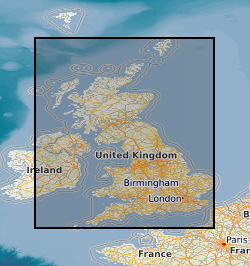
Map based index (GeoIndex) urban geochemical reports
This layer displays the urban areas for which there is an "urban geochemical mapping" report. An integral part of the G-BASE (Geochemical Baseline Survey of the Environment) mapping programme is to map and establish the soil geochemical baselines of urban areas. These data provide unique soil chemical information for the urban environment and are used to; assess the condition of soils within populated areas, identify and quantify human impact on soils in urban areas through comparison with the rural, natural soil geochemical background and Indicate elevated concentrations of potential harmful elements. 27 urban areas which have been sampled by the project to date.These include Glasgow, Nottingham, Ipswich and Cardiff.
Simple
- Date (Creation)
- 2000
- Citation identifier
- http://data.bgs.ac.uk/id/dataHolding/13605458
- Point of contact
-
Organisation name Individual name Electronic mail address Role British Geological Survey
Enquiries
Distributor British Geological Survey
Enquiries
Point of contact
- Maintenance and update frequency
- As needed
-
GEMET - INSPIRE themes, version 1.0
-
BGS Thesaurus of Geosciences
-
-
Geochemistry
-
- dataCentre
- Keywords
-
-
NERC_DDC
-
- Access constraints
- Other restrictions
- Other constraints
- Free access. The usual BGS licensing terms and conditions apply to external use of the data.
- Use constraints
- Other restrictions
- Other constraints
-
The copyright of materials derived from the British Geological Survey's work is vested in the Natural Environment Research Council [NERC]. No part of this work may be reproduced or transmitted in any form or by any means, or stored in a retrieval system of any nature, without the prior permission of the copyright holder, via the BGS Intellectual Property Rights Manager. Use by customers of information provided by the BGS, is at the customer's own risk. In view of the disparate sources of information at BGS's disposal, including such material donated to BGS, that BGS accepts in good faith as being accurate, the Natural Environment Research Council (NERC) gives no warranty, expressed or implied, as to the quality or accuracy of the information supplied, or to the information's suitability for any use. NERC/BGS accepts no liability whatever in respect of loss, damage, injury or other occurence however caused.
- Other constraints
-
Either: (i) the dataset is made freely available, e.g. via the Internet, for a restricted category of use (e.g. educational use only); or (ii) the dataset has not been formally approved by BGS for access and use by external clients under licence, but its use may be permitted under alternative formal arrangements; or (iii) the dataset contains 3rd party data or information obtained by BGS under terms and conditions that must be consulted in order to determine the permitted usage of the dataset. Refer to the BGS staff member responsible for the creation of the dataset if further advice is required. He / she should be familiar with the composition of the dataset, particularly with regard to 3rd party IPR contained in it, and any resultant use restrictions. This staff member should revert to the IPR Section ( ipr@bgs.ac.uk) for advice, should the position not be clear.
- Spatial representation type
- Vector
- Denominator
- 1000000
- Language
- English
- Topic category
-
- Geoscientific information
- Geographic identifier
-
Cardiff [id=1248135]
British Geological Survey Gazetteer: OS gazetteer 2002 revision
- Geographic identifier
-
Coventry [id=1264968]
British Geological Survey Gazetteer: OS gazetteer 2002 revision
- Geographic identifier
-
Derby [id=1275269]
British Geological Survey Gazetteer: OS gazetteer 2002 revision
- Geographic identifier
-
Doncaster [id=1276974]
British Geological Survey Gazetteer: OS gazetteer 2002 revision
- Geographic identifier
-
Glasgow [id=1298677]
British Geological Survey Gazetteer: OS gazetteer 2002 revision
- Geographic identifier
-
Ipswich [id=1327146]
British Geological Survey Gazetteer: OS gazetteer 2002 revision
- Geographic identifier
-
Kingston Upon Hull [id=1330999]
British Geological Survey Gazetteer: OS gazetteer 2002 revision
- Geographic identifier
-
Leicester [id=1337254]
British Geological Survey Gazetteer: OS gazetteer 2002 revision
- Geographic identifier
-
Lincoln [id=1338581]
British Geological Survey Gazetteer: OS gazetteer 2002 revision
- Geographic identifier
-
Manchester [id=1354818]
British Geological Survey Gazetteer: OS gazetteer 2002 revision
- Geographic identifier
-
Mansfield [id=1355935]
British Geological Survey Gazetteer: OS gazetteer 2002 revision
- Geographic identifier
-
Northampton [id=1375281]
British Geological Survey Gazetteer: OS gazetteer 2002 revision
- Geographic identifier
-
Nottingham [id=1375906]
British Geological Survey Gazetteer: OS gazetteer 2002 revision
- Geographic identifier
-
Peterborough [id=1386038]
British Geological Survey Gazetteer: OS gazetteer 2002 revision
- Geographic identifier
-
Scunthorpe [id=1405894]
British Geological Survey Gazetteer: OS gazetteer 2002 revision
- Geographic identifier
-
Sheffield [id=1408237]
British Geological Survey Gazetteer: OS gazetteer 2002 revision
- Geographic identifier
-
Stoke-On-Trent [id=1419238]
British Geological Survey Gazetteer: OS gazetteer 2002 revision
- Geographic identifier
-
Swansea [id=1422484]
British Geological Survey Gazetteer: OS gazetteer 2002 revision
- Geographic identifier
-
Telford [id=1424638]
British Geological Survey Gazetteer: OS gazetteer 2002 revision
- Geographic identifier
-
York [id=1453715]
British Geological Survey Gazetteer: OS gazetteer 2002 revision
))
- End date
- 2014-01 Before
- Supplemental Information
-
Data visible at map scales below 1:1million
- Unique resource identifier
- OSGB 1936 / British National Grid (EPSG::27700)
- Distribution format
-
Name Version Image (PNG)
- Distributor contact
-
Organisation name Individual name Electronic mail address Role British Geological Survey
Enquiries
Distributor
- OnLine resource
-
Protocol Linkage Name WWW:LINK-1.0-http--link
https://mapapps2.bgs.ac.uk/geoindex/home.html?layer=BGSUrbanGeochemical GeoIndex Onshore: Urban geochemical reports
- Hierarchy level
- Dataset
- Other
-
dataset
Conformance result
- Title
-
INSPIRE Implementing rules laying down technical arrangements for the interoperability and harmonisation of Geology
- Date (Publication)
- 2011
- Explanation
-
See the referenced specification
- Pass
- No
Conformance result
- Title
-
Commission Regulation (EU) No 1089/2010 of 23 November 2010 implementing Directive 2007/2/EC of the European Parliament and of the Council as regards interoperability of spatial data sets and services
- Date (Publication)
- 2010-12-08
- Explanation
-
See http://eur-lex.europa.eu/LexUriServ/LexUriServ.do?uri=OJ:L:2010:323:0011:0102:EN:PDF
- Pass
- No
- Statement
-
GeoIndex is a publically-accessible map-based index to the datasets that BGS have collected or have obtained from other sources. All datasets presented are derived from the BGS corporate data holdings. Urban geochemical reports are produced as part of the G-BASE mapping programme.
Metadata
- File identifier
- 9df8df53-2a8c-37a8-e044-0003ba9b0d98 XML
- Metadata language
- English
- Hierarchy level
- Dataset
- Date stamp
- 2026-06-24
- Metadata standard name
- UK GEMINI
- Metadata standard version
-
2.3
- Metadata author
-
Organisation name Individual name Electronic mail address Role British Geological Survey
Point of contact
- Dataset URI
)))
