BGS Data Catalogue
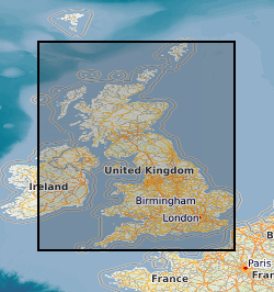
Map based index (GeoIndex) mineral reconnaissance programme reports
This layer of the map based index (GeoIndex) shows the locations of the Mineral Reconnaissance Programme Reports within Great Britain. The Mineral Reconnaissance Programme (MRP), funded by the Department for Trade and Industry (DTI), carried out mineral exploration reconnaissance in Great Britain between 1972 and 1997. The programme provided geological, geochemical, geophysical, mineralogical and metallogenic information on prospective areas in Britain. Work was carried out at various scales, from regional reconnaissance surveys or appraisal, to the drilling of a geochemical or geophysical anomaly. Projects were multidisciplinary, and used a combination of tried and tested methods, together with innovative techniques arising from research and development programmes. By the end of the Programme in 1997, 146 MRP reports had been issued covering localities across the UK. The programme was very successful in that more than half the projects reported attracted significant commercial follow-up resulting in the discovery of many new prospects. The reports themselves are being made available, for free, to downlaod over the next twelve months.
INSPIRE
Identification
- File identifier
- 9df8df53-2a8b-37a8-e044-0003ba9b0d98 XML
- Resource type
- dataset
Online resource
Resource identifier
- Metadata Language
- English (en)
- Spatial representation type
- vector
Encoding
- Format
-
Geographic Information System
Projection
Classification of data and services
- Topic category
-
- Geoscientific information
Classification of data and services
Coupled resource
Coupled resource
Classification of data and services
Coupled resource
Coupled resource
Keywords
- GEMET - INSPIRE themes, version 1.0
- BGS Thesaurus of Geosciences
-
-
Minerals
-
Ore reserves
-
Scottish SDI
-
Geochemistry
-
Mineral resources
-
UK Location (INSPIRE)
-
Geophysical surveys
-
Metallogenesis
-
Geographic coverage
))
Temporal reference
Temporal extent
Temporal extent
- Dataset Reference Date ()
- 2000
Quality and validity
- Lineage
-
The original data are Mineral Reconnaissance Programme Reports created as part of the Mineral Reconnaissance Programme. Index data from these reports were then transferred to a database, selected information from the database is then used to produce this layer of the GeoIndex.
- Denominator
- 2000000
Conformity
Conformity
Conformity
Conformity
Conformity
Conformity
- Explanation
-
See the referenced specification
Restrictions on access and use
- Access constraints
- Free access. The usual BGS licensing terms and conditions apply to external use of the data.
- Access constraints
-
The copyright of materials derived from the British Geological Survey's work is vested in the Natural Environment Research Council [NERC]. No part of this work may be reproduced or transmitted in any form or by any means, or stored in a retrieval system of any nature, without the prior permission of the copyright holder, via the BGS Intellectual Property Rights Manager. Use by customers of information provided by the BGS, is at the customer's own risk. In view of the disparate sources of information at BGS's disposal, including such material donated to BGS, that BGS accepts in good faith as being accurate, the Natural Environment Research Council (NERC) gives no warranty, expressed or implied, as to the quality or accuracy of the information supplied, or to the information's suitability for any use. NERC/BGS accepts no liability whatever in respect of loss, damage, injury or other occurence however caused.
- Access constraints
-
Either: (i) the dataset is made freely available, e.g. via the Internet, for a restricted category of use (e.g. educational use only); or (ii) the dataset has not been formally approved by BGS for access and use by external clients under licence, but its use may be permitted under alternative formal arrangements; or (iii) the dataset contains 3rd party data or information obtained by BGS under terms and conditions that must be consulted in order to determine the permitted usage of the dataset. Refer to the BGS staff member responsible for the creation of the dataset if further advice is required. He / she should be familiar with the composition of the dataset, particularly with regard to 3rd party IPR contained in it, and any resultant use restrictions. This staff member should revert to the IPR Section (ipr@bgs.ac.uk) for advice, should the position not be clear. ipr@bgs.ac Either: (i) the dataset is made freely available, e.g. via the Internet, for a restricted category of use (e.g. educational use only); or (ii) the dataset has not been formally approved by BGS for access and use by external clients under licence, but its use may be permitted under alternative formal arrangements; or (iii) the dataset contains 3rd party data or information obtained by BGS under terms and conditions that must be consulted in order to determine the permitted usage of the dataset. Refer to the BGS staff member responsible for the creation of the dataset if further advice is required. He / she should be familiar with the composition of the dataset, particularly with regard to 3rd party IPR contained in it, and any resultant use restrictions. This staff member should revert to the IPR Section (ipr@bgs.ac.uk) for advice, should the position not be clear.
Responsible organization (s)
Contact for the resource
- Organisation name
-
British Geological Survey
-
enquiries@bgs.ac enquiries@bgs.ac.uk
- Organisation name
-
British Geological Survey
-
enquiries@bgs.ac enquiries@bgs.ac.uk
Responsible organization (s)
Contact for the resource
- Organisation name
-
British Geological Survey
-
enquiries@bgs.ac enquiries@bgs.ac.uk
- Organisation name
-
British Geological Survey
-
enquiries@bgs.ac enquiries@bgs.ac.uk
Metadata information
Contact for the metadata
- Organisation name
-
British Geological Survey
-
enquiries@bgs.ac enquiries@bgs.ac.uk
- Metadata Date
- 2024-04-24
- Metadata Language
- English (en)