 BGS Metadata Catalogue
BGS G-BASE Regional Geochemical Atlases
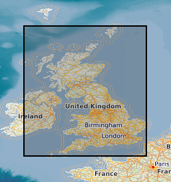
The Regional Geochemical Atlases are the principal hard copy product of the British Geological Survey G-BASE (Geochemical Baseline Survey of the Environment) project. The majority of atlases are for stream sediment, with data on stream water and soil included where available. Separate stream sediment, soil and stream water atlases have been published for Wales. This dataset relates to the hard-copy atlases, which are available for Shetland, Orkney, South Orkney and Caithness, Sutherland, Hebrides, Great Glen, East Grampians, Argyll, Southern Scotland, Lake District, NE England, NW England and N Wales and Wales. The atlases were issued between 1978 and 2000. Each atlas comprises a set of separate interpolated heat-maps for each analyte, as well as descriptive and interperative information. The atlases provide an invaluable, systematic baseline of geochemical information for Great Britain, serving as a marker of the state of the environment against which to measure future change. Digital atlases and map products are also available for the Clyde Basin, central England, the London region and south-west England. National-scale digital atlas products are also available.
Simple
- Date (Creation)
- 2000
- Citation identifier
- http://data.bgs.ac.uk/id/dataHolding/13605456
- Point of contact
-
Organisation name Individual name Electronic mail address Role British Geological Survey
Enquiries
Distributor British Geological Survey
Enquiries
Point of contact British Geological Survey
Enquiries
Distributor British Geological Survey
Enquiries
Point of contact
- Maintenance and update frequency
- Not planned
-
GEMET - INSPIRE themes, version 1.0
-
BGS Thesaurus of Geosciences
-
-
Atlases
-
Geochemistry
-
- dataCentre
- Keywords
-
-
NERC_DDC
-
- Access constraints
- Other restrictions
- Other constraints
- no limitations
- Other constraints
- The dataset is made freely available for access, e.g. via the Internet. Either no third party data / information is contained in the dataset or BGS has secured written permission from the owner(s) of any third party data / information contained in the dataset to make the dataset freely accessible.
- Use constraints
- Other restrictions
- Other constraints
-
The copyright of materials derived from the British Geological Survey's work is vested in the Natural Environment Research Council [NERC]. No part of this work may be reproduced or transmitted in any form or by any means, or stored in a retrieval system of any nature, without the prior permission of the copyright holder, via the BGS Intellectual Property Rights Manager. Use by customers of information provided by the BGS, is at the customer's own risk. In view of the disparate sources of information at BGS's disposal, including such material donated to BGS, that BGS accepts in good faith as being accurate, the Natural Environment Research Council (NERC) gives no warranty, expressed or implied, as to the quality or accuracy of the information supplied, or to the information's suitability for any use. NERC/BGS accepts no liability whatever in respect of loss, damage, injury or other occurence however caused.
- Other constraints
-
Available under the Open Government Licence subject to the following acknowledgement accompanying the reproduced NERC materials "Contains NERC materials ©NERC [year]"
- Spatial representation type
- Vector
- Denominator
- 1000000
- Language
- English
- Topic category
-
- Geoscientific information
- Geographic identifier
-
GBN
ISO 3166_2 2009 revision
- Geographic identifier
-
GREAT BRITAIN [id=139600]
British Geological Survey Gazetteer: Geographical hierarchy from Geosaurus 1979 creation
))
- End date
- 2014-01 Before
- Supplemental Information
-
Data is visible at all map scales.
- Unique resource identifier
- OSGB 1936 / British National Grid (EPSG::27700)
- Distribution format
-
Name Version
- Distributor contact
-
Organisation name Individual name Electronic mail address Role British Geological Survey
Enquiries
Distributor
- Distributor contact
-
Organisation name Individual name Electronic mail address Role British Geological Survey
Enquiries
Distributor
- OnLine resource
-
Protocol Linkage Name WWW:LINK-1.0-http--link
https://www.bgs.ac.uk/geology-projects/applied-geochemistry/g-base/ Geochemical baseline survey of the environment (G-BASE)
- OnLine resource
-
Protocol Linkage Name WWW:LINK-1.0-http--link
https://webapps.bgs.ac.uk/data/MapsPortal/regional-geochemical-atlas.html Maps Portal - Regional geochemical atlases
- Hierarchy level
- Dataset
- Other
-
dataset
Conformance result
- Title
-
INSPIRE Implementing rules laying down technical arrangements for the interoperability and harmonisation of Geology
- Date (Publication)
- 2011
- Explanation
-
See the referenced specification
- Pass
- No
Conformance result
- Title
-
Commission Regulation (EU) No 1089/2010 of 23 November 2010 implementing Directive 2007/2/EC of the European Parliament and of the Council as regards interoperability of spatial data sets and services
- Date (Publication)
- 2010-12-08
- Explanation
-
See http://eur-lex.europa.eu/LexUriServ/LexUriServ.do?uri=OJ:L:2010:323:0011:0102:EN:PDF
- Pass
- No
- Statement
-
The Geochemical Baseline Survey of the Environment (G-BASE) was a major BGS project which began in the late 1960s and ran until 2014, with an annual campaign of geochemical sampling within many parts of the UK. For more information on sampling and survey methodology and techniques, analysis and presentation of the data, refer to the G-BASE reports, available at https://www.bgs.ac.uk/geology-projects/applied-geochemistry/g-base/.
Metadata
- File identifier
- 9df8df53-2a8a-37a8-e044-0003ba9b0d98 XML
- Metadata language
- English
- Hierarchy level
- Dataset
- Date stamp
- 2026-07-26
- Metadata standard name
- UK GEMINI
- Metadata standard version
-
2.3
- Metadata author
-
Organisation name Individual name Electronic mail address Role British Geological Survey
Point of contact
- Dataset URI
)))
