BGS Data Catalogue
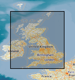
Map based index (GeoIndex) stream sediment
This layer of the map based index (GeoIndex) shows the locations where stream sediment samples are collected under the G-BASE (Geochemical Baseline Survey of the Environment) programme at an average density of approximately one site per 1.5 km square. Analytical data for the minus 150 micron fraction of stream sediment samples are available for some or all of the following elements by a variety of analytical methods (now predominantly XRFS): Mg, P, K, Ca, Ti, Mn, Fe, V, Cr, Co, Ba, Ni, Cu, Zn, Ga, As, Se, Rb, Sr, Y, Zr, Nb, Mo, Pb, Bi, Th, U, Ag, Cd, Sn, Sb, Cs, La, Ce, Ge, Sc, Se, Br, Hf, Ta, W, Tl, Te and I. Stream sediment samples were also collected by the now defunct MRP programme and analytical data for the minus 150 micron fraction of samples is available for a variety of elements including Ag, As, Au, Ba, Bi, Ca, Ce, Cu, Fe, Mn, Mo, Ni, Pb, Sb, Sn, Sr, Ti, U, V, W, Zn and Zr. Some of the MRP samples may have undergone several stages of analysis, some for inclusion in the G-BASE project. The samples may have been assigned a different sample number but will plot at the same site. Data is available for most Great Britain, apart from some parts of Southern England which have yet to be surveyed.
INSPIRE
Identification
- File identifier
- 9df8df53-2a85-37a8-e044-0003ba9b0d98 XML
- Resource type
- dataset
Online resource
Resource identifier
- Metadata Language
- English (en)
- Spatial representation type
- vector
Encoding
Projection
Classification of data and services
- Topic category
-
- Geoscientific information
Classification of data and services
Coupled resource
Coupled resource
Classification of data and services
Coupled resource
Coupled resource
Keywords
- GEMET - INSPIRE themes, version 1.0
- BGS Thesaurus of Geosciences
-
-
Chemical analysis
-
Geochemistry
-
Fluvial sediments
-
Scottish SDI
-
X ray fluorescence spectroscopy
-
UK Location (INSPIRE)
-
Geographic coverage
))
Temporal reference
Temporal extent
Temporal extent
- Dataset Reference Date ()
- 2000
Quality and validity
- Lineage
-
The original data are stream sediment samples collected and analysed under the BGS G-BASE project. A database holds the information from the analysis and this layer of the GeoIndex is derived from this database.
- Denominator
- 250000
Conformity
Conformity
Conformity
Conformity
Conformity
Conformity
- Explanation
-
See the referenced specification
Restrictions on access and use
- Access constraints
- Free access. The usual BGS licensing terms and conditions apply to external use of the data.
- Access constraints
-
The copyright of materials derived from the British Geological Survey's work is vested in the Natural Environment Research Council [NERC]. No part of this work may be reproduced or transmitted in any form or by any means, or stored in a retrieval system of any nature, without the prior permission of the copyright holder, via the BGS Intellectual Property Rights Manager. Use by customers of information provided by the BGS, is at the customer's own risk. In view of the disparate sources of information at BGS's disposal, including such material donated to BGS, that BGS accepts in good faith as being accurate, the Natural Environment Research Council (NERC) gives no warranty, expressed or implied, as to the quality or accuracy of the information supplied, or to the information's suitability for any use. NERC/BGS accepts no liability whatever in respect of loss, damage, injury or other occurence however caused.
- Access constraints
-
Either: (i) the dataset is made freely available, e.g. via the Internet, for a restricted category of use (e.g. educational use only); or (ii) the dataset has not been formally approved by BGS for access and use by external clients under licence, but its use may be permitted under alternative formal arrangements; or (iii) the dataset contains 3rd party data or information obtained by BGS under terms and conditions that must be consulted in order to determine the permitted usage of the dataset. Refer to the BGS staff member responsible for the creation of the dataset if further advice is required. He / she should be familiar with the composition of the dataset, particularly with regard to 3rd party IPR contained in it, and any resultant use restrictions. This staff member should revert to the IPR Section (ipr@bgs.ac.uk) for advice, should the position not be clear. ipr@bgs.ac Either: (i) the dataset is made freely available, e.g. via the Internet, for a restricted category of use (e.g. educational use only); or (ii) the dataset has not been formally approved by BGS for access and use by external clients under licence, but its use may be permitted under alternative formal arrangements; or (iii) the dataset contains 3rd party data or information obtained by BGS under terms and conditions that must be consulted in order to determine the permitted usage of the dataset. Refer to the BGS staff member responsible for the creation of the dataset if further advice is required. He / she should be familiar with the composition of the dataset, particularly with regard to 3rd party IPR contained in it, and any resultant use restrictions. This staff member should revert to the IPR Section (ipr@bgs.ac.uk) for advice, should the position not be clear.
Responsible organization (s)
Contact for the resource
- Organisation name
-
British Geological Survey
-
enquiries@bgs.ac enquiries@bgs.ac.uk
- Organisation name
-
British Geological Survey
-
enquiries@bgs.ac enquiries@bgs.ac.uk
Responsible organization (s)
Contact for the resource
- Organisation name
-
British Geological Survey
-
enquiries@bgs.ac enquiries@bgs.ac.uk
- Organisation name
-
British Geological Survey
-
enquiries@bgs.ac enquiries@bgs.ac.uk
Metadata information
Contact for the metadata
- Organisation name
-
British Geological Survey
-
enquiries@bgs.ac enquiries@bgs.ac.uk
- Metadata Date
- 2024-04-25
- Metadata Language
- English (en)