BGS Data Catalogue
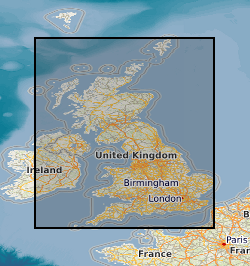
Map based index (GeoIndex) profile soil
Profile soil analyses are available from a number of BGS programmes, notably the Mineral Reconnaissance Programme (MRP) and the Geochemical Baseline Survey of the Environment (G-BASE) programme. Sampling depth and range of analytes determined is very variable for the MRP. G-BASE samples are consistently from 35 - 50 cm though since 2003 it has become routine practice in the G-BASE project to collect a top soil and deeper profile sample from the same site but only analyses the top soil and store the profile soil. This also applies in urban areas. The G-BASE profile soils were generally sieved to 150 microns before analysis and determined by XRFS for some or all of: Mg, P, K, Ca, Ti, Mn, Fe, V, Cr, Co, Ba, Ni, Cu, Zn, Ga, As, Se, Rb, Sr, Y, Zr, Nb, Mo, Pb, Bi, Th, U, Ag, Cd, Sn, Sb, Cs, La, Ce, Ge, Sc, Se, Br, Hf, Ta, W, Tl, Te and I. MRP samples can include profile samples from greater than 1 meter collected using a power auger and also include till samples. The G-BASE samples are collected at a density of 1 sample per two square kilometres in rural areas and 4 samples every kilometre square in urban areas. MRP sampling was more site specific generally collecting soil samples along lines at spacing intervals generally 25 - 250 m.
INSPIRE
Identification
- File identifier
- 9df8df53-2a84-37a8-e044-0003ba9b0d98 XML
- Hierarchy level
- Dataset
Online resource
Resource identifier
- Metadata language
- English
- Spatial representation type
- Vector
Encoding
- Format
-
Geographic Information System
Projection
Classification of data and services
- Topic category
-
- Geoscientific information
Keywords
-
GEMET - INSPIRE themes, version 1.0
-
BGS Thesaurus of Geosciences
-
-
UK Location (INSPIRE)
-
Trace analysis
-
Chemical analysis
-
Geochemistry
-
Major element analysis
-
X ray fluorescence spectroscopy
-
Scottish SDI
-
Soil analysis
-
Geographic coverage
))
Temporal reference
Temporal extent
- End
- 2014-01 Before
Temporal extent
- Date (Creation)
- 2000
Quality and validity
- Lineage
-
Profile soil samples collected, and analysed, from a number of BGS programmes, notably the Mineral Reconnaissance Programme (MRP) and the Geochemical Baseline Survey of the Environment (G-BASE) programme. A database was created to hold the information from the analysis and this layer of the GeoIndex is derived from this database.
- Denominator
- 250000
Conformity
Conformity
Conformity
Restrictions on access and use
- Access constraints
- Free access. The usual BGS licensing terms and conditions apply to external use of the data.
- Access constraints
-
The copyright of materials derived from the British Geological Survey's work is vested in the Natural Environment Research Council [NERC]. No part of this work may be reproduced or transmitted in any form or by any means, or stored in a retrieval system of any nature, without the prior permission of the copyright holder, via the BGS Intellectual Property Rights Manager. Use by customers of information provided by the BGS, is at the customer's own risk. In view of the disparate sources of information at BGS's disposal, including such material donated to BGS, that BGS accepts in good faith as being accurate, the Natural Environment Research Council (NERC) gives no warranty, expressed or implied, as to the quality or accuracy of the information supplied, or to the information's suitability for any use. NERC/BGS accepts no liability whatever in respect of loss, damage, injury or other occurence however caused.
- Access constraints
-
Either: (i) the dataset is made freely available, e.g. via the Internet, for a restricted category of use (e.g. educational use only); or (ii) the dataset has not been formally approved by BGS for access and use by external clients under licence, but its use may be permitted under alternative formal arrangements; or (iii) the dataset contains 3rd party data or information obtained by BGS under terms and conditions that must be consulted in order to determine the permitted usage of the dataset. Refer to the BGS staff member responsible for the creation of the dataset if further advice is required. He / she should be familiar with the composition of the dataset, particularly with regard to 3rd party IPR contained in it, and any resultant use restrictions. This staff member should revert to the IPR Section ( ipr@bgs.ac.uk ) for advice, should the position not be clear.
Responsible organization (s)
Contact for the resource
- Organisation name
-
British Geological Survey
- Organisation name
-
British Geological Survey
Metadata information
Contact for the metadata
- Organisation name
-
British Geological Survey
- Date stamp
- 2024-05-01T09:05:36.412159Z
- Metadata language
- English