 BGS Metadata Catalogue
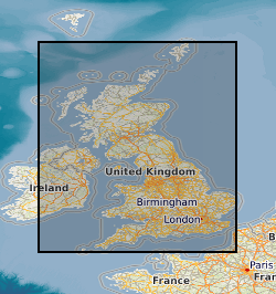
G-BASE shallow soil samples
The BGS Geochemical Baseline Survey of the Environment (G-BASE) was the national strategic geochemical mapping programme in Great Britain. The project set out to establish the chemistry of the surface environment by the collection and analysis of stream sediment, stream water and soil samples. Beginning in the late 1960s in northern Scotland and moving southwards across the country, the primary focus was mineral exploration, however, the project quickly developed to address important environmental concerns. The final G-BASE samples were collected in southern England in 2014. The outputs from the G-BASE project provide an invaluable, systematic baseline of geochemical information for Great Britain, serving as a marker of the state of the environment against which to measure future change. The routine collection of regional soil samples was introduced in 1986 in areas of poor drainage density, with an average sample density of one site per 2 square kilometres. Urban soil sampling commenced in 1991, with an average density of four samples per square kilometres, for the urban areas of Belfast, Cardiff, Corby, Coventry, Derby, Doncaster, Glasgow, Hull, Ipswich, Leicester, Lincoln, Manchester, Mansfield, Northampton, Nottingham, Peterborough, Scunthorpe, Sheffield, Swansea, Stoke, Telford, Wolverhampton and York. Topsoil samples were collected between depths of 5 cm and 20 cm, and were sieved through a 2 mm mesh and milled to less than 150 microns. The data include XRF and direct-reading optical emission spectrometry (DR-OES) analyses for some or all of the following elements: Ag, As, Ba, Bi, Br, Ca, Cd, Ce, Co, Cr, Cs, Cu, Fe, Ga, Ge, Hf, I, K, La, Mg, Mn, Mo, Nb, Ni, P, Pb, Rb, Sb, Sc, Se, Se, Sn, Sr, Ta, Te, Th, Ti, Tl, U, V, W, Y, Zn and Zr. Loss on Ignition (LOI) and pH (in a slurry of 0.01 M CaCl2) were also routinely determined on 50% of regional and all urban samples. For more information about accessing these samples and their analytical results, contact BGS Enquiries ( enquries@bgs.ac.uk).
Simple
- Date (Creation)
- 2000
- Citation identifier
- http://data.bgs.ac.uk/id/dataHolding/13605449
- Point of contact
-
Organisation name Individual name Electronic mail address Role British Geological Survey
Enquiries
Distributor British Geological Survey
Enquiries
Point of contact British Geological Survey
Enquiries
Distributor British Geological Survey
Enquiries
Point of contact
- Maintenance and update frequency
- Not planned
-
GEMET - INSPIRE themes, version 1.0
-
BGS Thesaurus of Geosciences
-
-
Sampling
-
Geochemical data
-
Geochemical mapping
-
Geochemical sampling
-
Geochemistry
-
Geochemical background
-
Sample analysis
-
Soil analysis
-
Soil chemistry
-
Geology
-
- dataCentre
- Keywords
-
-
NERC_DDC
-
- Access constraints
- Other restrictions
- Other constraints
- no limitations
- Other constraints
- The dataset is made freely available for access, e.g. via the Internet. Either no third party data / information is contained in the dataset or BGS has secured written permission from the owner(s) of any third party data / information contained in the dataset to make the dataset freely accessible.
- Use constraints
- Other restrictions
- Other constraints
-
The copyright of materials derived from the British Geological Survey's work is vested in the Natural Environment Research Council [NERC]. No part of this work may be reproduced or transmitted in any form or by any means, or stored in a retrieval system of any nature, without the prior permission of the copyright holder, via the BGS Intellectual Property Rights Manager. Use by customers of information provided by the BGS, is at the customer's own risk. In view of the disparate sources of information at BGS's disposal, including such material donated to BGS, that BGS accepts in good faith as being accurate, the Natural Environment Research Council (NERC) gives no warranty, expressed or implied, as to the quality or accuracy of the information supplied, or to the information's suitability for any use. NERC/BGS accepts no liability whatever in respect of loss, damage, injury or other occurence however caused.
- Other constraints
-
Available under the Open Government Licence subject to the following acknowledgement accompanying the reproduced NERC materials "Contains NERC materials ©NERC [year]"
- Other constraints
-
The dataset is made available to external clients under BGS Digital Data Licence terms and conditions. Revert to the IPR Section ( iprdigital@bgs.ac.uk) if further advice is required with regard to permitted usage.
- Spatial representation type
- Text, table
- Language
- English
- Topic category
-
- Geoscientific information
- Geographic identifier
-
EAW
ISO 3166_2 2009 revision
- Geographic identifier
-
ENGLAND & WALES [id=149000]
British Geological Survey Gazetteer: Geographical hierarchy from Geosaurus 1979 creation
))
- Begin date
- 1968
- End date
- 2014
- Unique resource identifier
- OSGB 1936 / British National Grid (EPSG::27700)
- Unique resource identifier
- WGS 84 (EPSG::4326)
- Distribution format
-
Name Version Image (PNG)
Adobe Acrobat document (PDF)
ESRI ASCII Grid (ASC)
- Distributor contact
-
Organisation name Individual name Electronic mail address Role British Geological Survey
Enquiries
Distributor
- Distributor contact
-
Organisation name Individual name Electronic mail address Role British Geological Survey
Enquiries
Distributor
- OnLine resource
-
Protocol Linkage Name WWW:LINK-1.0-http--link
https://www.bgs.ac.uk/geology-projects/applied-geochemistry/g-base/ Geochemical baseline survey of the environment (G-BASE)
- Hierarchy level
- Dataset
- Other
-
dataset
Conformance result
- Title
-
INSPIRE Implementing rules laying down technical arrangements for the interoperability and harmonisation of Geology
- Date (Publication)
- 2011
- Explanation
-
See the referenced specification
- Pass
- No
Conformance result
- Title
-
Commission Regulation (EU) No 1089/2010 of 23 November 2010 implementing Directive 2007/2/EC of the European Parliament and of the Council as regards interoperability of spatial data sets and services
- Date (Publication)
- 2010-12-08
- Explanation
-
See http://eur-lex.europa.eu/LexUriServ/LexUriServ.do?uri=OJ:L:2010:323:0011:0102:EN:PDF
- Pass
- No
- Statement
-
Sampling and data collection procedures evolved over the course of the G-BASE project. More information may be found in the G-BASE field procedures manual (2005): https://nora.nerc.ac.uk/id/eprint/5190/. The G-BASE project was initially called the 'Regional Geochemical Reconnaissance Programme' (RGRP) and subsequently the 'Geochemical Survey Project' (GSP). All G-BASE data have been loaded into the BGS Geochemistry Database.
Metadata
- File identifier
- 9df8df53-2a83-37a8-e044-0003ba9b0d98 XML
- Metadata language
- English
- Hierarchy level
- Dataset
- Date stamp
- 2026-07-10
- Metadata standard name
- UK GEMINI
- Metadata standard version
-
2.3
- Metadata author
-
Organisation name Individual name Electronic mail address Role British Geological Survey
Point of contact
- Dataset URI
)))
