 BGS Metadata Catalogue
Teaching Pack of Digital Geological Data (GeoScholar)
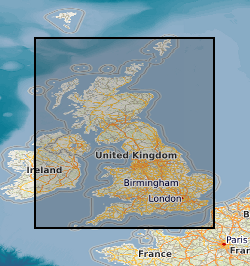
GeoScholar is a set of free geological data - available in GIS format - for UK universities and the higher education sector, to support teaching and learning within the geosciences. The dataset includes digital geological map data from BGS, aerial photos from Infoterra, NEXTmap digital terrain model from Intermap Technologies, borehole data and their corresponding logs, several BGS geological map sheets. Each Geoscholar teaching package will include 12 different geographical regions, including Assynt, Coniston and South West Wales.
Simple
- Date (Creation)
- 2009-02
- Citation identifier
- http://data.bgs.ac.uk/id/dataHolding/13605387
- Point of contact
-
Organisation name Individual name Electronic mail address Role British Geological Survey
Enquiries
Distributor British Geological Survey
Enquiries
Point of contact British Geological Survey
Enquiries
Custodian
- Maintenance and update frequency
- Not planned
-
GEMET - INSPIRE themes, version 1.0
-
BGS Thesaurus of Geosciences
-
-
Digital maps
-
Boreholes
-
DEM
-
Aerial photographs
-
Geological maps
-
GIS
-
Well logging
-
- dataCentre
- Keywords
-
-
NERC_DDC
-
- Access constraints
- Other restrictions
- Other constraints
- license
- Use constraints
- Other restrictions
- Other constraints
-
The copyright of materials derived from the British Geological Survey's work is vested in the Natural Environment Research Council [NERC]. No part of this work may be reproduced or transmitted in any form or by any means, or stored in a retrieval system of any nature, without the prior permission of the copyright holder, via the BGS Intellectual Property Rights Manager. Use by customers of information provided by the BGS, is at the customer's own risk. In view of the disparate sources of information at BGS's disposal, including such material donated to BGS, that BGS accepts in good faith as being accurate, the Natural Environment Research Council (NERC) gives no warranty, expressed or implied, as to the quality or accuracy of the information supplied, or to the information's suitability for any use. NERC/BGS accepts no liability whatever in respect of loss, damage, injury or other occurence however caused.
- Other constraints
-
Either: (i) the dataset is made freely available, e.g. via the Internet, for a restricted category of use (e.g. educational use only); or (ii) the dataset has not been formally approved by BGS for access and use by external clients under licence, but its use may be permitted under alternative formal arrangements; or (iii) the dataset contains 3rd party data or information obtained by BGS under terms and conditions that must be consulted in order to determine the permitted usage of the dataset. Refer to the BGS staff member responsible for the creation of the dataset if further advice is required. He / she should be familiar with the composition of the dataset, particularly with regard to 3rd party IPR contained in it, and any resultant use restrictions. This staff member should revert to the IPR Section ( ipr@bgs.ac.uk) for advice, should the position not be clear.
- Other constraints
-
The dataset is made available to external clients under BGS Digital Data Licence terms and conditions. Revert to the IPR Section ( iprdigital@bgs.ac.uk) if further advice is required with regard to permitted usage.
- Spatial representation type
- Vector
- Denominator
- 50000
- Language
- English
- Topic category
-
- Geoscientific information
- Geographic identifier
-
England + Wales 119 Snowdon [id=1624396]
British Geological Survey Gazetteer: Map sheets 1950 revision
- Geographic identifier
-
England + Wales 226 [id=1624515]
British Geological Survey Gazetteer: Map sheets 1950 revision
- Geographic identifier
-
England + Wales 227 [id=1624516]
British Geological Survey Gazetteer: Map sheets 1950 revision
- Geographic identifier
-
England + Wales 228 Haverfordwest [id=1624517]
British Geological Survey Gazetteer: Map sheets 1950 revision
- Geographic identifier
-
England + Wales 244 Linney Head [id=1624534]
British Geological Survey Gazetteer: Map sheets 1950 revision
- Geographic identifier
-
England + Wales 245 Pembroke [id=1624535]
British Geological Survey Gazetteer: Map sheets 1950 revision
- Geographic identifier
-
England + Wales 29 Keswick [id=1624583]
British Geological Survey Gazetteer: Map sheets 1950 revision
- Geographic identifier
-
England + Wales 31 Brough-under-Stainmore [id=1624606]
British Geological Survey Gazetteer: Map sheets 1950 revision
- Geographic identifier
-
England + Wales 330 Lymington [id=1624629]
British Geological Survey Gazetteer: Map sheets 1950 revision
- Geographic identifier
-
England + Wales 331 Portsmouth [id=1624630]
British Geological Survey Gazetteer: Map sheets 1950 revision
- Geographic identifier
-
England + Wales 344 [id=1624644]
British Geological Survey Gazetteer: Map sheets 1950 revision
- Geographic identifier
-
England + Wales 345 [id=1624645]
British Geological Survey Gazetteer: Map sheets 1950 revision
- Geographic identifier
-
England + Wales 38 Ambleside [id=1624664]
British Geological Survey Gazetteer: Map sheets 1950 revision
- Geographic identifier
-
Scotland 15E Leadhills [id=1624845]
British Geological Survey Gazetteer: Map sheets 1950 revision
- Geographic identifier
-
Scotland 15W New Cumnock [id=1624846]
British Geological Survey Gazetteer: Map sheets 1950 revision
- Geographic identifier
-
Scotland 28E Knapdale [id=1624887]
British Geological Survey Gazetteer: Map sheets 1950 revision
- Geographic identifier
-
Scotland 44 Mull [id=1624940]
British Geological Survey Gazetteer: Map sheets 1950 revision
- Geographic identifier
-
Scotland 71W Broadford [id=1625035]
British Geological Survey Gazetteer: Map sheets 1950 revision
))
- End date
- 2009 Before
- Supplemental Information
-
GeoScholar is available under free licence to academic institutions. Please note that only academic institutions can apply for a licence, GeoScholar data and licenses are not available to individual students. The data is in ESRI ArcGIS format. Users must have an ESRI licence for ArcGIS 9.2 or higher to view the project files, although the data can be loaded individually in previous versions of ArcGIS or ArcView 3.X.
- Unique resource identifier
- OSGB 1936 / British National Grid (EPSG::27700)
- Distribution format
-
Name Version ESRI Files
- Distributor contact
-
Organisation name Individual name Electronic mail address Role British Geological Survey
Enquiries
Distributor
- OnLine resource
-
Protocol Linkage Name WWW:LINK-1.0-http--link
https://www.bgs.ac.uk/geological-data/opengeoscience/ OpenGeoscience
- Hierarchy level
- Dataset
Conformance result
- Title
-
INSPIRE Implementing rules laying down technical arrangements for the interoperability and harmonisation of Geology
- Date (Publication)
- 2011
- Explanation
-
See the referenced specification
- Pass
- No
Conformance result
- Title
-
Commission Regulation (EU) No 1089/2010 of 23 November 2010 implementing Directive 2007/2/EC of the European Parliament and of the Council as regards interoperability of spatial data sets and services
- Date (Publication)
- 2010-12-08
- Explanation
-
See http://eur-lex.europa.eu/LexUriServ/LexUriServ.do?uri=OJ:L:2010:323:0011:0102:EN:PDF
- Pass
- No
- Statement
-
First version of dataset. This teaching package is compiled from current BGS and other datasets already in existence. This includes published geological map sheets, DiGMapGB-50, SOBI, borehole logs, aerial photos (from Infoterra), Digital Terrain Models (NEXTMap).
Metadata
- File identifier
- 9df8df53-2a41-37a8-e044-0003ba9b0d98 XML
- Metadata language
- English
- Hierarchy level
- Dataset
- Date stamp
- 2026-07-03
- Metadata standard name
- UK GEMINI
- Metadata standard version
-
2.3
- Metadata author
-
Organisation name Individual name Electronic mail address Role British Geological Survey
Point of contact
- Dataset URI
)))
