BGS Data Catalogue
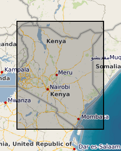
Kenya regional geochemistry
The Samburu - Marsabit Geological Mapping and Mineral Exploration Project was a joint Kenyan and British technical co-operation project, carried out by staff of the Mines and Geological Department, Ministry of Environment and Natural Resources, Kenya and staff from the British Geological Survey. The first phase of the project commenced in 1980, and covered the area between 36degrees and 38degrees E and from the equator to 2degrees N. The second phase, carried out between 1984 and 1986 covered the area between 36degrees and 38degrees E and from 2degrees N to the Ethiopian border. Sampling was carried out concurrently with geological mapping and was largely constrained by the requirements of that exercise. Little or no sampling was done in areas previously mapped by other bodies. Sampling was mainly confined to areas underlain by basement rocks of the Mozambique Belt and was very sparse over most of the Tertiary and Quaternary volcanic cover. Chemical analyses for the stream sediments were: Ag, Ba, Co, Cu, Fe, Li, Mn, Mo, Ni, Pb, Sr, and Zn. Raw data is available from the Mines and Geological Survey Department, Ministry of Environment and Natural Resources, Nairobi, Kenya. Sampling densities varied considerably across the Phase 1 project area, but generally a stream sediment sample density of one per 4 to 8 km2 and a panned concentrate density of one per 13 to 16 km2 was achieved. In the Phase 2 area, which was mainly very arid, a few samples were collected from dry stream beds, as part of a helicopter survey of the area, to provide some idea of the geochemistry of the major lithological units. Stream sediments were collected by combining grab samples from 5 to 10 points within a 10m radius of the selected site. If necessary the samples were dried before being sieved and the fine (-80 mesh B.S.) fraction retained for analysis. Heavy mineral concentrates were obtained by taking 2 to 5kg of material from the sample site and panning at the base camp, where water was available, or at the Mines and Geological Department headquarters at Nairobi.
INSPIRE
Identification
- File identifier
- 9df8df52-d7b2-37a8-e044-0003ba9b0d98 XML
- Resource type
- dataset
Online resource
Resource identifier
- Metadata Language
- English (en)
- Spatial representation type
- grid
Encoding
- Format
-
Data in various formats, MS Excel, MS Word and image files available on a CD-ROM
Projection
Classification of data and services
- Topic category
-
- Geoscientific information
Classification of data and services
Coupled resource
Coupled resource
Classification of data and services
Coupled resource
Coupled resource
Keywords
- GEMET - INSPIRE themes, version 1.0
- BGS Thesaurus of Geosciences
-
-
Sampling
-
Exploration
-
data.gov.uk (non-INSPIRE)
-
Geochemistry
-
Geology
-
Geographic coverage
))
Temporal reference
Temporal extent
Temporal extent
- Dataset Reference Date ()
- 1980
Quality and validity
- Lineage
-
CD-Rom database made up from digital data files produced during the two phases of the project.
- Denominator
- 50000
Conformity
Conformity
Conformity
Conformity
Conformity
Conformity
- Explanation
-
See the referenced specification
Restrictions on access and use
- Access constraints
- Subject to a licence fee. Subject to usual BGS terms and conditions.
- Access constraints
-
The copyright of materials derived from the British Geological Survey's work is vested in the Natural Environment Research Council [NERC]. No part of this work may be reproduced or transmitted in any form or by any means, or stored in a retrieval system of any nature, without the prior permission of the copyright holder, via the BGS Intellectual Property Rights Manager. Use by customers of information provided by the BGS, is at the customer's own risk. In view of the disparate sources of information at BGS's disposal, including such material donated to BGS, that BGS accepts in good faith as being accurate, the Natural Environment Research Council (NERC) gives no warranty, expressed or implied, as to the quality or accuracy of the information supplied, or to the information's suitability for any use. NERC/BGS accepts no liability whatever in respect of loss, damage, injury or other occurence however caused.
- Access constraints
-
Either: (i) the dataset is made freely available, e.g. via the Internet, for a restricted category of use (e.g. educational use only); or (ii) the dataset has not been formally approved by BGS for access and use by external clients under licence, but its use may be permitted under alternative formal arrangements; or (iii) the dataset contains 3rd party data or information obtained by BGS under terms and conditions that must be consulted in order to determine the permitted usage of the dataset. Refer to the BGS staff member responsible for the creation of the dataset if further advice is required. He / she should be familiar with the composition of the dataset, particularly with regard to 3rd party IPR contained in it, and any resultant use restrictions. This staff member should revert to the IPR Section (ipr@bgs.ac.uk) for advice, should the position not be clear. ipr@bgs.ac Either: (i) the dataset is made freely available, e.g. via the Internet, for a restricted category of use (e.g. educational use only); or (ii) the dataset has not been formally approved by BGS for access and use by external clients under licence, but its use may be permitted under alternative formal arrangements; or (iii) the dataset contains 3rd party data or information obtained by BGS under terms and conditions that must be consulted in order to determine the permitted usage of the dataset. Refer to the BGS staff member responsible for the creation of the dataset if further advice is required. He / she should be familiar with the composition of the dataset, particularly with regard to 3rd party IPR contained in it, and any resultant use restrictions. This staff member should revert to the IPR Section (ipr@bgs.ac.uk) for advice, should the position not be clear.
Responsible organization (s)
Contact for the resource
- Organisation name
-
British Geological Survey
-
enquiries@bgs.ac enquiries@bgs.ac.uk
- Organisation name
-
British Geological Survey
-
enquiries@bgs.ac enquiries@bgs.ac.uk
- Organisation name
-
British Geological Survey
-
enquiries@bgs.ac enquiries@bgs.ac.uk
- Organisation name
-
British Geological Survey
-
enquiries@bgs.ac enquiries@bgs.ac.uk
Metadata information
Contact for the metadata
- Organisation name
-
British Geological Survey
-
enquiries@bgs.ac enquiries@bgs.ac.uk
- Metadata Date
- 2024-04-18
- Metadata Language
- English (en)