 BGS Metadata Catalogue
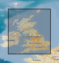
UK Geomagnetic Observatory K-Indices.
The K-index scale summarises geomagnetic activity at an observatory by assigning a code, an integer in the range 0 to 9 (0 being the least active field and 9 the most active field) to each 3-hour Universal Time (UT) interval. K-Indices are available for Lerwick, Eskdalemuir, Greenwich, Abinger and Hartland Magnetic Observatories. From 1954-90 the values are hand scaled, from 1991 to the present day they are automatically scaled. The data not only aids scientific research into rates of change of the magnetic field and increases the accuracy of the BGS Global Geomagnetic Model, but also provides data to exploration geophysicists engaged in current and future oil exploration.
Simple
- Date (Creation)
- 1868
- Citation identifier
- http://data.bgs.ac.uk/id/dataHolding/13480122
- Point of contact
-
Organisation name Individual name Electronic mail address Role British Geological Survey
Enquiries
Distributor British Geological Survey
Enquiries
Originator British Geological Survey
Enquiries
Point of contact British Geological Survey
Enquiries
Custodian
- Maintenance and update frequency
- Daily
-
GEMET - INSPIRE themes, version 1.0
-
BGS Thesaurus of Geosciences
-
-
Geomagnetism
-
- dataCentre
- Keywords
-
-
NERC_DDC
-
- Access constraints
- Other restrictions
- Use constraints
- Other restrictions
- Other constraints
-
The copyright of materials derived from the British Geological Survey's work is vested in the Natural Environment Research Council [NERC]. No part of this work may be reproduced or transmitted in any form or by any means, or stored in a retrieval system of any nature, without the prior permission of the copyright holder, via the BGS Intellectual Property Rights Manager. Use by customers of information provided by the BGS, is at the customer's own risk. In view of the disparate sources of information at BGS's disposal, including such material donated to BGS, that BGS accepts in good faith as being accurate, the Natural Environment Research Council (NERC) gives no warranty, expressed or implied, as to the quality or accuracy of the information supplied, or to the information's suitability for any use. NERC/BGS accepts no liability whatever in respect of loss, damage, injury or other occurence however caused.
- Other constraints
-
Either: (i) the dataset is made freely available, e.g. via the Internet, for a restricted category of use (e.g. educational use only); or (ii) the dataset has not been formally approved by BGS for access and use by external clients under licence, but its use may be permitted under alternative formal arrangements; or (iii) the dataset contains 3rd party data or information obtained by BGS under terms and conditions that must be consulted in order to determine the permitted usage of the dataset. Refer to the BGS staff member responsible for the creation of the dataset if further advice is required. He / she should be familiar with the composition of the dataset, particularly with regard to 3rd party IPR contained in it, and any resultant use restrictions. This staff member should revert to the IPR Section ( ipr@bgs.ac.uk) for advice, should the position not be clear.
- Spatial representation type
- Text, table
- Language
- English
- Topic category
-
- Geoscientific information
- Geographic identifier
-
GB
ISO 3166_1 alpha-3 2009 revision
- Geographic identifier
-
UK [id=139300]
British Geological Survey Gazetteer: Geographical hierarchy from Geosaurus 1979 creation
- Geographic identifier
-
UKM
ISO 3166_2 2009 revision
))
- Begin date
- 1954
- Supplemental Information
-
Abinger & Hartland - all available values. Not available digitally - Greenwich 1841-1867, Lerwich 1923-1953 and Eskdalemuir 1911-1953. 5 Uk Locations.
- Unique resource identifier
- WGS 84 (EPSG::4326)
- Distribution format
-
Name Version DELIMITED ASCII - Yearly data files ( ASII) or user defined.
witheld
- Distributor contact
-
Organisation name Individual name Electronic mail address Role British Geological Survey
Enquiries
Distributor
- OnLine resource
-
Protocol Linkage Name WWW:LINK-1.0-http--link
https://geomag.bgs.ac.uk/data_service/data/magnetic_indices/k_indices.html K Indices inquiry form
- Hierarchy level
- Dataset
Conformance result
- Title
-
INSPIRE Implementing rules laying down technical arrangements for the interoperability and harmonisation of Geology
- Date (Publication)
- 2011
- Explanation
-
See the referenced specification
- Pass
- No
Conformance result
- Title
-
Commission Regulation (EU) No 1089/2010 of 23 November 2010 implementing Directive 2007/2/EC of the European Parliament and of the Council as regards interoperability of spatial data sets and services
- Date (Publication)
- 2010-12-08
- Explanation
-
See http://eur-lex.europa.eu/LexUriServ/LexUriServ.do?uri=OJ:L:2010:323:0011:0102:EN:PDF
- Pass
- No
- Statement
-
Hand-scaled until 1990, automatically derived using computer algorithm from 1991 onward. Since 1983 the raw unfiltered data have been retrieved automatically from Hartland, Lerwick and Eskdalemuir via Internet connections to the BGS office in Edinburgh in near real time.
Metadata
- File identifier
- 9df8df52-d795-37a8-e044-0003ba9b0d98 XML
- Metadata language
- English
- Hierarchy level
- Dataset
- Date stamp
- 2026-07-10
- Metadata standard name
- UK GEMINI
- Metadata standard version
-
2.3
- Metadata author
-
Organisation name Individual name Electronic mail address Role British Geological Survey
Point of contact
- Dataset URI
)))
