 BGS Metadata Catalogue
GeoSure Basic
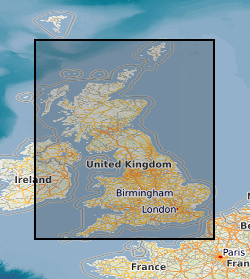
The GeoSure data sets and reports from the British Geological Survey provide information about potential ground movement or subsidence in a helpful and user-friendly format. The reports can help inform planning decisions and indicate causes of subsidence. Complete Great Britain national coverage is available. GeoSure Basic is a single, combined GeoSure model, containing only the highest score of all the GeoSure layers. The model has been re-classified to negligible - very low, low and moderate - high. The methodology is based on the 6 GeoSure individual hazard Assessments. The storage formats of the data are ESRI and MapInfo but other formats can be supplied.
Simple
- Date (Creation)
- 2006-03-31
- Citation identifier
- http://data.bgs.ac.uk/id/dataHolding/13603186
- Point of contact
-
Organisation name Individual name Electronic mail address Role British Geological Survey
Enquiries
Distributor British Geological Survey
Enquiries
Point of contact British Geological Survey
Enquiries
Custodian
- Maintenance and update frequency
- Annually
-
GEMET - INSPIRE themes, version 1.0
-
BGS Thesaurus of Geosciences
-
-
Natural hazards
-
- dataCentre
- Keywords
-
-
NERC_DDC
-
- Access constraints
- Other restrictions
- Use constraints
- Other restrictions
- Other constraints
-
The copyright of materials derived from the British Geological Survey's work is vested in the Natural Environment Research Council [NERC]. No part of this work may be reproduced or transmitted in any form or by any means, or stored in a retrieval system of any nature, without the prior permission of the copyright holder, via the BGS Intellectual Property Rights Manager. Use by customers of information provided by the BGS, is at the customer's own risk. In view of the disparate sources of information at BGS's disposal, including such material donated to BGS, that BGS accepts in good faith as being accurate, the Natural Environment Research Council (NERC) gives no warranty, expressed or implied, as to the quality or accuracy of the information supplied, or to the information's suitability for any use. NERC/BGS accepts no liability whatever in respect of loss, damage, injury or other occurence however caused.
- Other constraints
-
The dataset is made available to external clients under BGS Digital Data Licence terms and conditions. Revert to the IPR Section ( iprdigital@bgs.ac.uk) if further advice is required with regard to permitted usage.
- Spatial representation type
- Vector
- Denominator
- 50000
- Language
- English
- Topic category
-
- Geoscientific information
- Geographic identifier
-
ENG
ISO 3166_1 alpha-3 2009 revision
- Geographic identifier
-
ENGLAND [id=150000]
British Geological Survey Gazetteer: Geographical hierarchy from Geosaurus 1979 creation
- Geographic identifier
-
SCOTLAND [id=140000]
British Geological Survey Gazetteer: Geographical hierarchy from Geosaurus 1979 creation
- Geographic identifier
-
SCT
ISO 3166_1 alpha-3 2009 revision
- Geographic identifier
-
WALES [id=170000]
British Geological Survey Gazetteer: Geographical hierarchy from Geosaurus 1979 creation
- Geographic identifier
-
WLS
ISO 3166_1 alpha-3 2009 revision
))
- End date
- 2006 Before
- Supplemental Information
-
Geotechnical data abstracted from NGDC site investigation collection and entered into the BGS geotechnical database. Methodology may be revised in the light of new knowledge or customer feedback. Changes in DiGMapGB-50 base data will require periodic or continuous revision. ADDITIONAL_INFO 1 = Complete GB National Coverage, subject to revision in line with changes in DiGMapGB-50 lithology codes. Based on 1:50 000 DiGMapGB-50 linework. Methodology consistent throughout. Otherwise subject to logical consistency of DiGMapGB-50.
- Unique resource identifier
- OSGB 1936 / British National Grid (EPSG::27700)
- Distribution format
-
Name Version Raster Grid
Postcode Database
- Distributor contact
-
Organisation name Individual name Electronic mail address Role British Geological Survey
Enquiries
Distributor
- OnLine resource
-
Protocol Linkage Name WWW:LINK-1.0-http--link
https://www.bgs.ac.uk/geological-data/datasets/?tax_topic=all&tax_purpose=all&tax_area=all&sterm=Geosure&order=asc BGS Datasets - Geosure
- Hierarchy level
- Dataset
Conformance result
- Title
-
INSPIRE Implementing rules laying down technical arrangements for the interoperability and harmonisation of Geology
- Date (Publication)
- 2011
- Explanation
-
See the referenced specification
- Pass
- No
Conformance result
- Title
-
Commission Regulation (EU) No 1089/2010 of 23 November 2010 implementing Directive 2007/2/EC of the European Parliament and of the Council as regards interoperability of spatial data sets and services
- Date (Publication)
- 2010-12-08
- Explanation
-
See http://eur-lex.europa.eu/LexUriServ/LexUriServ.do?uri=OJ:L:2010:323:0011:0102:EN:PDF
- Pass
- No
- Statement
-
Methodology devised by Natural Geohazards project. Latest version and earlier versions are held in project files.
Metadata
- File identifier
- 9df8df52-d6a9-37a8-e044-0003ba9b0d98 XML
- Metadata language
- English
- Hierarchy level
- Dataset
- Date stamp
- 2026-06-23
- Metadata standard name
- UK GEMINI
- Metadata standard version
-
2.3
- Metadata author
-
Organisation name Individual name Electronic mail address Role British Geological Survey
Point of contact
- Dataset URI
)))
