 BGS Metadata Catalogue
Digital Geophysical Borehole Log Index (RECALL database)
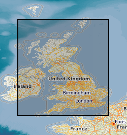
[This metadata record has been superseded, see http://data.bgs.ac.uk/id/dataHolding/13480158] The Geophysical Borehole Log index provides details of all digital geophysical logs available to BGS. The database provides the borehole metadata related to logging and metadata for the logging itself and log data stored in a proprietary hierarchical database system (PETRIS RECALL). Contains most digital geophysically logged bores known to BGS National Geological Records Centre. Scattered distribution of boreholes, locally dense coverage, relatively few logs from Scotland & Central Wales, increasing data density on UK continental Shelf.
Simple
- Date (Creation)
- 2005
- Citation identifier
- http://data.bgs.ac.uk/id/dataHolding/13603163
- Point of contact
-
Organisation name Individual name Electronic mail address Role British Geological Survey
Enquiries
Distributor British Geological Survey
Enquiries
Custodian British Geological Survey
Enquiries
Distributor British Geological Survey
Enquiries
Originator British Geological Survey
Enquiries
Point of contact
- Maintenance and update frequency
- Continual
-
GEMET - INSPIRE themes, version 1.0
-
BGS Thesaurus of Geosciences
-
-
Logging
-
Boreholes
-
Formation evaluation
-
Geophysics
-
Wire line logging
-
Geophysical logs
-
- dataCentre
- Keywords
-
-
NERC_DDC
-
- Access constraints
- Other restrictions
- Other constraints
- Access to the index for boreholes which are Confidential is restricted for external users.
- Use constraints
- Other restrictions
- Other constraints
-
The copyright of materials derived from the British Geological Survey's work is vested in the Natural Environment Research Council [NERC]. No part of this work may be reproduced or transmitted in any form or by any means, or stored in a retrieval system of any nature, without the prior permission of the copyright holder, via the BGS Intellectual Property Rights Manager. Use by customers of information provided by the BGS, is at the customer's own risk. In view of the disparate sources of information at BGS's disposal, including such material donated to BGS, that BGS accepts in good faith as being accurate, the Natural Environment Research Council (NERC) gives no warranty, expressed or implied, as to the quality or accuracy of the information supplied, or to the information's suitability for any use. NERC/BGS accepts no liability whatever in respect of loss, damage, injury or other occurence however caused.
- Other constraints
-
Either: (i) the dataset is made freely available, e.g. via the Internet, for a restricted category of use (e.g. educational use only); or (ii) the dataset has not been formally approved by BGS for access and use by external clients under licence, but its use may be permitted under alternative formal arrangements; or (iii) the dataset contains 3rd party data or information obtained by BGS under terms and conditions that must be consulted in order to determine the permitted usage of the dataset. Refer to the BGS staff member responsible for the creation of the dataset if further advice is required. He / she should be familiar with the composition of the dataset, particularly with regard to 3rd party IPR contained in it, and any resultant use restrictions. This staff member should revert to the IPR Section ( ipr@bgs.ac.uk) for advice, should the position not be clear.
- Spatial representation type
- Grid
- Denominator
- 10000
- Language
- English
- Topic category
-
- Geoscientific information
- Geographic identifier
-
GB
ISO 3166_1 alpha-3 2009 revision
- Geographic identifier
-
UK [id=139300]
British Geological Survey Gazetteer: Geographical hierarchy from Geosaurus 1979 creation
- Geographic identifier
-
UKM
ISO 3166_2 2009 revision
))
- Begin date
- 2005
- End date
- 2024
- Supplemental Information
-
The data is updated when new data becomes available. Contains most geophysically logged bores known to BGS NGRC. Relatively few logs from Scotland and Central Wales. Scattered distribution of boreholes - locally dense coverage. Inconsistent, but improving quality dependent on the quality of the data on the borehole log header sheets and improving internal understanding of log data quality.
- Unique resource identifier
- OSGB 1936 / British National Grid (EPSG::27700)
- Distribution format
-
Name Version Text file (TXT)
witheld
Delimited ASCII
witheld
Log ASCII Standard (LAS)
2.0
Log Information Standard (LIS)
Near Schlumberger LIS
Digital Log Information Standard (DLIS)
POSC RP66 V1
- Distributor contact
-
Organisation name Individual name Electronic mail address Role British Geological Survey
Enquiries
Distributor
- Distributor contact
-
Organisation name Individual name Electronic mail address Role British Geological Survey
Enquiries
Distributor
- OnLine resource
-
Protocol Linkage Name WWW:LINK-1.0-http--link
https://www.bgs.ac.uk/ BGS Homepage
- Hierarchy level
- Dataset
- Other
-
dataset
Conformance result
- Title
-
INSPIRE Implementing rules laying down technical arrangements for the interoperability and harmonisation of Geology
- Date (Publication)
- 2011
- Explanation
-
See the referenced specification
- Pass
- No
Conformance result
- Title
-
Commission Regulation (EU) No 1089/2010 of 23 November 2010 implementing Directive 2007/2/EC of the European Parliament and of the Council as regards interoperability of spatial data sets and services
- Date (Publication)
- 2010-12-08
- Explanation
-
See http://eur-lex.europa.eu/LexUriServ/LexUriServ.do?uri=OJ:L:2010:323:0011:0102:EN:PDF
- Pass
- No
- Statement
-
Propriatory hierarchical database based on details from geophysically logged bores known to BGS National Geological Records Centre.
Metadata
- File identifier
- 9df8df52-d692-37a8-e044-0003ba9b0d98 XML
- Metadata language
- English
- Hierarchy level
- Dataset
- Date stamp
- 2026-07-10
- Metadata standard name
- UK GEMINI
- Metadata standard version
-
2.3
- Metadata author
-
Organisation name Individual name Electronic mail address Role British Geological Survey
Point of contact
- Dataset URI
)))
