BGS Metadata Catalogue
Applied Geology Maps and Sections
This dataset contains the .tif (Tag Image File Format) scans of all the applied geology maps (otherwise known as thematic or environmental) and sections produced as part of "Geological background for planning and development" and preliminary sand and gravel projects carried out by the British Geological Survey for the Department of the Environment, Scottish Development Department and Scottish Office from 1975 to 1996. The maps and sections cover a number of themes for specific areas relating to the project area within the United Kingdom. Metadata on the maps, sections and project reports are in the associated excel spreadsheet. The geological line work and the methods used to produce the maps are those current at the time of production. Map scales are 1:10 000, 1:25 000 and 1:50 000. The maps have Ordnance Survey map bases and are bounded by the project area. The maps could be used for geological, engineering geological, environmental and resources research, as an information and reference resource and for inclusion in reports and papers. There are no access or usage constraints for BGS staff for BGS purposes. The scans are .tif files and can, therefore, be displayed using any suitable package. The original file size varies between 170 kb to 250 Mb. The dataset is stand-alone.
INSPIRE
Identification
- File identifier
- 9df8df52-d675-37a8-e044-0003ba9b0d98 XML
- Hierarchy level
- Dataset
Online resource
- Protocol
-
HTTP
Resource identifier
- Metadata language
- English
Encoding
- Format
-
tiff
Projection
Classification of data and services
- Topic category
-
- Geoscientific information
Keywords
-
GEMET - INSPIRE themes
-
BGS Thesaurus of Geosciences
-
-
Land use planning
-
Mining
-
Engineering geology
-
Natural resources
-
Cross sections
-
Natural hazards
-
Maps
-
Geological mapping
-
Geology
-
Geological maps
-
Other keywords
- Keywords
-
-
NERC_DDC
-
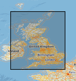
Geographic coverage
))
Temporal reference
Temporal extent
- Begin
- 1975
- End
- 1996
Temporal extent
- Date (Creation)
- 2001
Quality and validity
- Lineage
-
The maps and a few sections were produced as part of applied geological projects produced for the Department of the Environment and the Scottish Office. The paper maps are available only as part of BGS technical reports. They were scanned in 2001 and held as tifs on CDs. In 2007 the files were transferred to the SAN (Storage Area Network).
- Denominator
- 10000
Conformity
Conformity
Conformity
Restrictions on access and use
- Access constraints
- Access and use restricted to BGS staff.
- Access constraints
-
The copyright of materials derived from the British Geological Survey's work is vested in the Natural Environment Research Council [NERC]. No part of this work may be reproduced or transmitted in any form or by any means, or stored in a retrieval system of any nature, without the prior permission of the copyright holder, via the BGS Intellectual Property Rights Manager. Use by customers of information provided by the BGS, is at the customer's own risk. In view of the disparate sources of information at BGS's disposal, including such material donated to BGS, that BGS accepts in good faith as being accurate, the Natural Environment Research Council (NERC) gives no warranty, expressed or implied, as to the quality or accuracy of the information supplied, or to the information's suitability for any use. NERC/BGS accepts no liability whatever in respect of loss, damage, injury or other occurence however caused.
- Access constraints
-
Either: (i) the dataset is made freely available, e.g. via the Internet, for a restricted category of use (e.g. educational use only); or (ii) the dataset has not been formally approved by BGS for access and use by external clients under licence, but its use may be permitted under alternative formal arrangements; or (iii) the dataset contains 3rd party data or information obtained by BGS under terms and conditions that must be consulted in order to determine the permitted usage of the dataset. Refer to the BGS staff member responsible for the creation of the dataset if further advice is required. He / she should be familiar with the composition of the dataset, particularly with regard to 3rd party IPR contained in it, and any resultant use restrictions. This staff member should revert to the IPR Section ( ipr@bgs.ac.uk ) for advice, should the position not be clear.
Responsible organization (s)
Contact for the resource
- Organisation name
-
British Geological Survey
- Organisation name
-
British Geological Survey
- Organisation name
-
British Geological Survey
Metadata information
Contact for the metadata
- Organisation name
-
British Geological Survey
- Date stamp
- 2024-02-15
- Metadata language
- English