 BGS Metadata Catalogue
Mining Remediation Authority abandoned coal mine plans collection
The dataset comprises of the plans of abandoned coal mines in Great Britain deposited with the Mining Remediation Authority (MRA) and held on behalf of the Health and Safety Executive in line with the 1872 Coal Mines Regulation Act and Metalliferous Mines Regulation Act. The physical plans are held by the MRA and a digital copy of the index to and scans of these plans was deposited to the British Geological Survey (BGS) for delivery through the BGS mine plans viewer. BGS also holds an incomplete disaster recovery copy of the microfiche of the statutory mine abandonment plans for the MRA.
Simple
- Date (Creation)
- 1800
- Citation identifier
- http://data.bgs.ac.uk/id/dataHolding/13603116
- Point of contact
-
Organisation name Individual name Electronic mail address Role British Geological Survey
Enquiries
Distributor British Geological Survey
Enquiries
Point of contact
- Maintenance and update frequency
- As needed
-
GEMET - INSPIRE themes, version 1.0
-
BGS Thesaurus of Geosciences
-
-
Mine shafts
-
Economic geology
-
Mine planning
-
Mining
-
Coal
-
Mines
-
Minerals
-
- dataCentre
- Keywords
-
-
NERC_DDC
-
- Access constraints
- Other restrictions
- Other constraints
- licenceOGL
- Use constraints
- Other restrictions
- Other constraints
-
The copyright of materials derived from the British Geological Survey's work is vested in the Natural Environment Research Council [NERC]. No part of this work may be reproduced or transmitted in any form or by any means, or stored in a retrieval system of any nature, without the prior permission of the copyright holder, via the BGS Intellectual Property Rights Manager. Use by customers of information provided by the BGS, is at the customer's own risk. In view of the disparate sources of information at BGS's disposal, including such material donated to BGS, that BGS accepts in good faith as being accurate, the Natural Environment Research Council (NERC) gives no warranty, expressed or implied, as to the quality or accuracy of the information supplied, or to the information's suitability for any use. NERC/BGS accepts no liability whatever in respect of loss, damage, injury or other occurence however caused.
- Other constraints
-
Available under the Open Government Licence subject to the following acknowledgement accompanying the reproduced NERC materials "Contains NERC materials ©NERC [year]"
- Spatial representation type
- Vector
- Denominator
- 10000
- Language
- English
- Topic category
-
- Geoscientific information
- Geographic identifier
-
GBN
ISO 3166_2 2009 revision
- Geographic identifier
-
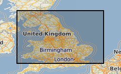
GREAT BRITAIN [id=139600]
British Geological Survey Gazetteer: Geographical hierarchy from Geosaurus 1979 creation
))
- Begin date
- 1800
- Unique resource identifier
- OSGB 1936 / British National Grid (EPSG::27700)
- Distribution format
-
Name Version
- Distributor contact
-
Organisation name Individual name Electronic mail address Role British Geological Survey
Enquiries
Distributor
- OnLine resource
-
Protocol Linkage Name WWW:LINK-1.0-http--link
https://www.bgs.ac.uk/information-hub/scanned-records/mining-plans-2/ BGS Mine Plan Viewer
- Hierarchy level
- Dataset
- Other
-
dataset
Conformance result
- Title
-
INSPIRE Implementing rules laying down technical arrangements for the interoperability and harmonisation of Geology
- Date (Publication)
- 2011
- Explanation
-
See the referenced specification
- Pass
- No
Conformance result
- Title
-
Commission Regulation (EU) No 1089/2010 of 23 November 2010 implementing Directive 2007/2/EC of the European Parliament and of the Council as regards interoperability of spatial data sets and services
- Date (Publication)
- 2010-12-08
- Explanation
-
See http://eur-lex.europa.eu/LexUriServ/LexUriServ.do?uri=OJ:L:2010:323:0011:0102:EN:PDF
- Pass
- No
- Statement
-
A copy of the index to and scans of Scottish abandoned coal mine plans was deposited with BGS in 2017 to facilitate an in-person viewing service at the BGS Edinburgh office. In 2025, the data were redeposited along with those for England and Wales to allow BGS to deliver these scans on behalf of the Mining Remediation Authority (MRA) via the BGS mine plan viewer. Microfiche copies of the original MRA statutory mine abandonment plans were deposited prior to 2017.
Metadata
- File identifier
- 9df8df52-d658-37a8-e044-0003ba9b0d98 XML
- Metadata language
- English
- Hierarchy level
- Dataset
- Date stamp
- 2026-02-11
- Metadata standard name
- UK GEMINI
- Metadata standard version
-
2.3
- Metadata author
-
Organisation name Individual name Electronic mail address Role British Geological Survey
Point of contact
- Dataset URI
)))
