BGS Metadata Catalogue
Geological Indicators of Flooding Great Britain
The BGS Geological Indicators of Flooding (GIF) dataset is a digital map based on the BGS Digital Geological Map of Great Britain at the 1:50,000 scale (DiGMapGB-50, BGS, 2009). Current coverage includes England, Wales and Scotland. It characterises Superficial Deposits on DiGMapGB-50 in terms of their likely susceptibility to flooding, either from coastal inundation or fluvial (inland) water flow. These Superficial Deposits are considered 'recent' in geological terms, most having been formed within the last few tens of thousands of years. Typically they have been laid down by processes of erosion and deposition and they have produced subtle topographical features, resulting in low-lying landforms we call floodplains. The mapping of these landforms, in conjunction with characterisation of deposits that underlie them allows us to determine the extent of the coastal and inland flooding that created them.
INSPIRE
Identification
- File identifier
- 9df8df52-d644-37a8-e044-0003ba9b0d98 XML
- Hierarchy level
- Dataset
Online resource
- Protocol
-
http
- Protocol
-
http
Resource identifier
- Metadata language
- English
- Spatial representation type
- Vector
Encoding
- Format
-
GIS Files(shp and tab)
- Format
-
Hardcopy - Printed Map
Projection
Classification of data and services
- Topic category
-
- Geoscientific information
Keywords
-
GEMET - INSPIRE themes, version 1.0
-
BGS Thesaurus of Geosciences
-
-
Floods
-
UK Location (INSPIRE)
-
Natural hazards
-
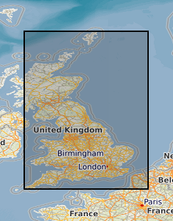
Geographic coverage
))
Temporal reference
Temporal extent
Temporal extent
- Date (Creation)
- 2006
Quality and validity
- Lineage
-
The Geological Indicators of Flooding in Great Britain dataset characterises superficial deposits such as river and lake alluvium taken from DiGMapGB-50 and applies the defined criteria to the individual DigMap polygons. The 'indicator' deposits have been subdivided into two categories; zone 1 being the initial areas prone to flooding, and zone 2 containing areas that may be susceptible to secondary flooding in extreme or prolonged events and the details of this classification are given in the accompanying methodology BGS report IR\10\30 Geological Indicators of Flooding Version 5.2.
- Denominator
- 50000
Conformity
Conformity
Conformity
Restrictions on access and use
- Access constraints
- license
- Access constraints
- This information has commercial potential and access should be subject to the project leader's approval, contact the BGS.
- Access constraints
-
The copyright of materials derived from the British Geological Survey's work is vested in the Natural Environment Research Council [NERC]. No part of this work may be reproduced or transmitted in any form or by any means, or stored in a retrieval system of any nature, without the prior permission of the copyright holder, via the BGS Intellectual Property Rights Manager. Use by customers of information provided by the BGS, is at the customer's own risk. In view of the disparate sources of information at BGS's disposal, including such material donated to BGS, that BGS accepts in good faith as being accurate, the Natural Environment Research Council (NERC) gives no warranty, expressed or implied, as to the quality or accuracy of the information supplied, or to the information's suitability for any use. NERC/BGS accepts no liability whatever in respect of loss, damage, injury or other occurence however caused.
- Access constraints
-
The dataset is made available to external clients under BGS Digital Data Licence terms and conditions. Revert to the IPR Section ( iprdigital@bgs.ac.uk ) if further advice is required with regard to permitted usage.
- Access constraints
-
Either: (i) the dataset is made freely available, e.g. via the Internet, for a restricted category of use (e.g. educational use only); or (ii) the dataset has not been formally approved by BGS for access and use by external clients under licence, but its use may be permitted under alternative formal arrangements; or (iii) the dataset contains 3rd party data or information obtained by BGS under terms and conditions that must be consulted in order to determine the permitted usage of the dataset. Refer to the BGS staff member responsible for the creation of the dataset if further advice is required. He / she should be familiar with the composition of the dataset, particularly with regard to 3rd party IPR contained in it, and any resultant use restrictions. This staff member should revert to the IPR Section ( ipr@bgs.ac.uk ) for advice, should the position not be clear.
Responsible organization (s)
Contact for the resource
- Organisation name
-
British Geological Survey
- Organisation name
-
British Geological Survey
Metadata information
Contact for the metadata
- Organisation name
-
British Geological Survey
- Date stamp
- 2024-05-07
- Metadata language
- English