 BGS Metadata Catalogue
Land survey collection of photographs
This is the core collection of photographs in BGS it represents photographs taken by professional photographers and selected by subject and quality for public reference in the BGS libraries. The collection dates from c 1890 to c.1995 and is organized in a series of sub-collections depending on which office the photographers were based. The collection covers photography taken in the field during the geological mapping programme. Series A, the main Land Survey collection for England and Wales, are all taken by professional photographers and are of high quality. Dates from c.1890 to the start of the current "P" system, the first 7500 are glass plates. Series B, Edinburgh, part of the main Land Survey collection for Scotland, full plate size and all glass plates. Series C, Edinburgh, part of the main Land Survey collection for Scotland, half plate size. Series D, Edinburgh, part of the main Land Survey collection for Scotland consists of large format negative size with additional 35mm transparencies, earlier parts of the collection are black and white, later, colour. Series L, Keyworth, the main Land Survey collection for Northern England and Wales emanating from the Leeds Office, all are taken by professional photographers and include large format black and white, colour originals and colour 35 mm transparencies. Access constraints are only physical constraints relating to handling negatives and glass plates. scans are available in the Geoscience Imagebase. Photographs are either: Out of copyright; Crown or NERC.
Simple
- Date (Creation)
- 1890
- Citation identifier
- http://data.bgs.ac.uk/id/dataHolding/13603090
- Point of contact
-
Organisation name Individual name Electronic mail address Role British Geological Survey
Enquiries
Distributor British Geological Survey
Enquiries
Point of contact British Geological Survey
Enquiries
Distributor British Geological Survey
Enquiries
Custodian
- Maintenance and update frequency
- As needed
-
GEMET - INSPIRE themes, version 1.0
-
BGS Thesaurus of Geosciences
-
-
Photography
-
- dataCentre
- Keywords
-
-
NERC_DDC
-
- Access constraints
- Other restrictions
- Other constraints
- Physical costraints relating to handling negatives and glass plates. Scans are available in the Geoscience Imagebase.
- Use constraints
- Other restrictions
- Other constraints
-
The copyright of materials derived from the British Geological Survey's work is vested in the Natural Environment Research Council [NERC]. No part of this work may be reproduced or transmitted in any form or by any means, or stored in a retrieval system of any nature, without the prior permission of the copyright holder, via the BGS Intellectual Property Rights Manager. Use by customers of information provided by the BGS, is at the customer's own risk. In view of the disparate sources of information at BGS's disposal, including such material donated to BGS, that BGS accepts in good faith as being accurate, the Natural Environment Research Council (NERC) gives no warranty, expressed or implied, as to the quality or accuracy of the information supplied, or to the information's suitability for any use. NERC/BGS accepts no liability whatever in respect of loss, damage, injury or other occurence however caused.
- Other constraints
-
There are no restrictions on the use that may be made of the dataset, although an appropriate copyright acknowledgement must be made when any part of the dataset is reproduced. Either no third party data / information is contained in the dataset or BGS has secured written permission from the owner of any third party data / information contained in the dataset to make the dataset freely available without any use constraints - inclusion of any third party data / information will affect the copyright acknowledgement that needs to be made.
- Denominator
- 10000
- Language
- English
- Topic category
-
- Geoscientific information
- Geographic identifier
-
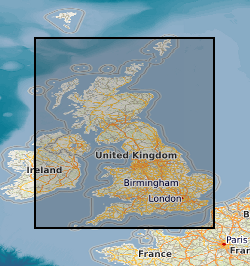
CHA
ISO 3166_1 alpha-3 2009 revision
- Geographic identifier
-
CHANNEL ISLES [id=192500]
British Geological Survey Gazetteer: Geographical hierarchy from Geosaurus 1979 creation
- Geographic identifier
-
GBN
ISO 3166_2 2009 revision
- Geographic identifier
-
GREAT BRITAIN [id=139600]
British Geological Survey Gazetteer: Geographical hierarchy from Geosaurus 1979 creation
- Geographic identifier
-
NIR
ISO 3166_1 alpha-3 2009 revision
- Geographic identifier
-
NORTHERN IRELAND [id=181000]
British Geological Survey Gazetteer: Geographical hierarchy from Geosaurus 1979 creation
))
- Begin date
- 1890
- End date
- 1995
- Unique resource identifier
- OSGB 1936 / British National Grid (EPSG::27700)
- Distribution format
-
Name Version Hardcopy - Photographs
- Distributor contact
-
Organisation name Individual name Electronic mail address Role British Geological Survey
Enquiries
Distributor
- Distributor contact
-
Organisation name Individual name Electronic mail address Role British Geological Survey
Enquiries
Distributor
- OnLine resource
-
Protocol Linkage Name WWW:LINK-1.0-http--link
https://www.bgs.ac.uk/ BGS Homepage
- Hierarchy level
- Dataset
- Other
-
dataset
Conformance result
- Title
-
INSPIRE Implementing rules laying down technical arrangements for the interoperability and harmonisation of Geology
- Date (Publication)
- 2011
- Explanation
-
See the referenced specification
- Pass
- No
Conformance result
- Title
-
Commission Regulation (EU) No 1089/2010 of 23 November 2010 implementing Directive 2007/2/EC of the European Parliament and of the Council as regards interoperability of spatial data sets and services
- Date (Publication)
- 2010-12-08
- Explanation
-
See http://eur-lex.europa.eu/LexUriServ/LexUriServ.do?uri=OJ:L:2010:323:0011:0102:EN:PDF
- Pass
- No
- Statement
-
All photographs were taken by GSGB/IGS/BGS Photographers
Metadata
- File identifier
- 9df8df52-d641-37a8-e044-0003ba9b0d98 XML
- Metadata language
- English
- Hierarchy level
- Dataset
- Date stamp
- 2026-07-10
- Metadata standard name
- UK GEMINI
- Metadata standard version
-
2.3
- Metadata author
-
Organisation name Individual name Electronic mail address Role British Geological Survey
Point of contact
- Dataset URI
)))
