 BGS Metadata Catalogue
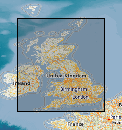
UK Coal Resource for New Exploitation Technologies
Several coal resource maps for the whole of the UK have been produced by the British Geological Survey as a result of joint work with Department of Trade and Industry and the Coal Authority. The UK Coal Resource for new exploitation technologies map is a map of Britain depicting the spatial extent of the principal coal resources overlayed with existing workings and potential new technologies for accessing the resource. The map also shows the areas where coal and lignite are present at the surface and also where coal is buried at depth beneath younger rocks. The project covers all onshore coalfields in the UK, including Northern Ireland. It includes coal under estuaries and near-shore areas that can practically be reached by land-based directional drilling. No data more than 5 km offshore were considered. The maps are intended to be used for resource development, energy policy, strategic planning, land-use planning, the indication of hazard in mined areas, environment assessment and as a teaching aid. In addition to a summary map at 1:750000 scale for Britain data also exists for each technology of 21 individual regions or coal fields at a scale of 1:100000. The data was published in printed map form for the summary map, inkjet plots for the 42 individual maps and as PDF documents on CD. The maps were accompanied by BGS report CR/04/015N, "UK Coal Resource for New Technologies, Final Report". The work was initiated in April 2002 and completed in October 2003. The data was also simplified for inclusion in the Britain Beneath your Feet atlas 2005.
Simple
- Date (Creation)
- 1998
- Citation identifier
- http://data.bgs.ac.uk/id/dataHolding/13603088
- Point of contact
-
Organisation name Individual name Electronic mail address Role British Geological Survey
Enquiries
Author British Geological Survey
Enquiries
Distributor British Geological Survey
Enquiries
Point of contact British Geological Survey
Enquiries
Custodian
- Maintenance and update frequency
- Not planned
-
GEMET - INSPIRE themes, version 1.0
-
BGS Thesaurus of Geosciences
-
-
Coal
-
Mineral resources
-
Coal resource maps
-
Coalbed methane
-
- dataCentre
- Keywords
-
-
NERC_DDC
-
- Access constraints
- Other restrictions
- Other constraints
- There are no constraints on the access to the dataset and no constraints on the usage.
- Use constraints
- Other restrictions
- Other constraints
-
The copyright of materials derived from the British Geological Survey's work is vested in the Natural Environment Research Council [NERC]. No part of this work may be reproduced or transmitted in any form or by any means, or stored in a retrieval system of any nature, without the prior permission of the copyright holder, via the BGS Intellectual Property Rights Manager. Use by customers of information provided by the BGS, is at the customer's own risk. In view of the disparate sources of information at BGS's disposal, including such material donated to BGS, that BGS accepts in good faith as being accurate, the Natural Environment Research Council (NERC) gives no warranty, expressed or implied, as to the quality or accuracy of the information supplied, or to the information's suitability for any use. NERC/BGS accepts no liability whatever in respect of loss, damage, injury or other occurence however caused.
- Other constraints
-
Either: (i) the dataset is made freely available, e.g. via the Internet, for a restricted category of use (e.g. educational use only); or (ii) the dataset has not been formally approved by BGS for access and use by external clients under licence, but its use may be permitted under alternative formal arrangements; or (iii) the dataset contains 3rd party data or information obtained by BGS under terms and conditions that must be consulted in order to determine the permitted usage of the dataset. Refer to the BGS staff member responsible for the creation of the dataset if further advice is required. He / she should be familiar with the composition of the dataset, particularly with regard to 3rd party IPR contained in it, and any resultant use restrictions. This staff member should revert to the IPR Section ( ipr@bgs.ac.uk) for advice, should the position not be clear.
- Spatial representation type
- Vector
- Denominator
- 750000
- Language
- English
- Topic category
-
- Geoscientific information
- Geographic identifier
-
GBN
ISO 3166_2 2009 revision
- Geographic identifier
-
GREAT BRITAIN [id=139600]
British Geological Survey Gazetteer: Geographical hierarchy from Geosaurus 1979 creation
- Geographic identifier
-
NIR
ISO 3166_1 alpha-3 2009 revision
- Geographic identifier
-
NORTHERN IRELAND [id=181000]
British Geological Survey Gazetteer: Geographical hierarchy from Geosaurus 1979 creation
))
- Begin date
- 2002-04
- End date
- 2003-10
- Supplemental Information
-
All existing data are available to users.
- Unique resource identifier
- OSGB 1936 / British National Grid (EPSG::27700)
- Distribution format
-
Name Version Hardcopy Map
- Distributor contact
-
Organisation name Individual name Electronic mail address Role British Geological Survey
Enquiries
Distributor
- OnLine resource
-
Protocol Linkage Name WWW:LINK-1.0-http--link
https://www.bgs.ac.uk/ BGS Homepage
- Hierarchy level
- Dataset
- Other
-
dataset
Conformance result
- Title
-
INSPIRE Implementing rules laying down technical arrangements for the interoperability and harmonisation of Geology
- Date (Publication)
- 2011
- Explanation
-
See the referenced specification
- Pass
- No
Conformance result
- Title
-
Commission Regulation (EU) No 1089/2010 of 23 November 2010 implementing Directive 2007/2/EC of the European Parliament and of the Council as regards interoperability of spatial data sets and services
- Date (Publication)
- 2010-12-08
- Explanation
-
See http://eur-lex.europa.eu/LexUriServ/LexUriServ.do?uri=OJ:L:2010:323:0011:0102:EN:PDF
- Pass
- No
- Statement
-
Coal resource maps for the whole of the UK have been produced by the British Geological Survey as a result of joint work with Department of Trade and Industry and the Coal Authority.
Metadata
- File identifier
- 9df8df52-d63f-37a8-e044-0003ba9b0d98 XML
- Metadata language
- English
- Hierarchy level
- Dataset
- Date stamp
- 2026-06-27
- Metadata standard name
- UK GEMINI
- Metadata standard version
-
2.3
- Metadata author
-
Organisation name Individual name Electronic mail address Role British Geological Survey
Point of contact
- Dataset URI
)))
