 BGS Metadata Catalogue
Groundwater Flooding Susceptibility
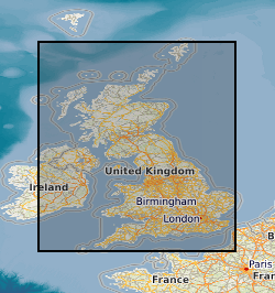
The groundwater flooding susceptibility data shows the degree to which areas of England, Scotland and Wales are susceptible to groundwater flooding on the basis of geological and hydrogeological conditions. It does not show the likelihood of groundwater flooding occurring, i.e. it is a hazard not risk-based dataset. The data covers Great Britain in a consistent manner. It will be updated periodically (at least bi-annually) as the underlying datasets or the methodology to derive the groundwater flooding susceptibility data are improved. The data is based on data sets with a range of resolutions, but the derived data set has an effective spatial resolution of about 50m by 50m. The susceptibility data is suitable for use for regional or national planning purposes where the groundwater flooding information will be used along with a range of other relevant information to inform land-use planning decisions. It might also be used in conjunction with a large number of other factors, e.g. records of previous incidence of groundwater flooding, rainfall, property type, and land drainage information, to establish relative, but not absolute, risk of groundwater flooding at a resolution of greater than a few hundred metres. In all cases it is strongly recommend the confidence data is used in conjunction with the groundwater flooding susceptibility data. The susceptibility data should not be used on its own to make planning decisions at any scale, and, in particular, should not be used to inform planning decisions at the site scale. The susceptibility data cannot be used on its own to indicate risk of groundwater flooding.
Simple
- Date (Creation)
- 2006-08
- Citation identifier
- http://data.bgs.ac.uk/id/dataHolding/13603085
- Point of contact
-
Organisation name Individual name Electronic mail address Role British Geological Survey
Enquiries
Distributor British Geological Survey
Enquiries
Originator British Geological Survey
Enquiries
Point of contact British Geological Survey
Enquiries
Custodian
- Maintenance and update frequency
- As needed
-
GEMET - INSPIRE themes, version 1.0
-
BGS Thesaurus of Geosciences
-
-
Groundwater
-
Water flooding
-
Floods
-
- dataCentre
- Keywords
-
-
NERC_DDC
-
- Access constraints
- Other restrictions
- Use constraints
- Other restrictions
- Other constraints
-
The copyright of materials derived from the British Geological Survey's work is vested in the Natural Environment Research Council [NERC]. No part of this work may be reproduced or transmitted in any form or by any means, or stored in a retrieval system of any nature, without the prior permission of the copyright holder, via the BGS Intellectual Property Rights Manager. Use by customers of information provided by the BGS, is at the customer's own risk. In view of the disparate sources of information at BGS's disposal, including such material donated to BGS, that BGS accepts in good faith as being accurate, the Natural Environment Research Council (NERC) gives no warranty, expressed or implied, as to the quality or accuracy of the information supplied, or to the information's suitability for any use. NERC/BGS accepts no liability whatever in respect of loss, damage, injury or other occurence however caused.
- Other constraints
-
Either: (i) the dataset is made freely available, e.g. via the Internet, for a restricted category of use (e.g. educational use only); or (ii) the dataset has not been formally approved by BGS for access and use by external clients under licence, but its use may be permitted under alternative formal arrangements; or (iii) the dataset contains 3rd party data or information obtained by BGS under terms and conditions that must be consulted in order to determine the permitted usage of the dataset. Refer to the BGS staff member responsible for the creation of the dataset if further advice is required. He / she should be familiar with the composition of the dataset, particularly with regard to 3rd party IPR contained in it, and any resultant use restrictions. This staff member should revert to the IPR Section ( ipr@bgs.ac.uk) for advice, should the position not be clear.
- Spatial representation type
- Vector
- Denominator
- 10000
- Language
- English
- Topic category
-
- Geoscientific information
- Geographic identifier
-
GB
ISO 3166_1 alpha-3 2009 revision
- Geographic identifier
-
UK [id=139300]
British Geological Survey Gazetteer: Geographical hierarchy from Geosaurus 1979 creation
- Geographic identifier
-
UKM
ISO 3166_2 2009 revision
))
- End date
- 2006 Before
- Supplemental Information
-
The data are updated when new data become available. GROUNDWATER FLOODING DATABANK VERSION 1. Systematic national coverage with GIS data. Derived from other BGS datasets using a documented methodology. The data can be viewed at a range of scales, no typical scale can be identified.
- Unique resource identifier
- OSGB 1936 / British National Grid (EPSG::27700)
- Distribution format
-
Name Version ESRI Shapefile
1994
MapInfo (TAB)
- Distributor contact
-
Organisation name Individual name Electronic mail address Role British Geological Survey
Enquiries
Distributor
- OnLine resource
-
Protocol Linkage Name WWW:LINK-1.0-http--link
https://www.bgs.ac.uk/ BGS Homepage
- Hierarchy level
- Dataset
- Other
-
dataset
Conformance result
- Title
-
INSPIRE Implementing rules laying down technical arrangements for the interoperability and harmonisation of Geology
- Date (Publication)
- 2011
- Explanation
-
See the referenced specification
- Pass
- No
Conformance result
- Title
-
Commission Regulation (EU) No 1089/2010 of 23 November 2010 implementing Directive 2007/2/EC of the European Parliament and of the Council as regards interoperability of spatial data sets and services
- Date (Publication)
- 2010-12-08
- Explanation
-
See http://eur-lex.europa.eu/LexUriServ/LexUriServ.do?uri=OJ:L:2010:323:0011:0102:EN:PDF
- Pass
- No
- Statement
-
This dataset is derived in part from BGS DiGMapBG-50 data attributed with BGS Permeability Index data, from groundwater levels from BGS WellMaster database and from regional hydrogeological contours taken from the IGS series hydrogeological maps. The data has been produced using a 'rule-based' approach. The first step was to apply 'rules' to identify areas, based on geological considerations, where groundwater flooding could not occur, i.e. areas where non-aquifers are present at the ground surface. For all areas that were geologically susceptible, a second suite of rules was used to produce a national groundwater level surface using data taken from published BGS groundwater level contours, groundwater levels in BGS WellMaster database and inferred from some river levels. A further suite of rules was used to modify this groundwater level surface so that it was representative of conditions of groundwater flooding. Finally, this modified groundwater surface was compared with a digital terrain model (DTM) of the ground surface elevation and a final set of rules was used to zone the degree of susceptibility depending on the modelled depth of the groundwater surface below the land surface.
Metadata
- File identifier
- 9df8df52-d63d-37a8-e044-0003ba9b0d98 XML
- Metadata language
- English
- Hierarchy level
- Dataset
- Date stamp
- 2026-07-10
- Metadata standard name
- UK GEMINI
- Metadata standard version
-
2.3
- Metadata author
-
Organisation name Individual name Electronic mail address Role British Geological Survey
Point of contact
- Dataset URI
)))
