BGS Data Catalogue
Index to Waste Disposal Site Records
Oracle index to records of some 3500 waste sites in England and Wales identified by BGS as part of a survey carried out on behalf of the Departement of the Environment in 1973. The index has been corrected and updated to a limited extent, but the data itself has not been changed. The data was collected in 1972 and the information reflects the knowledge at that time. It does not reflect current interpretation. Not all authorities made returns and there are not records for all of the sites listed. However, the data is an invaluable source of information about pre-1974 sites. Information includes site name, location and risks to aquifers. It should be noted that the assessments were carried out when the data was collected and may not reflect current interpretation.
INSPIRE
Identification
- File identifier
- 9df8df52-d61f-37a8-e044-0003ba9b0d98 XML
- Resource type
- dataset
Online resource
- Protocol
-
HTTP
Resource identifier
- Metadata Language
- English (en)
Encoding
- Format
-
Hardcopy - Data from Oracle tables can be supplied in hardcopy format
- Format
-
Oracle
- Version
-
Current BGS version
- Format
-
MS Excel Spreadsheet
- Version
-
Current BGS version
Projection
Classification of data and services
- Topic category
-
- Geoscientific information
Classification of data and services
Coupled resource
Coupled resource
Classification of data and services
Coupled resource
Coupled resource
Keywords
- GEMET - INSPIRE themes, version 1.0
- BGS Thesaurus of Geosciences
-
-
Land filling
-
Groundwater
-
Pollution
-
Surface waters
-
Waste disposal
-
UK Location (INSPIRE)
-
Aquifers
-
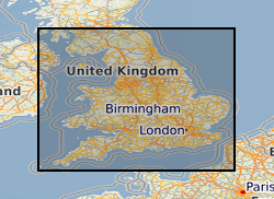
Geographic coverage
))
Temporal reference
Temporal extent
Temporal extent
- Dataset Reference Date ()
- 1990
Quality and validity
- Lineage
-
Index information taken from Waste disposal site records and entered into Oracle table.
- Denominator
- 10000
Conformity
Conformity
Conformity
Conformity
Conformity
Conformity
- Explanation
-
See the referenced specification
Restrictions on access and use
- Access constraints
- No restrictions on the access and use of the dataset.
- Access constraints
-
The copyright of materials derived from the British Geological Survey's work is vested in the Natural Environment Research Council [NERC]. No part of this work may be reproduced or transmitted in any form or by any means, or stored in a retrieval system of any nature, without the prior permission of the copyright holder, via the BGS Intellectual Property Rights Manager. Use by customers of information provided by the BGS, is at the customer's own risk. In view of the disparate sources of information at BGS's disposal, including such material donated to BGS, that BGS accepts in good faith as being accurate, the Natural Environment Research Council (NERC) gives no warranty, expressed or implied, as to the quality or accuracy of the information supplied, or to the information's suitability for any use. NERC/BGS accepts no liability whatever in respect of loss, damage, injury or other occurence however caused.
- Access constraints
-
Either: (i) the dataset is made freely available, e.g. via the Internet, for a restricted category of use (e.g. educational use only); or (ii) the dataset has not been formally approved by BGS for access and use by external clients under licence, but its use may be permitted under alternative formal arrangements; or (iii) the dataset contains 3rd party data or information obtained by BGS under terms and conditions that must be consulted in order to determine the permitted usage of the dataset. Refer to the BGS staff member responsible for the creation of the dataset if further advice is required. He / she should be familiar with the composition of the dataset, particularly with regard to 3rd party IPR contained in it, and any resultant use restrictions. This staff member should revert to the IPR Section (ipr@bgs.ac.uk) for advice, should the position not be clear. ipr@bgs.ac Either: (i) the dataset is made freely available, e.g. via the Internet, for a restricted category of use (e.g. educational use only); or (ii) the dataset has not been formally approved by BGS for access and use by external clients under licence, but its use may be permitted under alternative formal arrangements; or (iii) the dataset contains 3rd party data or information obtained by BGS under terms and conditions that must be consulted in order to determine the permitted usage of the dataset. Refer to the BGS staff member responsible for the creation of the dataset if further advice is required. He / she should be familiar with the composition of the dataset, particularly with regard to 3rd party IPR contained in it, and any resultant use restrictions. This staff member should revert to the IPR Section (ipr@bgs.ac.uk) for advice, should the position not be clear.
Responsible organization (s)
Contact for the resource
- Organisation name
-
British Geological Survey
-
enquiries@bgs.ac enquiries@bgs.ac.uk
- Organisation name
-
British Geological Survey
-
enquiries@bgs.ac enquiries@bgs.ac.uk
- Organisation name
-
British Geological Survey
-
enquiries@bgs.ac enquiries@bgs.ac.uk
- Organisation name
-
British Geological Survey
-
enquiries@bgs.ac enquiries@bgs.ac.uk
Metadata information
Contact for the metadata
- Organisation name
-
British Geological Survey
-
enquiries@bgs.ac enquiries@bgs.ac.uk
- Metadata Date
- 2024-04-17
- Metadata Language
- English (en)