BGS Data Catalogue
GeoSure Slope Instability
The GeoSure data sets and reports from the British Geological Survey provide information about potential ground movement or subsidence in a helpful and user-friendly format. The reports can help inform planning decisions and indicate causes of subsidence. The methodology is based on BGS DiGMap (Digital Map) and expert knowledge of the behaviour of the formations so defined. This dataset provides an assessment of slope instability. Landslide hazard occurs due to particular slope characteristics (such as geology, gradient, sources of water, drainage, man-made constructions) combining to cause the slope to become unstable. Downslope movement of materials, such as a landslide or rockfall may lead to a loss of support and damage to buildings. Complete Great Britain national coverage is available. The storage formats of the data are ESRI and MapInfo but other formats can be supplied.
- Identification
- Distribution
- Quality
- Spatial rep.
- Ref. system
- Content
- Portrayal
- Metadata
- Md. constraints
- Md. maintenance
- Schema info
Identification
Data identification
Citation
- Dataset Reference Date ()
- 2005-05-09
British Geological Survey
-Enquiries
Environmental Science Centre, Nicker Hill, Keyworth
,NOTTINGHAM
,NOTTINGHAMSHIRE
,NG12 5GG
,United Kingdom
0115 936 3276
British Geological Survey
-Enquiries
Environmental Science Centre, Nicker Hill, Keyworth
,NOTTINGHAM
,NOTTINGHAMSHIRE
,NG12 5GG
,United Kingdom
0115 936 3276
British Geological Survey
-Enquiries
Environmental Science Centre, Nicker Hill, Keyworth
,NOTTINGHAM
,NOTTINGHAMSHIRE
,NG12 5GG
,United Kingdom
0115 936 3276
- Maintenance and update frequency
- asNeeded
- GEMET - INSPIRE themes, version 1.0
- BGS Thesaurus of Geosciences
-
-
Natural hazards
-
UK Location (INSPIRE)
-
Scottish SDI
-
- Keywords ()
- Keywords
-
-
NERC_DDC
-
Legal constraints
- Limitations on Public Access
- otherRestrictions
Legal constraints
- Use constraints
- otherRestrictions
- Other constraints
-
The copyright of materials derived from the British Geological Survey's work is vested in the Natural Environment Research Council [NERC]. No part of this work may be reproduced or transmitted in any form or by any means, or stored in a retrieval system of any nature, without the prior permission of the copyright holder, via the BGS Intellectual Property Rights Manager. Use by customers of information provided by the BGS, is at the customer's own risk. In view of the disparate sources of information at BGS's disposal, including such material donated to BGS, that BGS accepts in good faith as being accurate, the Natural Environment Research Council (NERC) gives no warranty, expressed or implied, as to the quality or accuracy of the information supplied, or to the information's suitability for any use. NERC/BGS accepts no liability whatever in respect of loss, damage, injury or other occurence however caused.
- Other constraints
-
Either: (i) the dataset is made freely available, e.g. via the Internet, for a restricted category of use (e.g. educational use only); or (ii) the dataset has not been formally approved by BGS for access and use by external clients under licence, but its use may be permitted under alternative formal arrangements; or (iii) the dataset contains 3rd party data or information obtained by BGS under terms and conditions that must be consulted in order to determine the permitted usage of the dataset. Refer to the BGS staff member responsible for the creation of the dataset if further advice is required. He / she should be familiar with the composition of the dataset, particularly with regard to 3rd party IPR contained in it, and any resultant use restrictions. This staff member should revert to the IPR Section (ipr@bgs.ac.uk) for advice, should the position not be clear. ipr@bgs.ac Either: (i) the dataset is made freely available, e.g. via the Internet, for a restricted category of use (e.g. educational use only); or (ii) the dataset has not been formally approved by BGS for access and use by external clients under licence, but its use may be permitted under alternative formal arrangements; or (iii) the dataset contains 3rd party data or information obtained by BGS under terms and conditions that must be consulted in order to determine the permitted usage of the dataset. Refer to the BGS staff member responsible for the creation of the dataset if further advice is required. He / she should be familiar with the composition of the dataset, particularly with regard to 3rd party IPR contained in it, and any resultant use restrictions. This staff member should revert to the IPR Section (ipr@bgs.ac.uk) for advice, should the position not be clear.
- Spatial representation type
- vector
- Denominator
- 50000
- Metadata Language
- English (en)
- Topic category
-
- Geoscientific information
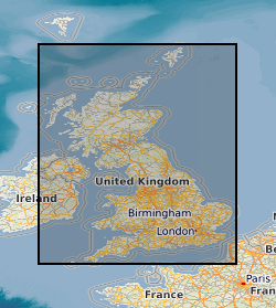
Extent
- Extent
-
ENG
Citation
- Dataset Reference Date ()
- 2009
- Extent
-
ENGLAND [id=150000]
Citation
- Dataset Reference Date ()
- 1979
- Extent
-
SCOTLAND [id=140000]
Citation
- Dataset Reference Date ()
- 1979
- Extent
-
SCT
Citation
- Dataset Reference Date ()
- 2009
- Extent
-
WALES [id=170000]
Citation
- Dataset Reference Date ()
- 1979
- Extent
-
WLS
Citation
- Dataset Reference Date ()
- 2009
))
- Additional information
-
Geotechnical data abstracted from NGDC site investigation collection and entered into the BGS geotechnical database. Methodology may be revised in the light of new knowledge or customer feedback. Changes in DiGMapGB-50 base data will require periodic or continuous revision. ADDITIONAL_INFO 1 = Complete GB National Coverage, subject to revision in line with changes in DiGMapGB-50 lithology codes. Based on 1:50 000 DiGMapGB-50 linework. Methodology consistent throughout. Otherwise subject to logical consistency of DiGMapGB-50.
Distribution
Distribution
- Data format
-
-
ESRI Shapefile
(Current BGS version
)
-
British Geological Survey
-Enquiries
Environmental Science Centre, Nicker Hill, Keyworth
,NOTTINGHAM
,NOTTINGHAMSHIRE
,NG12 5GG
,United Kingdom
0115 936 3276
- Resource Locator
- BGS GeoSure Homepage
Quality
Data quality
- Quality Scope
- dataset
Report
Citation
- Dataset Reference Date ()
- 2011
- Explanation
-
See the referenced specification
- Degree
Report
Citation
- Dataset Reference Date ()
- 2010-12-08
- Explanation
-
See http://eur-lex.europa.eu/LexUriServ/LexUriServ.do?uri=OJ:L:2010:323:0011:0102:EN:PDF
- Degree
- Statement
-
Methodology devised by GeoHazard project. Latest version and earlier versions are held in project files.
Ref. system
Metadata
Metadata
- File identifier
- 9df8df52-d609-37a8-e044-0003ba9b0d98 XML
- Metadata Language
- English (en)
- Resource type
- dataset
- Metadata Date
- 2024-04-18
- Metadata standard name
- UK GEMINI
- Metadata standard version
-
2.3
British Geological Survey
Environmental Science Centre, Keyworth
,NOTTINGHAM
,NOTTINGHAMSHIRE
,NG12 5GG
,United Kingdom
- Dataset URI