BGS Metadata Catalogue
Regional gravity survey data of onshore and nearshore United Kingdom
Indexes and data records for Regional gravity observations on the UK mainland, Northern Ireland, offshore islands, tidal estuaries and seabed. Records include station identities, position, gravity reading and reduced gravity values. Most of the surveys were carried out by the BGS but the database includes data originally acquired by other organisations and subsequently given to the BGS to be managed as part of the national archive. Complete coverage of the UK mainland with a station density of 1-2 stations per square kilometre.
INSPIRE
Identification
- File identifier
- 9df8df51-6404-37a8-e044-0003ba9b0d98 XML
- Hierarchy level
- Dataset
Online resource
Resource identifier
- Metadata language
- English
- Spatial representation type
- Vector
Encoding
- Format
-
OTHER, UNKNOWN OR OBSCURE - Gridded data
- Format
-
DIGITAL - Digital records
Projection
Classification of data and services
- Topic category
-
- Geoscientific information
Keywords
-
GEMET - INSPIRE themes, version 1.0
-
BGS Thesaurus of Geosciences
-
-
Gravity
-
UK Location (INSPIRE)
-
Geophysical surveys
-
Geophysics
-
Geology
-
Gravity surveys
-
Scottish SDI
-
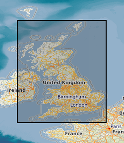
Geographic coverage
))
Temporal reference
Temporal extent
- Begin
- 1948
Temporal extent
- Date (Creation)
- 1948
Quality and validity
- Lineage
-
Data predominantly acquired by BGS but other data from commercial and academic organisations
Conformity
Conformity
Conformity
Restrictions on access and use
- Access constraints
-
The copyright of materials derived from the British Geological Survey's work is vested in the Natural Environment Research Council [NERC]. No part of this work may be reproduced or transmitted in any form or by any means, or stored in a retrieval system of any nature, without the prior permission of the copyright holder, via the BGS Intellectual Property Rights Manager. Use by customers of information provided by the BGS, is at the customer's own risk. In view of the disparate sources of information at BGS's disposal, including such material donated to BGS, that BGS accepts in good faith as being accurate, the Natural Environment Research Council (NERC) gives no warranty, expressed or implied, as to the quality or accuracy of the information supplied, or to the information's suitability for any use. NERC/BGS accepts no liability whatever in respect of loss, damage, injury or other occurence however caused.
- Access constraints
-
Either: (i) the dataset is made freely available, e.g. via the Internet, for a restricted category of use (e.g. educational use only); or (ii) the dataset has not been formally approved by BGS for access and use by external clients under licence, but its use may be permitted under alternative formal arrangements; or (iii) the dataset contains 3rd party data or information obtained by BGS under terms and conditions that must be consulted in order to determine the permitted usage of the dataset. Refer to the BGS staff member responsible for the creation of the dataset if further advice is required. He / she should be familiar with the composition of the dataset, particularly with regard to 3rd party IPR contained in it, and any resultant use restrictions. This staff member should revert to the IPR Section ( ipr@bgs.ac.uk ) for advice, should the position not be clear.
Responsible organization (s)
Contact for the resource
- Organisation name
-
British Geological Survey
- Organisation name
-
British Geological Survey
- Organisation name
-
British Geological Survey
- Organisation name
-
British Geological Survey
- Organisation name
-
British Geological Survey
Metadata information
Contact for the metadata
- Organisation name
-
British Geological Survey
- Date stamp
- 2024-05-07
- Metadata language
- English