 BGS Metadata Catalogue
Aeromagnetic Survey Of Great Britain And Northern Ireland
Digitised version of aeromagnetic survey records of Great Britain comprising a record for each digitised point, supported by survey and 'ends and bends' based line indexes. Original records include flight line records, worksheets, contour sheets and air photos provided by contractors at completion of each survey. Worksheets digitised by BGS during 1980's Smith and Royles 1989. Between 1955 and 1965 an airborne magnetic survey was conducted covering the land and parts of the sea areas of the United Kingdom. Different sections of the survey were conducted in different years by Hunting Geology and Geophysics Ltd. (variously Hunting Surveys Ltd. or Hunting Geophysics Ltd.) and Canadian Aeroservices Inc. The survey was funded by the Department of Scientific and Industrial Research and, in Northern Ireland, by the Department of Commerce. For the first year of survey funds were also provided by the Nuffield Foundation. The survey was overseen by the Geophysics Department of the (then) Geological Survey and Museum (subsequently Institute of Geological Sciences, subsequently British Geological Survey), in collaboration with the United Kingdom Atomic Energy Authority, Harwell, when local radiometric surveys were incorporated.
Simple
- Date (Creation)
- 1987
- Citation identifier
- http://data.bgs.ac.uk/id/dataHolding/13480445
- Point of contact
-
Organisation name Individual name Electronic mail address Role British Geological Survey
Enquiries
Distributor British Geological Survey
Enquiries
Custodian British Geological Survey
Enquiries
Distributor British Geological Survey
Enquiries
Originator British Geological Survey
Enquiries
Point of contact
- Maintenance and update frequency
- Not planned
-
GEMET - INSPIRE themes, version 1.0
-
BGS Thesaurus of Geosciences
-
-
Geophysics
-
Geophysical surveys
-
Aerial magnetic surveys
-
Geology
-
Magnetic surveys
-
Aerial geophysical surveys
-
- dataCentre
- Keywords
-
-
NERC_DDC
-
- Access constraints
- Other restrictions
- Other constraints
- licenceOGL
- Use constraints
- Other restrictions
- Other constraints
-
The copyright of materials derived from the British Geological Survey's work is vested in the Natural Environment Research Council [NERC]. No part of this work may be reproduced or transmitted in any form or by any means, or stored in a retrieval system of any nature, without the prior permission of the copyright holder, via the BGS Intellectual Property Rights Manager. Use by customers of information provided by the BGS, is at the customer's own risk. In view of the disparate sources of information at BGS's disposal, including such material donated to BGS, that BGS accepts in good faith as being accurate, the Natural Environment Research Council (NERC) gives no warranty, expressed or implied, as to the quality or accuracy of the information supplied, or to the information's suitability for any use. NERC/BGS accepts no liability whatever in respect of loss, damage, injury or other occurence however caused.
- Other constraints
-
Available under the Open Government Licence subject to the following acknowledgement accompanying the reproduced NERC materials "Contains NERC materials ©NERC [year]"
- Spatial representation type
- Text, table
- Language
- English
- Topic category
-
- Geoscientific information
- Geographic identifier
-
GB
ISO 3166_1 alpha-3 2009 revision
- Geographic identifier
-
UK CONTINENTAL SHELF [id=121701]
British Geological Survey Gazetteer: Geographical hierarchy from Geosaurus 1979 creation
- Geographic identifier
-
UK [id=139300]
British Geological Survey Gazetteer: Geographical hierarchy from Geosaurus 1979 creation
- Geographic identifier
-
UKM
ISO 3166_2 2009 revision
))
- Begin date
- 1955
- End date
- 1965
- Supplemental Information
-
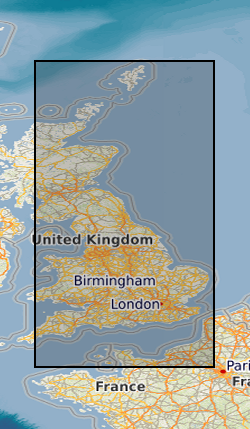
Bounding rectangle approx 70% covered. Flight line separation varies between 2km and 0.4km. Line spacing 2km, but 0.4km in SW England. Fuducial Location, Doppler Offshore. Mostly digitised from 1:63360 (+1:253440 and 1:25000) scale worksheets. 305m (+457m,549m,152m) flying height. Surveys flown over 10 years. Some variation in flying heights, line separation etc
- Unique resource identifier
- OSGB 1936 / British National Grid (EPSG::27700)
- Distribution format
-
Name Version Comma-Separated Values (CSV) file (.csv)
- Distributor contact
-
Organisation name Individual name Electronic mail address Role British Geological Survey
Enquiries
Distributor
- Distributor contact
-
Organisation name Individual name Electronic mail address Role British Geological Survey
Enquiries
Distributor
- OnLine resource
-
Protocol Linkage Name WWW:DOWNLOAD-1.0-http--download
https://ogc.bgs.ac.uk/services/inspire/datasets/13480445.xml Aeromagnetic Survey of Great Britain and Northern Ireland (Geopairgsgbdig)
- OnLine resource
-
Protocol Linkage Name WWW:DOWNLOAD-1.0-http--download
https://webapps.bgs.ac.uk/services/ngdc/accessions/index.html#item192232 Data
- Hierarchy level
- Dataset
- Other
-
dataset
Conformance result
- Title
-
INSPIRE Implementing rules laying down technical arrangements for the interoperability and harmonisation of Geology
- Date (Publication)
- 2011
- Explanation
-
See the referenced specification
- Pass
- No
Conformance result
- Title
-
Commission Regulation (EU) No 1089/2010 of 23 November 2010 implementing Directive 2007/2/EC of the European Parliament and of the Council as regards interoperability of spatial data sets and services
- Date (Publication)
- 2010-12-08
- Explanation
-
See http://eur-lex.europa.eu/LexUriServ/LexUriServ.do?uri=OJ:L:2010:323:0011:0102:EN:PDF
- Pass
- No
- Statement
-
The data was recorded in analogue form and reduced to provide hand drawn maps, contoured at 10 nT intervals. Flight-line/contour-line intercepts were subsequently digitised from these maps to produce the digital aeromagnetic data set for the UK, comprising over 540 000 points. The data has been reprocessed to refer anomalies to a variant of IGRF-90, which makes allowance for the inaccurate prediction of the geomagnetic field model prior to 1971. Most of the surveys had a flight-line spacing of 2 km, with 10 km tie-lines. Flight lines for each survey were north to south or east to west, depending on the predominant geological strike, and most of the country was flown at 1000 ft (305 m) mean terrain clearance. Flight line records, worksheets, contour sheets and air photos provided by contractors at completion of each survey. Worksheets digitised by BGS during 1980's Smith and Royles 1989.
Metadata
- File identifier
- 9df8df51-63f3-37a8-e044-0003ba9b0d98 XML
- Metadata language
- English
- Hierarchy level
- Dataset
- Date stamp
- 2026-07-26
- Metadata standard name
- UK GEMINI
- Metadata standard version
-
2.3
- Metadata author
-
Organisation name Individual name Electronic mail address Role British Geological Survey
Point of contact
- Dataset URI
)))
