 BGS Metadata Catalogue
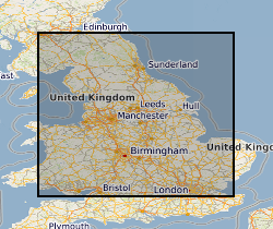
Geochemical Baseline Survey of the Environment (G-BASE) for UK Soils in urban areas
Soil samples collected in urban areas throughout the UK are analysed for their major and trace element geochemistry, their pH and organic matter content. Samples are collected at two depths; 0-15cm and 35-45cm at sites selected using a stratified, random design. The data can be used to identify and prioritize contaminated sites. In 1993, the Geochemical Baseline Survey Of The Environm (G-BASE) rural geochemical mapping programme was extended to include sampling in urban areas and to date around 22 urban centres have been sampled. Data is available on key inorganic contaminants including Cr, Cu, Cd, Ni, As, Pb, Zn, Sn and Sb. Results have been standardised to ensure seamless joins between geochemical sampling campaigns. Urban centres are selected in areas where rural sampling is undertaken or where the BGS urban programme is active. Urban centres will continue to be sampled until completion of the rural programme, scheduled for 2015.
Simple
- Date (Creation)
- 1993
- Citation identifier
- http://data.bgs.ac.uk/id/dataHolding/13480371
- Point of contact
-
Organisation name Individual name Electronic mail address Role British Geological Survey
Enquiries
Distributor British Geological Survey
Enquiries
Originator British Geological Survey
Enquiries
Point of contact British Geological Survey
Enquiries
Custodian
- Maintenance and update frequency
- Irregular
-
GEMET - INSPIRE themes, version 1.0
-
BGS Thesaurus of Geosciences
-
-
Geochemistry
-
Soil chemistry
-
- dataCentre
- Keywords
-
-
NERC_DDC
-
- Access constraints
- Other restrictions
- Other constraints
- Data sold under licence. Copyright control. Landowners permission given for non-site specific survey.
- Use constraints
- Other restrictions
- Other constraints
-
The copyright of materials derived from the British Geological Survey's work is vested in the Natural Environment Research Council [NERC]. No part of this work may be reproduced or transmitted in any form or by any means, or stored in a retrieval system of any nature, without the prior permission of the copyright holder, via the BGS Intellectual Property Rights Manager. Use by customers of information provided by the BGS, is at the customer's own risk. In view of the disparate sources of information at BGS's disposal, including such material donated to BGS, that BGS accepts in good faith as being accurate, the Natural Environment Research Council (NERC) gives no warranty, expressed or implied, as to the quality or accuracy of the information supplied, or to the information's suitability for any use. NERC/BGS accepts no liability whatever in respect of loss, damage, injury or other occurence however caused.
- Other constraints
-
Either: (i) the dataset is made freely available, e.g. via the Internet, for a restricted category of use (e.g. educational use only); or (ii) the dataset has not been formally approved by BGS for access and use by external clients under licence, but its use may be permitted under alternative formal arrangements; or (iii) the dataset contains 3rd party data or information obtained by BGS under terms and conditions that must be consulted in order to determine the permitted usage of the dataset. Refer to the BGS staff member responsible for the creation of the dataset if further advice is required. He / she should be familiar with the composition of the dataset, particularly with regard to 3rd party IPR contained in it, and any resultant use restrictions. This staff member should revert to the IPR Section ( ipr@bgs.ac.uk) for advice, should the position not be clear.
- Spatial representation type
- Grid
- Denominator
- 25000
- Language
- English
- Topic category
-
- Geoscientific information
- Geographic identifier
-
CARDIFF [id=99844]
British Geological Survey Gazetteer: Geographical hierarchy from Geosaurus 1979 creation
- Geographic identifier
-
CORBY [id=157481]
British Geological Survey Gazetteer: Geographical hierarchy from Geosaurus 1979 creation
- Geographic identifier
-
DERBY [id=157301]
British Geological Survey Gazetteer: Geographical hierarchy from Geosaurus 1979 creation
- Geographic identifier
-
DONCASTER [id=156701]
British Geological Survey Gazetteer: Geographical hierarchy from Geosaurus 1979 creation
- Geographic identifier
-
GREATER MANCHESTER [id=154800]
British Geological Survey Gazetteer: Geographical hierarchy from Geosaurus 1979 creation
- Geographic identifier
-
HULL [id=156802]
British Geological Survey Gazetteer: Geographical hierarchy from Geosaurus 1979 creation
- Geographic identifier
-
LINCOLN [id=157201]
British Geological Survey Gazetteer: Geographical hierarchy from Geosaurus 1979 creation
- Geographic identifier
-
MANSFIELD [id=157331]
British Geological Survey Gazetteer: Geographical hierarchy from Geosaurus 1979 creation
- Geographic identifier
-
NOTTINGHAM [id=157332]
British Geological Survey Gazetteer: Geographical hierarchy from Geosaurus 1979 creation
- Geographic identifier
-
PETERBOROUGH [id=158501]
British Geological Survey Gazetteer: Geographical hierarchy from Geosaurus 1979 creation
- Geographic identifier
-
SCUNTHORPE [id=157202]
British Geological Survey Gazetteer: Geographical hierarchy from Geosaurus 1979 creation
- Geographic identifier
-
SHEFFIELD [id=156702]
British Geological Survey Gazetteer: Geographical hierarchy from Geosaurus 1979 creation
- Geographic identifier
-
STOKE-ON-TRENT [id=157601]
British Geological Survey Gazetteer: Geographical hierarchy from Geosaurus 1979 creation
- Geographic identifier
-
SWANSEA [id=172281]
British Geological Survey Gazetteer: Geographical hierarchy from Geosaurus 1979 creation
- Geographic identifier
-
TELFORD [id=157701]
British Geological Survey Gazetteer: Geographical hierarchy from Geosaurus 1979 creation
- Geographic identifier
-
WOLVERHAMPTON [id=157951]
British Geological Survey Gazetteer: Geographical hierarchy from Geosaurus 1979 creation
- Geographic identifier
-
YORK [id=156502]
British Geological Survey Gazetteer: Geographical hierarchy from Geosaurus 1979 creation
))
- Begin date
- 1968
- Supplemental Information
-
In 1993, the G-BASE rural geochemical mapping programme was extended to include sampling in urban areas. New data is added irregularly (maybe once a year or longer), but never updated once loaded. Data reported for each urban centre in BGS internal report series. PUBLICATION: GEOCHEMICAL BASELINES FOR SUSTAINABLE DEVELOPMENT. THE G-BASE PROJECT. Samples are 1 per 500m square. Sampling is undertaken in a consistent manner, derived from the geochemical sampling methods of IGCP 259.
- Unique resource identifier
- OSGB 1936 / British National Grid (EPSG::27700)
- Distribution format
-
Name Version Hardcopy, BGS IR reports
- Distributor contact
-
Organisation name Individual name Electronic mail address Role British Geological Survey
Enquiries
Distributor
- OnLine resource
-
Protocol Linkage Name WWW:LINK-1.0-http--link
https://www.bgs.ac.uk/geology-projects/applied-geochemistry/g-base/ Geochemical baseline survey of the environment (G-BASE)
- Hierarchy level
- Dataset
- Other
-
dataset
Conformance result
- Title
-
INSPIRE Implementing rules laying down technical arrangements for the interoperability and harmonisation of Geology
- Date (Publication)
- 2011
- Explanation
-
See the referenced specification
- Pass
- No
Conformance result
- Title
-
Commission Regulation (EU) No 1089/2010 of 23 November 2010 implementing Directive 2007/2/EC of the European Parliament and of the Council as regards interoperability of spatial data sets and services
- Date (Publication)
- 2010-12-08
- Explanation
-
See http://eur-lex.europa.eu/LexUriServ/LexUriServ.do?uri=OJ:L:2010:323:0011:0102:EN:PDF
- Pass
- No
- Statement
-
Developed from G-BASE programme in 1993. Run as Geochemical Surveys of the Urban Environment (GSUE) project 2000-2005. From April 2005 a task within G-BASE project.
Metadata
- File identifier
- 9df8df51-63bd-37a8-e044-0003ba9b0d98 XML
- Metadata language
- English
- Hierarchy level
- Dataset
- Date stamp
- 2026-07-10
- Metadata standard name
- UK GEMINI
- Metadata standard version
-
2.3
- Metadata author
-
Organisation name Individual name Electronic mail address Role British Geological Survey
Point of contact
- Dataset URI
)))
