BGS Data Catalogue
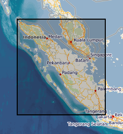
Sumatra Regional Geochemistry
Regional Geochemical data from drainage basin reconnaissance survey carried out as part of a bilateral aid project between the UK Department for International development (DFID) (formerly ODA) and the Indonesian Government. Some 23,000 stream sediment samples collected and analysed (less than 80 mesh fraction) for Copper, Lead, Zinc, Cobalt, Nickel, Manganese, Silver, Arsenic, Molybdenum, Tin and Tungsten (partial extraction) and Lithium, Potassium, Chromium and Iron (total extraction). Samples collected and classified on the basis of 1:250 000 map quadrangle areas. Data gathering completed in two phases: First phase: North of the equator (North Sumatra Project, NSP). Second phase: South of the equator (Southern Sumatra Geological and mineral exploration Project). Sampling and analytical methodology has been consistent throughout. All data is available as on the Sumatra CD-database CD-ROM. North of the equator data published as 1:250 000 single element classified symbol plots and as a monochrome geochemical atlas. South of the equator data published as 1:250 000 single element proportional symbol plots and a geochemical atlas (hardcopy and CD-ROM). Projects also involved regional geological mapping and in Southern Sumatra regional geophysics (gravity). Raw data can be obtained from the Directorate of Mineral Resources, Bandung, Indonesia.
INSPIRE
Identification
- File identifier
- 9df8df51-63a9-37a8-e044-0003ba9b0d98 XML
- Resource type
- dataset
Online resource
Resource identifier
- Metadata Language
- English (en)
- Spatial representation type
- grid
Encoding
- Format
-
Data in various formats, MS Excel, MS Word and image files available on a CD-ROM
Classification of data and services
- Topic category
-
- Geoscientific information
Classification of data and services
Coupled resource
Coupled resource
Classification of data and services
Coupled resource
Coupled resource
Keywords
- GEMET - INSPIRE themes, version 1.0
- BGS Thesaurus of Geosciences
-
-
data.gov.uk (non-INSPIRE)
-
Geochemical exploration
-
Geochemical maps
-
Geochemistry
-
Atlases
-
Geographic coverage
))
Temporal reference
Temporal extent
Temporal extent
- Dataset Reference Date ()
- 1975
Quality and validity
- Lineage
-
North Sumatra Project (NSP) started in 1975. End of Southern Sumatra Geological and Mineral Exploration Project (SSGMEP) 1994. Updates in response to customer feedback. Includes locational and site information. Excludes follow-up survey results and Au data. Samples av. 1 per 10-5km square collected using 1:100 000 base maps. Consistent sampling and analytical methods used throughout survey. North Sumatra data prepared by North Sumatra Project (NSP). South Sumatran data prepared by Southern Sumatra Geological and Mineral Exploration Project (SSGMEP). Completed set prepared to common consistency by C C Johnson.
- Denominator
- 250000
Conformity
Conformity
Conformity
Conformity
Conformity
Conformity
- Explanation
-
See the referenced specification
Restrictions on access and use
- Access constraints
- Data sold on production cost basis. Wide dissemination and use of data encouraged. Not for resale. Acknowledgement of source.
- Access constraints
-
The copyright of materials derived from the British Geological Survey's work is vested in the Natural Environment Research Council [NERC]. No part of this work may be reproduced or transmitted in any form or by any means, or stored in a retrieval system of any nature, without the prior permission of the copyright holder, via the BGS Intellectual Property Rights Manager. Use by customers of information provided by the BGS, is at the customer's own risk. In view of the disparate sources of information at BGS's disposal, including such material donated to BGS, that BGS accepts in good faith as being accurate, the Natural Environment Research Council (NERC) gives no warranty, expressed or implied, as to the quality or accuracy of the information supplied, or to the information's suitability for any use. NERC/BGS accepts no liability whatever in respect of loss, damage, injury or other occurence however caused.
- Access constraints
-
Either: (i) the dataset is made freely available, e.g. via the Internet, for a restricted category of use (e.g. educational use only); or (ii) the dataset has not been formally approved by BGS for access and use by external clients under licence, but its use may be permitted under alternative formal arrangements; or (iii) the dataset contains 3rd party data or information obtained by BGS under terms and conditions that must be consulted in order to determine the permitted usage of the dataset. Refer to the BGS staff member responsible for the creation of the dataset if further advice is required. He / she should be familiar with the composition of the dataset, particularly with regard to 3rd party IPR contained in it, and any resultant use restrictions. This staff member should revert to the IPR Section (ipr@bgs.ac.uk) for advice, should the position not be clear. ipr@bgs.ac Either: (i) the dataset is made freely available, e.g. via the Internet, for a restricted category of use (e.g. educational use only); or (ii) the dataset has not been formally approved by BGS for access and use by external clients under licence, but its use may be permitted under alternative formal arrangements; or (iii) the dataset contains 3rd party data or information obtained by BGS under terms and conditions that must be consulted in order to determine the permitted usage of the dataset. Refer to the BGS staff member responsible for the creation of the dataset if further advice is required. He / she should be familiar with the composition of the dataset, particularly with regard to 3rd party IPR contained in it, and any resultant use restrictions. This staff member should revert to the IPR Section (ipr@bgs.ac.uk) for advice, should the position not be clear.
Responsible organization (s)
Contact for the resource
- Organisation name
-
British Geological Survey
-
enquiries@bgs.ac enquiries@bgs.ac.uk
- Organisation name
-
British Geological Survey
-
enquiries@bgs.ac enquiries@bgs.ac.uk
- Organisation name
-
British Geological Survey
-
enquiries@bgs.ac enquiries@bgs.ac.uk
Metadata information
Contact for the metadata
- Organisation name
-
British Geological Survey
-
enquiries@bgs.ac enquiries@bgs.ac.uk
- Metadata Date
- 2024-04-22
- Metadata Language
- English (en)