 BGS Metadata Catalogue
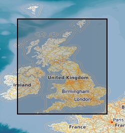
Onshore borehole collection
The British Geological Survey onshore borehole collection database of core and sample types and depths contains records of over 15 000 onshore boreholes drilled in the UK by BGS, commercial and public bodies. Material types include continuous drillcore, core samples, individual hand specimens, bulk samples, unwashed cuttings, washed and dried cuttings, plugs, powders and bulk samples. The physical collection and database was developed as part of the British Geological Survey's responsibility to establish and maintain a national borehole collection. Details of the collection are held in the Borehole Materials Database, and may be accessed via the BGS website. The collection was initiated in 1968, and the database is updated daily by the addition of new data and by modification of existing data. Most material is stored at the facility in BGS Keyworth. Some material is held at BGS Edinburgh. The majority of borehole cores and samples are available for study and sub-sampling by bona fide academics and commercial companies. Commercial companies are charged for access; academics will need to complete an academic waiver form. Some boreholes, especially recent hydrocarbon wells, are confidential, and depths and sample details may not be given. If you require further information about these boreholes, contact kwcorestore@bgs.ac.uk for details of the owner. In a few cases, the precise map references are also confidential.
Simple
- Date (Creation)
- 1968
- Citation identifier
- http://data.bgs.ac.uk/id/dataHolding/13480339
- Point of contact
-
Organisation name Individual name Electronic mail address Role British Geological Survey
Enquiries
Distributor British Geological Survey
Enquiries
Point of contact
- Maintenance and update frequency
- Daily
-
GEMET - INSPIRE themes, version 1.0
-
BGS Thesaurus of Geosciences
-
-
Sampling
-
Boreholes
-
Drill core
-
Rock samples
-
Bulk sampling
-
General geology
-
Drill cuttings
-
- dataCentre
- Keywords
-
-
NERC_DDC
-
- Access constraints
- Other restrictions
- Other constraints
- no limitations
- Other constraints
- restricted
- Other constraints
- The dataset is made freely available for access, e.g. via the Internet. Either no third party data / information is contained in the dataset or BGS has secured written permission from the owner(s) of any third party data / information contained in the dataset to make the dataset freely accessible.
- Use constraints
- Other restrictions
- Other constraints
-
The copyright of materials derived from the British Geological Survey's work is vested in the Natural Environment Research Council [NERC]. No part of this work may be reproduced or transmitted in any form or by any means, or stored in a retrieval system of any nature, without the prior permission of the copyright holder, via the BGS Intellectual Property Rights Manager. Use by customers of information provided by the BGS, is at the customer's own risk. In view of the disparate sources of information at BGS's disposal, including such material donated to BGS, that BGS accepts in good faith as being accurate, the Natural Environment Research Council (NERC) gives no warranty, expressed or implied, as to the quality or accuracy of the information supplied, or to the information's suitability for any use. NERC/BGS accepts no liability whatever in respect of loss, damage, injury or other occurence however caused.
- Other constraints
-
Either: (i) the dataset is made freely available, e.g. via the Internet, for a restricted category of use (e.g. educational use only); or (ii) the dataset has not been formally approved by BGS for access and use by external clients under licence, but its use may be permitted under alternative formal arrangements; or (iii) the dataset contains 3rd party data or information obtained by BGS under terms and conditions that must be consulted in order to determine the permitted usage of the dataset. Refer to the BGS staff member responsible for the creation of the dataset if further advice is required. He / she should be familiar with the composition of the dataset, particularly with regard to 3rd party IPR contained in it, and any resultant use restrictions. This staff member should revert to the IPR Section ( ipr@bgs.ac.uk) for advice, should the position not be clear.
- Spatial representation type
- Vector
- Language
- English
- Topic category
-
- Geoscientific information
- Geographic identifier
-
GB
ISO 3166_1 alpha-3 2009 revision
- Geographic identifier
-
IOM
ISO 3166_1 alpha-3 2009 revision
- Geographic identifier
-
ISLE OF MAN [id=178000]
British Geological Survey Gazetteer: Geographical hierarchy from Geosaurus 1979 creation
- Geographic identifier
-
UK [id=139300]
British Geological Survey Gazetteer: Geographical hierarchy from Geosaurus 1979 creation
- Geographic identifier
-
UKM
ISO 3166_2 2009 revision
))
- Begin date
- 1968
- Unique resource identifier
- OSGB 1936 / British National Grid (EPSG::27700)
- Unique resource identifier
- WGS 84 (EPSG::4326)
- Distribution format
-
Name Version
- Distributor contact
-
Organisation name Individual name Electronic mail address Role British Geological Survey
Enquiries
Distributor
- OnLine resource
-
Protocol Linkage Name WWW:LINK-1.0-http--link
https://webapps.bgs.ac.uk/data/bmd/home.html Onshore borehole material database
- OnLine resource
-
Protocol Linkage Name WWW:LINK-1.0-http--link
https://www.bgs.ac.uk/technologies/databases/borehole-materials-database/ Borehole materials database
- Hierarchy level
- Dataset
- Other
-
dataset
Conformance result
- Title
-
INSPIRE Implementing rules laying down technical arrangements for the interoperability and harmonisation of Geology
- Date (Publication)
- 2011
- Explanation
-
See the referenced specification
- Pass
- No
Conformance result
- Title
-
Commission Regulation (EU) No 1089/2010 of 23 November 2010 implementing Directive 2007/2/EC of the European Parliament and of the Council as regards interoperability of spatial data sets and services
- Date (Publication)
- 2010-12-08
- Explanation
-
See http://eur-lex.europa.eu/LexUriServ/LexUriServ.do?uri=OJ:L:2010:323:0011:0102:EN:PDF
- Pass
- No
- Statement
-
Materials are selected for addition to the collection according to the NGDC (National Geoscience Data Centre) accessions policy. Drillcore is divided into metre lengths and placed in cardboard boxes. Cuttings and bulk samples are similarly placed in appropriate metre length boxes. The samples are then added to the Borehole Materials Database, barcode labels stuck to the boxes, and the boxes placed on pallets for adding to the main store. The information has been accumulated over many years and contains some inconsistencies and imperfections. Feedback on these is welcomed and should be directed to Dr M P A Howe.
Metadata
- File identifier
- 9df8df51-63a6-37a8-e044-0003ba9b0d98 XML
- Metadata language
- English
- Hierarchy level
- Dataset
- Date stamp
- 2026-07-26
- Metadata standard name
- UK GEMINI
- Metadata standard version
-
2.3
- Metadata author
-
Organisation name Individual name Electronic mail address Role British Geological Survey
Point of contact
- Dataset URI
)))
