BGS Data Catalogue
Airborne Magnetic Survey Records For United Kingdom And Adjacent Areas.
Analogue aeromagnetic surveys of Great Britain for the Geological Survey (GSGB), subsequently digitised. Commercial Analogue survey of North Sea by Aerosurveys Inc, subsequently digitised by BGS. Commercial digital (+ one analogue) surveys off NW/N/NE of Britain by Huntings Geology and Geophysics and ESL, purchased outright by BGS. Local surveys, digital and analogue aeromagnetic (+ other methods) surveys for BGS and commercial companies. Data acquired over many years by different companies. Surveys vary from High Resolution helicopter covering a few square kms to regional surveys covering 1000s of square kms. Some data recorded analogue, subsequently digitised, other data full digital capture with GPS navigation. Approximately 75% of the bounding rectangle covered. Flight line separation varies between 2km and 0.4km, line spacing typically 2km over UK but 0.4km over Devon/Cornwall. Flight line separation for Aerosurveys/Huntings surveys vary between 6.4 to 15 km. Detailed surveys at various resolutions. Along line spacing varies, analogue data: digitised from 1:63 360 and 1:253 440 scale map sheets and digital surveys: Decca navigation, 305m asl (above sea level). Local helicopter surveys, analogue and digital recordings, various survey heights. HiRES survey, full digital data capture at 0.1 sec intervals, GPS navigation, 90m survey height.
INSPIRE
Identification
- File identifier
- 9df8df51-639e-37a8-e044-0003ba9b0d98 XML
- Resource type
- dataset
Online resource
Resource identifier
- Metadata Language
- English (en)
Encoding
- Format
-
OTHER, UNKNOWN OR OBSCURE - Record listings, grids
- Format
-
Digital - Digital records
- Format
-
Hardcopy - The paper chart records are old and fragile and do not photocopy well.
- Format
-
Hardcopy - Contour maps
Projection
Classification of data and services
- Topic category
-
- Geoscientific information
Classification of data and services
Coupled resource
Coupled resource
Classification of data and services
Coupled resource
Coupled resource
Keywords
- GEMET - INSPIRE themes, version 1.0
- BGS Thesaurus of Geosciences
-
-
Aerial magnetic surveys
-
data.gov.uk (non-INSPIRE)
-
Geology
-
Aerial geophysical surveys
-
Geophysical surveys
-
Geophysics
-
Magnetic surveys
-
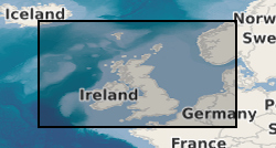
Geographic coverage
))
Temporal reference
Temporal extent
Temporal extent
- Dataset Reference Date ()
- 1955
Quality and validity
- Lineage
-
Flight line records, worksheets, contoured maps, aerial photographs provided by contractors at completion of each BGS survey. Other surveys acquired from companies on tape.
- Denominator
- 63360
Conformity
Conformity
Conformity
Conformity
Conformity
Conformity
- Explanation
-
See the referenced specification
Restrictions on access and use
- Access constraints
- Charges apply.
- Access constraints
-
The copyright of materials derived from the British Geological Survey's work is vested in the Natural Environment Research Council [NERC]. No part of this work may be reproduced or transmitted in any form or by any means, or stored in a retrieval system of any nature, without the prior permission of the copyright holder, via the BGS Intellectual Property Rights Manager. Use by customers of information provided by the BGS, is at the customer's own risk. In view of the disparate sources of information at BGS's disposal, including such material donated to BGS, that BGS accepts in good faith as being accurate, the Natural Environment Research Council (NERC) gives no warranty, expressed or implied, as to the quality or accuracy of the information supplied, or to the information's suitability for any use. NERC/BGS accepts no liability whatever in respect of loss, damage, injury or other occurence however caused.
- Access constraints
-
Either: (i) the dataset is made freely available, e.g. via the Internet, for a restricted category of use (e.g. educational use only); or (ii) the dataset has not been formally approved by BGS for access and use by external clients under licence, but its use may be permitted under alternative formal arrangements; or (iii) the dataset contains 3rd party data or information obtained by BGS under terms and conditions that must be consulted in order to determine the permitted usage of the dataset. Refer to the BGS staff member responsible for the creation of the dataset if further advice is required. He / she should be familiar with the composition of the dataset, particularly with regard to 3rd party IPR contained in it, and any resultant use restrictions. This staff member should revert to the IPR Section (ipr@bgs.ac.uk) for advice, should the position not be clear. ipr@bgs.ac Either: (i) the dataset is made freely available, e.g. via the Internet, for a restricted category of use (e.g. educational use only); or (ii) the dataset has not been formally approved by BGS for access and use by external clients under licence, but its use may be permitted under alternative formal arrangements; or (iii) the dataset contains 3rd party data or information obtained by BGS under terms and conditions that must be consulted in order to determine the permitted usage of the dataset. Refer to the BGS staff member responsible for the creation of the dataset if further advice is required. He / she should be familiar with the composition of the dataset, particularly with regard to 3rd party IPR contained in it, and any resultant use restrictions. This staff member should revert to the IPR Section (ipr@bgs.ac.uk) for advice, should the position not be clear.
Responsible organization (s)
Contact for the resource
- Organisation name
-
British Geological Survey
-
enquiries@bgs.ac enquiries@bgs.ac.uk
- Organisation name
-
British Geological Survey
-
enquiries@bgs.ac enquiries@bgs.ac.uk
- Organisation name
-
British Geological Survey
-
enquiries@bgs.ac enquiries@bgs.ac.uk
- Organisation name
-
British Geological Survey
-
enquiries@bgs.ac enquiries@bgs.ac.uk
- Organisation name
-
British Geological Survey
-
enquiries@bgs.ac enquiries@bgs.ac.uk
Metadata information
Contact for the metadata
- Organisation name
-
British Geological Survey
-
enquiries@bgs.ac enquiries@bgs.ac.uk
- Metadata Date
- 2024-04-19
- Metadata Language
- English (en)