BGS Data Catalogue
Index To The BGS Collection Of Large Scale Mine Plans & Land Survey Plans.
Index to the BGS collection of large scale or large format plans of all types including those relating to mining activity, including abandonment plans and site investigations. The Plans Database Index was set up c.1983 as a digital index to the collections of Land Survey Plans and Plans of Abandoned Mines. There are entries for all registered plans but not all the index fields are complete, as this depends on the nature of the original plan. The index covers the whole of Great Britain.
- Identification
- Distribution
- Quality
- Spatial rep.
- Ref. system
- Content
- Portrayal
- Metadata
- Md. constraints
- Md. maintenance
- Schema info
Identification
Data identification
Citation
- Dataset Reference Date ()
- 1988
British Geological Survey
-Enquiries
The Lyell Centre, Research Avenue South
,EDINBURGH
,LOTHIAN
,EH14 4AP
,United Kingdom
0115 936 3276
British Geological Survey
-Enquiries
The Lyell Centre, Research Avenue South
,EDINBURGH
,LOTHIAN
,EH14 4AP
,United Kingdom
0115 936 3276
British Geological Survey
-Enquiries
Environmental Science Centre, Nicker Hill, Keyworth
,NOTTINGHAM
,NOTTINGHAMSHIRE
,NG12 5GG
,United Kingdom
0115 936 3276
British Geological Survey
-Enquiries
Environmental Science Centre, Nicker Hill, Keyworth
,NOTTINGHAM
,NOTTINGHAMSHIRE
,NG12 5GG
,United Kingdom
0115 936 3276
British Geological Survey
-Enquiries
Environmental Science Centre, Nicker Hill, Keyworth
,NOTTINGHAM
,NOTTINGHAMSHIRE
,NG12 5GG
,United Kingdom
0115 936 3276
- Maintenance and update frequency
- daily
- GEMET - INSPIRE themes, version 1.0
- BGS Thesaurus of Geosciences
-
-
Ironstone
-
Maps
-
Quarrying
-
Site investigations
-
Metalliferous minerals
-
Mining
-
Mine shafts
-
UK Location (INSPIRE)
-
Coal
-
Geology
-
Mine planning
-
Minerals
-
- Keywords ()
- Keywords
-
-
NERC_DDC
-
Legal constraints
- Limitations on Public Access
- otherRestrictions
Legal constraints
- Use constraints
- otherRestrictions
- Other constraints
-
The copyright of materials derived from the British Geological Survey's work is vested in the Natural Environment Research Council [NERC]. No part of this work may be reproduced or transmitted in any form or by any means, or stored in a retrieval system of any nature, without the prior permission of the copyright holder, via the BGS Intellectual Property Rights Manager. Use by customers of information provided by the BGS, is at the customer's own risk. In view of the disparate sources of information at BGS's disposal, including such material donated to BGS, that BGS accepts in good faith as being accurate, the Natural Environment Research Council (NERC) gives no warranty, expressed or implied, as to the quality or accuracy of the information supplied, or to the information's suitability for any use. NERC/BGS accepts no liability whatever in respect of loss, damage, injury or other occurence however caused.
- Other constraints
-
Either: (i) the dataset is made freely available, e.g. via the Internet, for a restricted category of use (e.g. educational use only); or (ii) the dataset has not been formally approved by BGS for access and use by external clients under licence, but its use may be permitted under alternative formal arrangements; or (iii) the dataset contains 3rd party data or information obtained by BGS under terms and conditions that must be consulted in order to determine the permitted usage of the dataset. Refer to the BGS staff member responsible for the creation of the dataset if further advice is required. He / she should be familiar with the composition of the dataset, particularly with regard to 3rd party IPR contained in it, and any resultant use restrictions. This staff member should revert to the IPR Section (ipr@bgs.ac.uk) for advice, should the position not be clear. ipr@bgs.ac Either: (i) the dataset is made freely available, e.g. via the Internet, for a restricted category of use (e.g. educational use only); or (ii) the dataset has not been formally approved by BGS for access and use by external clients under licence, but its use may be permitted under alternative formal arrangements; or (iii) the dataset contains 3rd party data or information obtained by BGS under terms and conditions that must be consulted in order to determine the permitted usage of the dataset. Refer to the BGS staff member responsible for the creation of the dataset if further advice is required. He / she should be familiar with the composition of the dataset, particularly with regard to 3rd party IPR contained in it, and any resultant use restrictions. This staff member should revert to the IPR Section (ipr@bgs.ac.uk) for advice, should the position not be clear.
- Spatial representation type
- grid
- Denominator
- 10000
- Metadata Language
- English (en)
- Topic category
-
- Geoscientific information
Extent
- Extent
-
GBN
Citation
- Dataset Reference Date ()
- 2009
- Extent
-
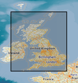
GREAT BRITAIN [id=139600]
Citation
- Dataset Reference Date ()
- 1979
))
- Begin date
- 1620
- Additional information
-
PUBLICATION: THE BRITISH GEOLOGICAL SURVEY MINE PLANS DATABASE AND ITS COMPUTER APPLICATIONS. BRITISH GEOLOGICAL SURVEY TECHNICAL REPORT WO/90/3. http://www.bgs.ac.uk/bgs/w3/cust/publications/publ.html (links to listings of all BGS publictions). Table name: BGS.ALL_PLANS.
Distribution
Distribution
- Data format
-
-
DIGITAL
()
-
British Geological Survey
-Enquiries
The Lyell Centre, Research Avenue South
,EDINBURGH
,LOTHIAN
,EH14 4AP
,United Kingdom
0115 936 3276
British Geological Survey
-Enquiries
Environmental Science Centre, Nicker Hill, Keyworth
,NOTTINGHAM
,NOTTINGHAMSHIRE
,NG12 5GG
,United Kingdom
0115 936 3276
- Resource Locator
-
Mining Plans Portal
The Mining Plans Portal is a partnership of public sector bodies who have come together to make information about the extent of historic underground mining of non-coal minerals in Britain more accessible.
- Resource Locator
- NGDC Homepage
Quality
Data quality
- Quality Scope
- dataset
Report
Citation
- Dataset Reference Date ()
- 2011
- Explanation
-
See the referenced specification
- Degree
Report
Citation
- Dataset Reference Date ()
- 2010-12-08
- Explanation
-
See http://eur-lex.europa.eu/LexUriServ/LexUriServ.do?uri=OJ:L:2010:323:0011:0102:EN:PDF
- Degree
- Statement
-
Set up in 1988 to index all large scale plans held in BGS Keyworth
Ref. system
Metadata
Metadata
- File identifier
- 9df8df51-6383-37a8-e044-0003ba9b0d98 XML
- Metadata Language
- English (en)
- Resource type
- dataset
- Metadata Date
- 2024-04-25
- Metadata standard name
- UK GEMINI
- Metadata standard version
-
2.3
British Geological Survey
The Lyell Centre, Research Avenue South
,EDINBURGH
,LOTHIAN
,EH14 4AP
,United Kingdom
- Dataset URI