BGS Data Catalogue
Borehole Records Collection.
Records of all onshore (or near shore) boreholes, trial pits, shafts and wells held in the BGS archives in either paper, microfilm or digital format. The records range from simple single page lithological logs through to hydrocarbon completion reports. Spatial coverage will vary considerably depending on drilling activity, collecting activity and donations. The majority of new data is from site investigation reports with concentrations in urban areas and along transport routes. Current collection over 1million records covering the whole of Great Britain with 50,000 new records added per annum. Some records date back to 1600 but the majority date from 1900 onwards. Copies of records are available in hard copy or digital formats subject to confidentiality.
INSPIRE
Identification
- File identifier
- 9df8df51-6372-37a8-e044-0003ba9b0d98 XML
- Resource type
- dataset
Online resource
- Protocol
-
HTTP
Resource identifier
- Metadata Language
- English (en)
Encoding
- Format
-
IMAGE FILE
- Format
-
DIGITAL
- Format
-
PAPER - Copies will be produced by the most appropriate methods available
Projection
Classification of data and services
- Topic category
-
- Geoscientific information
Classification of data and services
Coupled resource
Coupled resource
Classification of data and services
Coupled resource
Coupled resource
Keywords
- GEMET - INSPIRE themes, version 1.0
- BGS Thesaurus of Geosciences
-
-
Geology
-
data.gov.uk (non-INSPIRE)
-
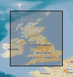
Geographic coverage
))
Temporal reference
Temporal extent
Temporal extent
- Dataset Reference Date ()
- 1876
Quality and validity
- Lineage
-
All onshore (or near shore) boreholes, trial pits, shafts and wells held in the BGS archives in either paper, microfilm or digital format. Received from a wide variety of external sources
- Denominator
- 10000
Conformity
Conformity
Conformity
Conformity
Conformity
Conformity
- Explanation
-
See the referenced specification
Restrictions on access and use
- Access constraints
-
The copyright of materials derived from the British Geological Survey's work is vested in the Natural Environment Research Council [NERC]. No part of this work may be reproduced or transmitted in any form or by any means, or stored in a retrieval system of any nature, without the prior permission of the copyright holder, via the BGS Intellectual Property Rights Manager. Use by customers of information provided by the BGS, is at the customer's own risk. In view of the disparate sources of information at BGS's disposal, including such material donated to BGS, that BGS accepts in good faith as being accurate, the Natural Environment Research Council (NERC) gives no warranty, expressed or implied, as to the quality or accuracy of the information supplied, or to the information's suitability for any use. NERC/BGS accepts no liability whatever in respect of loss, damage, injury or other occurence however caused.
- Access constraints
-
Either: (i) the dataset is made freely available, e.g. via the Internet, for a restricted category of use (e.g. educational use only); or (ii) the dataset has not been formally approved by BGS for access and use by external clients under licence, but its use may be permitted under alternative formal arrangements; or (iii) the dataset contains 3rd party data or information obtained by BGS under terms and conditions that must be consulted in order to determine the permitted usage of the dataset. Refer to the BGS staff member responsible for the creation of the dataset if further advice is required. He / she should be familiar with the composition of the dataset, particularly with regard to 3rd party IPR contained in it, and any resultant use restrictions. This staff member should revert to the IPR Section (ipr@bgs.ac.uk) for advice, should the position not be clear. ipr@bgs.ac Either: (i) the dataset is made freely available, e.g. via the Internet, for a restricted category of use (e.g. educational use only); or (ii) the dataset has not been formally approved by BGS for access and use by external clients under licence, but its use may be permitted under alternative formal arrangements; or (iii) the dataset contains 3rd party data or information obtained by BGS under terms and conditions that must be consulted in order to determine the permitted usage of the dataset. Refer to the BGS staff member responsible for the creation of the dataset if further advice is required. He / she should be familiar with the composition of the dataset, particularly with regard to 3rd party IPR contained in it, and any resultant use restrictions. This staff member should revert to the IPR Section (ipr@bgs.ac.uk) for advice, should the position not be clear.
Responsible organization (s)
Contact for the resource
- Organisation name
-
British Geological Survey
-
enquiries@bgs.ac enquiries@bgs.ac.uk
- Organisation name
-
British Geological Survey
-
enquiries@bgs.ac enquiries@bgs.ac.uk
Responsible organization (s)
Contact for the resource
- Organisation name
-
British Geological Survey
-
enquiries@bgs.ac enquiries@bgs.ac.uk
- Organisation name
-
British Geological Survey
-
enquiries@bgs.ac enquiries@bgs.ac.uk
Metadata information
Contact for the metadata
- Organisation name
-
British Geological Survey
-
enquiries@bgs.ac enquiries@bgs.ac.uk
- Metadata Date
- 2024-04-18
- Metadata Language
- English (en)