 BGS Metadata Catalogue
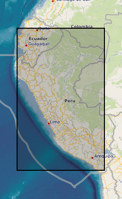
Northern Peru Regional Geochemical Exploration Survey.
During the period 1967 to 1971 a team of geoscientists carried out a programme of regional geological mapping in parts of Peru and a low-density regional geochemical exploration survey of the Western Cordillera of northern Peru. The work was funded by the UK Overseas Development Administration (ODA - now the Department for International Development, DfID) in collaboration with the Servicio de Geologia y Mineria (SGM), Lima, Peru (now INGEMMET). The geochemical exploration project was managed by a BGS geologist/ geochemist and supported by counterpart staff from the SGM. Locational and analytical data, maps and interpretative unpublished reports were deposited at the SGM in Lima in 1971. The geochemical data are a long term asset and continued interest in the results, particularly in recent years, has required that the data be made more readily available in a digital format. Some 1345 sites were sampled and stream sediments were analysed for Cu, Pb, Zn, (Co), Ag, Mo, (As), and (V). Raw data can be obtained from INGEMMET, AV Canada, 1470, San Borja, Lima, PERU. The sample location data have been digitised from a sample site map, as the original field sample cards and the port-a-punch cards were not retrievable in 1998/99. The sample site map was a paper copy - so, although the UTM co-ordinates for locations are given to the nearest metre, the true location of the original sample sites may vary by as much as 500 m, or in some cases even more. GENP 1967-71 was a low-density regional exploration survey based on the collection of some 1260 samples at key sites within the 25,000 km2 project area - a density of approximately 1 sample per 20 km2. Data cleaned for absent and below detection limit values.
Simple
- Date (Creation)
- 1967
- Citation identifier
- http://data.bgs.ac.uk/id/dataHolding/13480225
- Point of contact
-
Organisation name Individual name Electronic mail address Role British Geological Survey
Enquiries
Distributor British Geological Survey
Enquiries
Originator British Geological Survey
Enquiries
Point of contact British Geological Survey
Enquiries
Custodian
- Maintenance and update frequency
- Not planned
-
GEMET - INSPIRE themes, version 1.0
-
BGS Thesaurus of Geosciences
-
-
Geochemistry
-
Exploration
-
Geochemical exploration
-
Geochemical mapping
-
Geology
-
- dataCentre
- Keywords
-
-
NERC_DDC
-
- Access constraints
- Other restrictions
- Other constraints
- Subject to a licence fee.Subject to usual BGS terms and conditions.
- Use constraints
- Other restrictions
- Other constraints
-
The copyright of materials derived from the British Geological Survey's work is vested in the Natural Environment Research Council [NERC]. No part of this work may be reproduced or transmitted in any form or by any means, or stored in a retrieval system of any nature, without the prior permission of the copyright holder, via the BGS Intellectual Property Rights Manager. Use by customers of information provided by the BGS, is at the customer's own risk. In view of the disparate sources of information at BGS's disposal, including such material donated to BGS, that BGS accepts in good faith as being accurate, the Natural Environment Research Council (NERC) gives no warranty, expressed or implied, as to the quality or accuracy of the information supplied, or to the information's suitability for any use. NERC/BGS accepts no liability whatever in respect of loss, damage, injury or other occurence however caused.
- Other constraints
-
Either: (i) the dataset is made freely available, e.g. via the Internet, for a restricted category of use (e.g. educational use only); or (ii) the dataset has not been formally approved by BGS for access and use by external clients under licence, but its use may be permitted under alternative formal arrangements; or (iii) the dataset contains 3rd party data or information obtained by BGS under terms and conditions that must be consulted in order to determine the permitted usage of the dataset. Refer to the BGS staff member responsible for the creation of the dataset if further advice is required. He / she should be familiar with the composition of the dataset, particularly with regard to 3rd party IPR contained in it, and any resultant use restrictions. This staff member should revert to the IPR Section ( ipr@bgs.ac.uk) for advice, should the position not be clear.
- Spatial representation type
- Grid
- Denominator
- 400000
- Language
- English
- Topic category
-
- Geoscientific information
- Geographic identifier
-
PE
ISO 3166_1 alpha-2 2009 revision
- Geographic identifier
-
PER
ISO 3166_1 alpha-3 2009 revision
- Geographic identifier
-
PERU [id=864000]
British Geological Survey Gazetteer: Geographical hierarchy from Geosaurus 1979 creation
))
- Begin date
- 1967
- End date
- 1971
- Supplemental Information
-
The project was completed in 1971. The 1967-71 GENP project essentially pre-dated the era of data processing by computer. Locational and analytical data have now been digitised and stored as a CD-ROM database BGS (1999). Northern Peru Regional Geochemical Exploration Survey CD-ROM: Version 1.0. BGS International Regional Geochemistry CD-ROM Series, No. 4 Peru. British Geological Survey, Keyworth, Nottingham, UK. Baldock, J W. 1971. Geochemical Exploration of Northern Peru (GENP), 1967-71.
- Unique resource identifier
- WGS 84 / UTM zone 17N (EPSG::32617)
- Distribution format
-
Name Version Data in various formats, MS Excel, MS Word and image files available on a CD-ROM
witheld
- Distributor contact
-
Organisation name Individual name Electronic mail address Role British Geological Survey
Enquiries
Distributor
- OnLine resource
-
Protocol Linkage Name WWW:LINK-1.0-http--link
https://www.bgs.ac.uk/geology-projects/applied-geochemistry/international-geochemistry-cd-rom/peru-regional-geochemical-survey/ Northern Peru regional geochemical exploration survey CD-ROM version 2.0: September 2007
- Hierarchy level
- Dataset
Conformance result
- Title
-
INSPIRE Implementing rules laying down technical arrangements for the interoperability and harmonisation of Geology
- Date (Publication)
- 2011
- Explanation
-
See the referenced specification
- Pass
- No
Conformance result
- Title
-
Commission Regulation (EU) No 1089/2010 of 23 November 2010 implementing Directive 2007/2/EC of the European Parliament and of the Council as regards interoperability of spatial data sets and services
- Date (Publication)
- 2010-12-08
- Explanation
-
See http://eur-lex.europa.eu/LexUriServ/LexUriServ.do?uri=OJ:L:2010:323:0011:0102:EN:PDF
- Pass
- No
- Statement
-
The analytical data reported in this CD-ROM database were produced by the IGS laboratories, London (now the BGS analytical laboratories at Keyworth, Nottingham) in the period between May 1968 and January 1971.
Metadata
- File identifier
- 9df8df51-6352-37a8-e044-0003ba9b0d98 XML
- Metadata language
- English
- Hierarchy level
- Dataset
- Date stamp
- 2026-07-10
- Metadata standard name
- UK GEMINI
- Metadata standard version
-
2.3
- Metadata author
-
Organisation name Individual name Electronic mail address Role British Geological Survey
Point of contact
- Dataset URI
)))
