BGS Metadata Catalogue
Public Health England (PHE) - British Geological Survey (BGS) Joint Radon Dataset for England and Wales
The joint PHE-BGS digital radon potential dataset provides the current definitive map of radon Affected Areas in England and Wales. It will also allow an estimate to be made of the probability that an individual property in England and Wales is at or above the Action Level for radon. This information also provides an answer to one of the standard legal enquiries on house purchase in England and Wales, known as CON29 standard Enquiry of Local Authority; 3.13 Radon Gas: Location of the Property in a Radon Affected Area. The radon potential dataset will also provide information on the level of protection required for new buildings under as described in the latest Building Research Establishment guidance on radon protective measures for new buildings (BR 211 2007). This radon potential hazard information for England and Wales is based on Public Health England (PHE) indoor radon measurements and BGS digital geology information. This product was derived from DigMap50 V3.14 and PHE in-house radon measurement data. The indoor radon data is used with the agreement of the PHE. Confidentiality of measurement locations is maintained through data management practices. Access to the data is restricted. This dataset has been superseded by PHE-BGS Joint Radon Potential Dataset For Great Britain. Radon is a natural radioactive gas, which enters buildings from the ground. Exposure to high concentrations increases the risk of lung cancer. The Health Protection Agency recommends that radon levels should be reduced in homes where the annual average is at or above 200 becquerels per cubic metre (200 Bq m-3). This is termed the Action Level. The Health Protection Agency defines radon Affected Areas as those with 1% chance or more of a house having a radon concentration at or above the Action Level of 200 Bq m-3. The dataset was originally developed by BGS with the Health Protection Agency (HPA) which is now part of Public Health England.
INSPIRE
Identification
- File identifier
- 9df8df51-634a-37a8-e044-0003ba9b0d98 XML
- Hierarchy level
- Dataset
Online resource
Resource identifier
- Metadata language
- English
Encoding
- Format
-
Text. Information for single properties with postcodes available under www.UKradon.com. To access the radon potential information for a site area, the Central Enquiries team at the British Geological Survey should be contacted.
Projection
Classification of data and services
- Topic category
-
- Geoscientific information
Keywords
-
GEMET - INSPIRE themes, version 1.0
-
BGS Thesaurus of Geosciences
-
-
Geochemistry
-
Geology
-
UK Location (INSPIRE)
-
Natural hazards
-
Radon detection
-
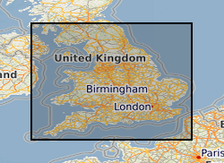
Geographic coverage
))
Temporal reference
Temporal extent
- Begin
- 2011
- End
- 2011
Temporal extent
- Date (Creation)
- 1998
Quality and validity
- Lineage
-
Derivation of radon potential data started as part of two DETR research projects, continued as part of the BGS GeoHazarD programme and is currently under the Hazard Products Team of the Environmental Modelling science directorate.
- Denominator
- 50000
Conformity
Conformity
Conformity
Restrictions on access and use
- Access constraints
-
The copyright of materials derived from the British Geological Survey's work is vested in the Natural Environment Research Council [NERC]. No part of this work may be reproduced or transmitted in any form or by any means, or stored in a retrieval system of any nature, without the prior permission of the copyright holder, via the BGS Intellectual Property Rights Manager. Use by customers of information provided by the BGS, is at the customer's own risk. In view of the disparate sources of information at BGS's disposal, including such material donated to BGS, that BGS accepts in good faith as being accurate, the Natural Environment Research Council (NERC) gives no warranty, expressed or implied, as to the quality or accuracy of the information supplied, or to the information's suitability for any use. NERC/BGS accepts no liability whatever in respect of loss, damage, injury or other occurence however caused.
- Access constraints
-
Either: (i) the dataset is made freely available, e.g. via the Internet, for a restricted category of use (e.g. educational use only); or (ii) the dataset has not been formally approved by BGS for access and use by external clients under licence, but its use may be permitted under alternative formal arrangements; or (iii) the dataset contains 3rd party data or information obtained by BGS under terms and conditions that must be consulted in order to determine the permitted usage of the dataset. Refer to the BGS staff member responsible for the creation of the dataset if further advice is required. He / she should be familiar with the composition of the dataset, particularly with regard to 3rd party IPR contained in it, and any resultant use restrictions. This staff member should revert to the IPR Section ( ipr@bgs.ac.uk ) for advice, should the position not be clear.
Responsible organization (s)
Contact for the resource
- Organisation name
-
British Geological Survey
- Organisation name
-
British Geological Survey
- Organisation name
-
British Geological Survey
- Organisation name
-
British Geological Survey
- Organisation name
-
British Geological Survey
Metadata information
Contact for the metadata
- Organisation name
-
British Geological Survey
- Date stamp
- 2024-05-06
- Metadata language
- English