 BGS Metadata Catalogue
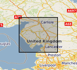
Plans of abandoned mines (other than coal) Cumbria
The collection comprises photographic half plate black & white negative and 35mm colour transparency copies of plans of mine workings for haematite, gypsum, limestone, baryte and metalliferous minerals for Cumbria dating from 1872 onwards. The plans were originally deposited in compliance with the Coal and Metalliferous Mines Regulation acts. The original plans are currently held by Cumbria County Record Office on behalf of the Health & Safety Executive (HSE) and total about 1240 plans. No digital index is available but a paper catalogue is provided by the Health & Safety Executive. As the collection relates to plans of mines abandoned after the 1872 Act, the holdings are fairly complete after this date. Note however, that the Metalliferous Mines Act originally applied only to mines employing more than 12 men, (eg. some limestone mines). Coal Authority may hold non-coal mine plans not covered by Mine Abandonment Plan collection.
Simple
- Date (Creation)
- 1872
- Citation identifier
- http://data.bgs.ac.uk/id/dataHolding/13480131
- Point of contact
-
Organisation name Individual name Electronic mail address Role British Geological Survey
Enquiries
Distributor British Geological Survey
Enquiries
Originator British Geological Survey
Enquiries
Point of contact British Geological Survey
Enquiries
Distributor British Geological Survey
Enquiries
Custodian
- Maintenance and update frequency
- Irregular
-
GEMET - INSPIRE themes, version 1.0
-
BGS Thesaurus of Geosciences
-
-
Geology
-
Mine planning
-
Barite
-
Gypsum
-
Limestone
-
Metalliferous minerals
-
Quarrying
-
Hematite
-
Mining
-
- dataCentre
- Keywords
-
-
NERC_DDC
-
- Access constraints
- Other restrictions
- Use constraints
- Other restrictions
- Other constraints
-
The copyright of materials derived from the British Geological Survey's work is vested in the Natural Environment Research Council [NERC]. No part of this work may be reproduced or transmitted in any form or by any means, or stored in a retrieval system of any nature, without the prior permission of the copyright holder, via the BGS Intellectual Property Rights Manager. Use by customers of information provided by the BGS, is at the customer's own risk. In view of the disparate sources of information at BGS's disposal, including such material donated to BGS, that BGS accepts in good faith as being accurate, the Natural Environment Research Council (NERC) gives no warranty, expressed or implied, as to the quality or accuracy of the information supplied, or to the information's suitability for any use. NERC/BGS accepts no liability whatever in respect of loss, damage, injury or other occurence however caused.
- Other constraints
-
Either: (i) the dataset is made freely available, e.g. via the Internet, for a restricted category of use (e.g. educational use only); or (ii) the dataset has not been formally approved by BGS for access and use by external clients under licence, but its use may be permitted under alternative formal arrangements; or (iii) the dataset contains 3rd party data or information obtained by BGS under terms and conditions that must be consulted in order to determine the permitted usage of the dataset. Refer to the BGS staff member responsible for the creation of the dataset if further advice is required. He / she should be familiar with the composition of the dataset, particularly with regard to 3rd party IPR contained in it, and any resultant use restrictions. This staff member should revert to the IPR Section ( ipr@bgs.ac.uk) for advice, should the position not be clear.
- Spatial representation type
- Text, table
- Denominator
- 10000
- Language
- English
- Topic category
-
- Geoscientific information
- Geographic identifier
-
CUMBRIA [id=151900]
British Geological Survey Gazetteer: Geographical hierarchy from Geosaurus 1979 creation
))
- Begin date
- 1872
- Supplemental Information
-
Collection started c.1872. HEALTH & SAFETY EXECUTIVE: Catalogue of Plans of Abandoned Mines for Cumbria. (unpub.)
- Unique resource identifier
- OSGB 1936 / British National Grid (EPSG::27700)
- Distribution format
-
Name Version PLANS - Mine Plans.
witheld
- Distributor contact
-
Organisation name Individual name Electronic mail address Role British Geological Survey
Enquiries
Distributor
- Distributor contact
-
Organisation name Individual name Electronic mail address Role British Geological Survey
Enquiries
Distributor
- OnLine resource
-
Protocol Linkage Name WWW:LINK-1.0-http--link
https://www.bgs.ac.uk/ BGS Homepage
- Hierarchy level
- Dataset
- Other
-
dataset
Conformance result
- Title
-
INSPIRE Implementing rules laying down technical arrangements for the interoperability and harmonisation of Geology
- Date (Publication)
- 2011
- Explanation
-
See the referenced specification
- Pass
- No
Conformance result
- Title
-
Commission Regulation (EU) No 1089/2010 of 23 November 2010 implementing Directive 2007/2/EC of the European Parliament and of the Council as regards interoperability of spatial data sets and services
- Date (Publication)
- 2010-12-08
- Explanation
-
See http://eur-lex.europa.eu/LexUriServ/LexUriServ.do?uri=OJ:L:2010:323:0011:0102:EN:PDF
- Pass
- No
- Statement
-
The plans were originally held by Mine Record Office, Home Office, London, subsequently becoming the Health & Safety Executive. (Coal plans were seperated and transferred to NCB c.1950; currently with the Coal Authority). In 1991, non-coal plans were transferred to BGS on a temporary basis. Original plans transferred to Cumbria County Record Office, Whitehaven, in November 2000 where they continue to be held on behalf of the Health & Safety Executive.
Metadata
- File identifier
- 9df8df51-62d6-37a8-e044-0003ba9b0d98 XML
- Metadata language
- English
- Hierarchy level
- Dataset
- Date stamp
- 2026-07-10
- Metadata standard name
- UK GEMINI
- Metadata standard version
-
2.3
- Metadata author
-
Organisation name Individual name Electronic mail address Role British Geological Survey
Point of contact
- Dataset URI
)))
