BGS Data Catalogue
UK Magnetic Observatory Magnetograms.
Magnetograms are records of variations in the strength and direction of the Earth’s magnetic field. Historically these magnetograms were recorded on paper using photographic techniques. In the UK, measurements were made at eight long-running observatories; Abinger, Eskdalemuir, Falmouth, Greenwich, Hartland, Kew, Lerwick, and Stonyhurst. BGS also hold magnetogram records from the Cape Evans observatory that ran continuously at Robert Falcon Scott’s Antarctic base camp during the British Antarctic Expedition 1910–13. The magnetogram collection, one of the longest running geomagnetic series in the world, provides a continuous record of more than 160 years of UK measurements. These magnetograms start in the 1840s and end in 1986 at which time digital recording of the magnetic field took over and magnetograms can be produced by computer graphic. The plots show variation in the Earth's magnetic field, typically over a 24-hour period. The collection is a valuable, partly untapped data resource for studying geomagnetic storms, space weather and the evolution of the Earth’s magnetic field. The magnetograms provide insight into: • the Earth’s outer core: long-term change (years to centuries) in the dynamo that sustains our magnetic field • space weather: short-term changes (seconds to days) in near-Earth space and on the ground • space climate: long-term change (decades to centuries) in solar activity and consequences for Earth’s environment All the above have an impact on human activities. For example, bad space weather affects technologies that we increasingly rely on, such as electrical power and GPS networks. In response to the threat of loss from degradation due to age and a desire to preserve and exploit old data, BGS undertook a programme of work to digitally photograph, archive and preserve the analogue paper records of magnetic field variation in the United Kingdom. Between 2009 and 2013, high-quality digital images of every available magnetogram were taken. These images are available to search online. Scientists and the general public around the world can now gain easy access to this historical dataset.
INSPIRE
Identification
- File identifier
- 9df8df51-62d0-37a8-e044-0003ba9b0d98 XML
- Resource type
- dataset
Online resource
Resource identifier
- Metadata Language
- English (en)
- Spatial representation type
- textTable
Encoding
- Format
-
PAPER - Paper copies.
- Format
-
Digital Image
Projection
- code
- WGS 84 (EPSG::4326)
Classification of data and services
- Topic category
-
- Geoscientific information
Classification of data and services
Coupled resource
Coupled resource
Classification of data and services
Coupled resource
Coupled resource
Keywords
- GEMET - INSPIRE themes, version 1.0
- BGS Thesaurus of Geosciences
-
-
Geomagnetism
-
UK Location (INSPIRE)
-
Observatories
-
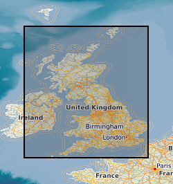
Geographic coverage
))
Temporal reference
Temporal extent
Temporal extent
- Dataset Reference Date ()
- 1841
Quality and validity
- Lineage
-
Original paper magnetograms recorded using photographic techniques at Abinger, Eskdalemuir, Falmouth, Greenwich, Hartland, Kew, Lerwick, and Stonyhurst magnetic observatories. Additionally, magnetograms from the Cape Evans observatory that ran continuously at Robert Falcon Scott’s Antarctic base camp during the British Antarctic Expedition 1910–13. Magnetograms start in the 1840s and end in 1986 at which time digital recording of the magnetic field took over and magnetograms can be produced by computer graphic. In response to the threat of loss from degradation due to age and a desire to preserve and exploit old data, BGS undertook a programme of work to digitally photograph, archive and preserve the analogue paper records of magnetic field variation in the United Kingdom. Between 2009 and 2013, high-quality digital images of every available magnetogram were taken. These images are available to search online. Scientists and the general public around the world can now gain easy access to this historical dataset. The programme of work to complete the magnetogram digitisation is ongoing and more will be added, observatory by observatory.
- Denominator
- 10000
Conformity
Conformity
Conformity
Conformity
Conformity
Conformity
- Explanation
-
See the referenced specification
Restrictions on access and use
- Access constraints
- Unrestricted access and use.
- Access constraints
-
The copyright of materials derived from the British Geological Survey's work is vested in the Natural Environment Research Council [NERC]. No part of this work may be reproduced or transmitted in any form or by any means, or stored in a retrieval system of any nature, without the prior permission of the copyright holder, via the BGS Intellectual Property Rights Manager. Use by customers of information provided by the BGS, is at the customer's own risk. In view of the disparate sources of information at BGS's disposal, including such material donated to BGS, that BGS accepts in good faith as being accurate, the Natural Environment Research Council (NERC) gives no warranty, expressed or implied, as to the quality or accuracy of the information supplied, or to the information's suitability for any use. NERC/BGS accepts no liability whatever in respect of loss, damage, injury or other occurence however caused.
- Access constraints
-
Either: (i) the dataset is made freely available, e.g. via the Internet, for a restricted category of use (e.g. educational use only); or (ii) the dataset has not been formally approved by BGS for access and use by external clients under licence, but its use may be permitted under alternative formal arrangements; or (iii) the dataset contains 3rd party data or information obtained by BGS under terms and conditions that must be consulted in order to determine the permitted usage of the dataset. Refer to the BGS staff member responsible for the creation of the dataset if further advice is required. He / she should be familiar with the composition of the dataset, particularly with regard to 3rd party IPR contained in it, and any resultant use restrictions. This staff member should revert to the IPR Section (ipr@bgs.ac.uk) for advice, should the position not be clear. ipr@bgs.ac Either: (i) the dataset is made freely available, e.g. via the Internet, for a restricted category of use (e.g. educational use only); or (ii) the dataset has not been formally approved by BGS for access and use by external clients under licence, but its use may be permitted under alternative formal arrangements; or (iii) the dataset contains 3rd party data or information obtained by BGS under terms and conditions that must be consulted in order to determine the permitted usage of the dataset. Refer to the BGS staff member responsible for the creation of the dataset if further advice is required. He / she should be familiar with the composition of the dataset, particularly with regard to 3rd party IPR contained in it, and any resultant use restrictions. This staff member should revert to the IPR Section (ipr@bgs.ac.uk) for advice, should the position not be clear.
Responsible organization (s)
Contact for the resource
- Organisation name
-
British Geological Survey
-
enquiries@bgs.ac enquiries@bgs.ac.uk
- Organisation name
-
British Geological Survey
-
enquiries@bgs.ac enquiries@bgs.ac.uk
Responsible organization (s)
Contact for the resource
- Organisation name
-
British Geological Survey
-
enquiries@bgs.ac enquiries@bgs.ac.uk
- Organisation name
-
British Geological Survey
-
enquiries@bgs.ac enquiries@bgs.ac.uk
Metadata information
Contact for the metadata
- Organisation name
-
British Geological Survey
-
enquiries@bgs.ac enquiries@bgs.ac.uk
- Metadata Date
- 2024-04-19
- Metadata Language
- English (en)