BGS Data Catalogue
Static gravity data Campi Flegrei, Italy (2015 survey) (NERC grant NE/J020052/1)
The data set contains location (latitude and longitude), ellipsoidal height (m) and observed gravity of benchmarks at the Campi Flegrei caldera, Italy. The gravity and location data were collected between 8 and 12 July, 2015 using a Scintrex CG5 gravimeter (serial number: 572) in tandem with a TOPCON HiPer Pro Dual-Frequency GNSS base and rover system. The survey contained a total of 85 benchmarks in addition to the base station.
INSPIRE
Identification
- File identifier
- 99fb8b16-4238-16b7-e054-002128a47908 XML
- Resource type
- dataset
Online resource
Resource identifier
- Metadata Language
- English (en)
Encoding
- Format
-
MS Excel
Projection
Classification of data and services
- Topic category
-
- Geoscientific information
Classification of data and services
Coupled resource
Coupled resource
Classification of data and services
Coupled resource
Coupled resource
Keywords
- GEMET - INSPIRE themes, version 1.0
- BGS Thesaurus of Geosciences
-
-
Caldera
-
NGDC Deposited Data
-
Gravity
-
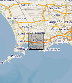
Geographic coverage
))
Temporal reference
Temporal extent
Temporal extent
- Dataset Reference Date ()
- 2019-12-13
Quality and validity
- Lineage
-
The derived precision of the benchmark locations was generally under 0.05 m in the vertical and better than 0.04 m in the horizontal after baseline processing of the benchmark locations against the base station which in turn was processed against three permanent reference stations of the local INGV Osservatorio Vesuviano Permanent Global Navigation Satellite System (GNSS) network and three regional International GNSS Service (IGS) references (NOT1, MAT1, MEDI).
Conformity
Conformity
Conformity
Conformity
Conformity
Conformity
- Explanation
-
See the referenced specification
Restrictions on access and use
- Access constraints
- no limitations
- Access constraints
- The dataset is made freely available for access, e.g. via the Internet. Either no third party data / information is contained in the dataset or BGS has secured written permission from the owner(s) of any third party data / information contained in the dataset to make the dataset freely accessible.
- Access constraints
-
The copyright of materials derived from the British Geological Survey's work is vested in the Natural Environment Research Council [NERC]. No part of this work may be reproduced or transmitted in any form or by any means, or stored in a retrieval system of any nature, without the prior permission of the copyright holder, via the BGS Intellectual Property Rights Manager. Use by customers of information provided by the BGS, is at the customer's own risk. In view of the disparate sources of information at BGS's disposal, including such material donated to BGS, that BGS accepts in good faith as being accurate, the Natural Environment Research Council (NERC) gives no warranty, expressed or implied, as to the quality or accuracy of the information supplied, or to the information's suitability for any use. NERC/BGS accepts no liability whatever in respect of loss, damage, injury or other occurence however caused.
- Access constraints
-
Available under the Open Government Licence subject to the following acknowledgement accompanying the reproduced NERC materials "Contains NERC materials ©NERC [year]"
Responsible organization (s)
Contact for the resource
- Organisation name
-
University of Bristol
-
not available
- Organisation name
-
University of Bristol
-
not available
Responsible organization (s)
Contact for the resource
- Organisation name
-
University of Bristol
-
not available
- Organisation name
-
University of Bristol
-
not available
Metadata information
Contact for the metadata
- Organisation name
-
British Geological Survey
-
enquiries@bgs.ac enquiries@bgs.ac.uk
- Metadata Date
- 2024-04-19
- Metadata Language
- English (en)